Steve Davison heads to Hawkley for a walk in the South Downs National Park to the north of Petersfield

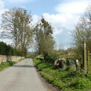
This month’s walk starts from the little village of Hawkley, tucked amongst the wooded contours of the South Downs National Park between Alton and Petersfield in East Hampshire. Overlooking the village green is the Church of St Peter and St Paul, with its distinctive ‘Rhenish Helm’ tower topped with a pyramidal roof, each of the four sides being a rhomboid in shape; a design more typically seen abroad. The church was rebuilt by celebrated gothic revivalist architect Samuel Sanders Teulon in the 1860s; he also designed nearby Hawkley Hurst house.
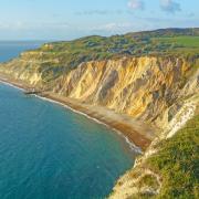
The area is associated with two literary figures. The writer, agriculturist and political reformer, William Cobbett travelled through the ‘hangers’ in November 1822 on one of his many ‘Rural Rides’ through the English countryside. Whilst the celebrated English naturalist and author of The Natural History of Selborne, Gilbert White, who lived at nearby Selborne, wrote about a dramatic geological event that occurred in 1774 when part of “the great woody hanger at Hawkley was torn from its place and fell down, leaving a high freestone cliff naked and bare, and resembling the steep cliff of a chalk pit.” The location of the landslip was just north of Scotland Farm, slightly off-route from Uplands.
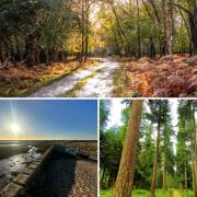
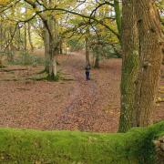
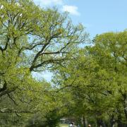
From the village green the first half of the walk follows part of the 21-mile long Hangers Way which meanders through Hampshire from Alton to the Queen Elizabeth Country Park; the name ‘hanger’ comes from the Old English word ‘hangra’, meaning a steeply wooded slope. The beech woods of Hawkley Hanger are home to one of Britain’s rarest orchids, red helleborine; however, you are more likely to catch sight of the common early purple orchid which flowers between April and June.
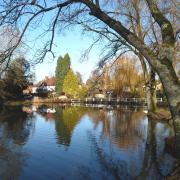
After Empshott Green the route heads down a muddy byway before crossing the infant River Rother near Hawkley Hurst house. The river starts hereabouts and flows south-eastwards to eventually join the River Arun in West Sussex. The final part of the walk follows Standfast Lane before passing Uplands and then heading past the Hawkley Inn back to the village green.
.
Information
• Distance: 4.25 miles (6.8km)
• Time: 2.25 hours without stops
• Terrain: Hilly route, tracks and paths which can be muddy, stiles and gates, sections of country road
• Start/Finish: Hawkley village green (SU745290) just west of the A3 at Liss; on-street parking in the village
• Map: OS Explorer 133
• Refreshments: The Hawkley Inn (01730 827205) at Hawkley
.
Directions
1 (SU745290) – From the village green head down the lane signposted for Oakshott, Priors Dean and Wheatham and after 50m turn right along the concrete driveway, signposted Hangers Way. At the end, go past the garages and continue along the right-hand field margin. Keep ahead into the trees where the route splits, take the right-hand bridleway, still following the Hangers Way along the lower edge of the trees of Hawkley Hanger. At a crossing path dogleg right and then keep ahead still following the Hangers Way just inside the trees. Later, continue along the narrow enclosed route (fence on the left) to a path and bridleway junction.
2 (SU737303) – Keep ahead following the path down some steps, cross the footbridge and then up some steps to a stile. Cross over and follow the left-hand edge of the field, at the corner stay in the field and turn right, still following the left-hand boundary. Cross a stile beside a gate and continue through the next field before leaving over a stile in the far left corner to join a lane at Vann Farm (pond on the left). Turn left up the lane and after 200m turn right over a stile beside a large gate to enter a field. Follow the left-hand margin, cross a stile and keep ahead between fenced paddocks gently downhill. Cross a stile and continue through the bushes to quickly cross another stile and join a lane.
3 (SU743310) – Turn right up the lane for 300m past some buildings (right) and at the slight left-hand bend, turn half-right to follow a signposted byway downhill. On reaching Mill Lane (tarmac) turn right for 50m and then left at a footpath sign. Follow the narrow enclosed path across a footbridge over the infant River Rother and keep ahead. Cross another stile into a field and turn left. Pass another stile and follow the field edge on the right. At the far-right corner go over a stile and keep ahead through the trees. Go through a kissing gate to enter a large field and immediately turn right along the right-hand field margin (hidden amongst the trees up on the right is Hawkley Hurst house).
4 (SU755305) – Go through the large gate and follow the track – Standfast Lane – up to a tarmac lane at Mabbotts. Keep ahead along the lane to the sharp right-hand bend and fork left (straight on) up the bank to enter a field. Follow the left-hand edge of the field and leave through a gate at the corner. Turn left along the lane past Uplands to a farm entrance on the right. Turn right here (large barn on the left) and follow the enclosed path between the fence and hedge to a road junction. Go straight on along Pococks Lane passing the Hawkley Inn to arrive back at the village green.
***
READ ON
• 5 mile walk around the North Hampshire Downs - Steve Davison heads to the North Hampshire Downs for a peaceful walk with some lovely views and a pub.
• Hampshire walk through Botley and alongside the River Hamble - Our walk this month, a figure-of-eight stroll which can easily be split into two shorter walks if required, is based at historic Botley and follows parts of the Strawberry Trail - a 15-mile route that weaves its way through an area that was once well-known for the sweet, red fruits.


