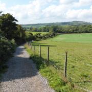
Follow Steve Davison as he heads to the west of Alton for a dog-friendly wander through fields and woods around Medstead
Our walk this month is based at Medstead, one of the highest villages in Hampshire, situated to the west of Alton, with a history stretching back 3000 years as shown by the tumuli, or Bronze Age burial mounds, close to the village. The main part of the village is clustered around St Andrew’s Church and the War Memorial. The church, which is partly shaded by great yew trees, dates back to Norman times, although from the Domesday Book we know that there was a chapel here in Saxon times.
Speaking of Saxons, it was during this period that land hereabouts was granted to the church at Winchester and became known as the ‘Liberty of Alresford’ which included present-day Medstead; the manor of Medstead was held by the Bishop of Winchester until the 14th century.
Just south of the village is Medstead and Four Marks railway station which opened in 1868 as part of the Mid-Hants Railway. Only ten years after its closure, the line reopened in 1983 and now forms the heritage Watercress Line between Alton and New Alresford. The section around Medstead passes through a fairly high-level area of rolling Hampshire countryside, often called ‘the Alps’.
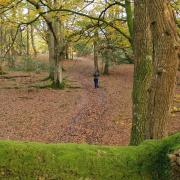
From the village hall the walk heads out through fields to reach the wooded expanse of Chawton Park Wood. The woodland now offers a number of walking options, however, in medieval times, it was set out as a deer park where deer were kept for hunting. The woodland was enclosed with a park pale, which consisted of a large ditch and adjoining earth bank topped with a fence, and the remains of the earth bank can still be seen in parts of the wood today.
After meandering through the woods we set out over open ground back towards Medstead, passing near to St Lucy’s Convent. Housed in the former Medstead Manor, the Roman Catholic convent is run by the Religious Teaching Order of St Lucy Filippini.
The final leg heads through the village, where a short detour leads to the unusually named Castle of Comfort pub, before passing the church and heading along High Street back to the start.
Information
• Start/finish: village hall and recreation ground car park (SU658368) along Roe Downs Road in Medstead, 1.5 miles north from the A31 at Four Marks
• Map: OS Explorer OL32
• Distance: 4.5 miles (7.1km)
• Terrain: ups and downs, tracks and paths which can be muddy, some gates and one stile, short sections of country road
• Time: 2 hours without stops
• Refreshments: The Castle of Comfort pub (01420 562112) at Medstead
• More Information: To find out more about Steve, including his books, visit: www.steve-davison.co.uk
The walk
1 (SU658368) – From the back of the village hall car park follow the track (Foul Lane) for 400m, and where the track swings right, go straight on through the trees. Turn right through a kissing gate into a field and follow the left-hand hedge. At the hedge corner, keep ahead (slightly left) across the field to enter Chawton Park Wood. Immediately after entering the wood turn right and follow a narrow path alongside the edge of the wood, with a field on right, for two thirds of a mile to join a wide track with a vehicle barrier ahead.
2 (SU671361) – Turn left and follow the track gently downhill (over to the right is a car park that can be used as an alternative start). Ignore a track to the left and follow the main track straight on down to a track junction at the bottom. Turn left along the track for 325m and where the track starts to curve left and rise, fork right along a wide grassy ride. Follow this for 500m to a cross-junction (it can be muddy along here). Turn right and follow the bridleway up through the trees. Leave the wood and continue along the narrow route, then keep ahead along the track.
3 (SU669375) – Cross straight over the road and take the track opposite for 275m to a footpath sign. Turn left along the enclosed path, passing just right of a large mast. Cross a stile and keep ahead. Go through a kissing gate and bear right along the road for 200m (ignoring Redwood Lane on the right). Turn right at the footpath sign and follow the enclosed path. Go through a kissing gate and continue across the field. Go through another kissing gate and keep ahead, soon passing just right of a brick building. Go through a kissing gate and bear slightly left across the field. Leave through another kissing gate and follow the enclosed path to a road.
4 (SU655372) – Turn left to a junction; a short way to the right is the Castle of Comfort pub. We keep left along Church Lane to a crossroads beside the war memorial with St Andrew’s Church over to the right. Cross over and turn left along the pavement following the High Street and passing the village shop. At the junction turn right along South Town Road for a few metres, then turn left across the road and take the path past the village pond, then alongside Roe Downs Road for 200m, before turning left across the road back to the car park.


