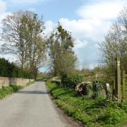
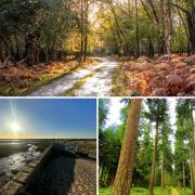
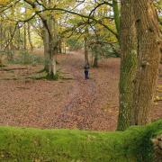
Follow Steve Davison as he takes a woodland wander through Alice Holt Forest, passing some interesting sculptures and a picturesque pond
Alice Holt Forest, tucked within the South Downs National Park, has a varied history spanning thousands of years. During the Roman period there was a network of pottery kilns and clay pits. In the Middle Ages, Alice Holt was a Royal Hunting Forest governed by strict laws, whilst during the Napoleonic Wars, timber from the forest was used for shipbuilding. Today, the Forestry Commission manages the forest for both recreation and timber production. As for the name, it was first mentioned as Alfsiholt before the Norman Conquest; the ‘Alice’ part is believed to be from the Bishop of Winchester who held the land in the 10th century, whilst ‘Holt’ is from the Saxon word for wood.
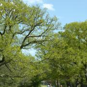
The first part of the walk sets off through Lodge Inclosure, soon passing Alice Holt Arboretum with its varied collection of trees, before heading towards the Alice Holt Research Station. The centre is housed in the early 19th century Alice Holt Lodge which was built on the site of the Great Lodge, once the home of the Lieutenant, or Ranger, of the Royal Forest of Alice Holt and Woolmer.
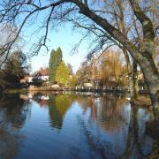
Soon, we pass the new café before following the Lodge Pond Trail through Glenbervire Inclosure, passing some interesting children’s play sculptures, including the Woodpecker tree and a giant wooden owl. Picturesque Lodge Pond with its picnic tables makes for a good lunch stop, before we continue towards Rowledge, home to the gothic-styled St James’ Church; call in to see the colourful Millennium Window.
Next stop is Holt Pound. It was here, in the 18th century, that a cricket ground – known locally as ‘the oval’ – was established. The final leg of the walk takes us through Holt Pound Inclosure back to the start.
Details
• Start/finish: Small parking area on west side of Gravel Hill Road (SU802434), half a mile off the A325 near Bucks Horn Oak
• Map: OS Explorer 144 and 145
• Distance: 5.5 miles (8.8km)
• Terrain: Fairly level walk on tracks, paths and some roads, gates but no stiles
• Time: 3 hours without stops
• Refreshments: The Cherry Tree (01252 792105) at Rowledge; The Forest Inn (01420 22276) at Holt Pound; café at Alice Holt (01420 521267)
• More Information: To find out more about Steve, including his books, visit: steve-davison.co.uk
The walk
1. (SU802434) – From the parking area head past the vehicle barrier and follow the track south-westwards for half a mile, passing Alice Holt Arboretum (on your right) to reach a cross junction (the path to the right leads to Bentley railway station). Turn left along the surfaced track with a pond on the right; the walk now follows the Shipwrights Way – a 50-mile trail from Bentley to Portsmouth Harbour – for one and half miles. As the surfaced track swings left to some houses, fork right past the vehicle barrier and follow the track for quarter of a mile; over to the left is the Alice Holt Research Station. At the track junction turn left along the path.
2. (SU807422) – With care, cross the A325 and follow the track opposite as it swings left to a junction. Turn sharp right and continue southwards as a track joins from the left to reach a track junction. Fork half-left to the education centre; spot the owl carving on the left. Cross over the surfaced drive and follow the track between trees, soon on the right is the café. Continue for 350m to a track junction and turn left down the track (Lodge Pond Trail). Keep ahead (right) at the junction (tunnels play area on the left), cross the bridge and follow the track up to a cross-junction; over to the right is Glenbervie Meadow.
3. (SU815424) – Turn left (Lodge Pond and Habitat Trails), passing some wooden sculptures, to a junction beside a large owl. Turn right along the path, then left at the junction and keep ahead at the cross-junction to join a gravel track. Turn right for 300m to an open area on the right and turn left, following the track as it swings right to a parking area. Turn left to Lodge Pond and then turn right, following the waterside path (pond on left) to the end of the pond; just to the left is a seat and nice view of the pond (the path across the dam leads to Birdworld). Turn right for 150m and then left along the gravel track, following it as it swings right to a junction. Turn left, following the track past a gate and parking area to Church Lane, with St James’ Church to the left.
4. (SU820430) – Follow Church Lane and then turn left along School Road; on the right is the Cherry Tree pub. At the T-junction turn left along Fullers Road for 200m to Poppy Briar (house) on the left; turn right across the road and follow the path down between hedges (easily missed). Cross the footbridge and head up to a track at a bend. Keep ahead, soon passing left of the buildings. With care, cross the A325 and go through the gate opposite. Walk through the Forest Inn pub garden and leave through a small gate. Once in the field – Holt Pound – bear half-left to the far side. Go through a kissing gate and keep ahead to a track (house opposite). Turn right past the vehicle barrier and follow the track for three quarters of a mile, ignoring crossing routes. Pass the vehicle barrier and turn left along the lane for 50m, then fork right back to the start.


