Explore the woodland trails on a walk through Queen Elizabeth Country Park that also takes in one of Hampshire’s most attractive villages
Situated at the western end of the South Downs (within the National Park), Queen Elizabeth Country Park covers some 1400 acres of open access woodland and downland, including Butser Hill, the highest point on the South Downs. The Park, which is to be found a few miles south of Petersfield, straddles the A3, with the open chalk downland of Butser Hill to the west and the wooded slopes of Holt Down and War Down to the east. These were planted with beech and conifer trees in the 1930s. The Park is jointly managed by Hampshire County Council and the Forestry Commission.
No fewer than four long distance paths run through the wooded eastern section of Queen Elizabeth Country Park, with one, the South Downs Way (the 100-mile National Trail that stretches from Winchester to Eastbourne in East Sussex), also crossing into the western side of the Park to ascend Butser Hill. The other routes include the 21-mile Hangers Way, which starts at Alton station and finishes here, the Staunton Way, linking Queen Elizabeth Country Park with Staunton Country Park on the edge of Havant to the south (a choice of two routes - 8½ or 10½ miles) and, lastly, the 50-mile Shipwright’s Way, which starts at Alice Holt Forest near Farnham and finishes at Portsmouth. All are waymarked, as are other walking trails in the Park; in addition to specific ones for cyclists (the Park is open to mountain bikers, too). Walkers are spoilt for choice!
This walk incorporates sections of all the routes, notably the South Downs Way (SDW), stretches of which are used both for the outward leg - which takes you to the attractive village of Buriton - and the return. (Note: the SDW was re-routed through Queen Elizabeth Country Park a few years ago, so your OS paper map may still show the former route through the Park).
At the end of the walk, if you have the time and are feeling energetic, a half hour climb up grassy slopes will take you to the top of Butser Hill, where you can enjoy the extensive views before an easy descent the same way.
Information
Start/finish: Queen Elizabeth Country Park main car park at entrance
Map: OS Explorer OL8. Also recommended: the leaflet with large scale map (showing all the Park trails) from the Queen Elizabeth Country Park Visitor Centre
Distance: 6 miles (9.5km). Butser Hill extension: 2? miles (3.7km)
Terrain: Woodland paths and tracks, quiet country lanes. Open grassy downland for extension to Butser Hill.
Time: 3 hours (allow an extra hour for Butser Hill)
Refreshments: Café at Queen Elizabeth Country Park; Five Bells, Buriton; Village Inn, Buriton
Public transport: Stagecoach bus service 37 Havant to Petersfield (stop for QECP)
Further information: Visitor Information Centre at Queen Elizabeth Country Park
The walk
1 (SU718185) From the main car park at the entrance follow the path that runs along the left hand side of the Visitor Centre (the cabin where the visitor reception is located during the refurbishment in the first half of 2019 is very nearby). This leads alongside woodland on your left to a grassy area known as the Meadow (where the café will be temporarily located in a marquee during the refurbishment). Continue along the path until you reach a road, which is the Forest Drive. Cross it diagonally to the left to continue along a wide track on the right (just beyond this is the entrance to Gravel Hill car park, an alternative starting point). Now on the route of the South Downs Way (SDW) just past a bridleway turn on the right you come to another junction.
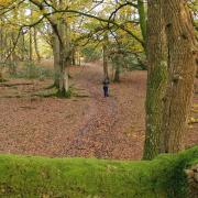
2 (SU719180) Turn left here, continuing along the SDW (waymarked with the acorn symbol for a National Trail). The path leads up through the woodland, with waymark posts from time to time to keep you on the right path (ignore any turnings), and then down to a track where you bear left. Another track soon joins from the left. Continue along the SDW descending to reach a car park (Halls Hill).
3 (SU733197) Cross the road and carry on along the no-through road opposite (still following the SDW) which leads past some cottages, continuing on the broad track, which becomes a lane again at Coulters Dean Farm. Stay on the lane as it bears left (passing Coulters Dean Nature Reserve and bridleway turn on right). Soon the road bends to the right.
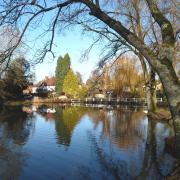
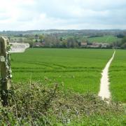
4 (SU749195) Leaving the SDW here, turn left down a track (called the Milky Way) which soon descends quite steeply, and can be muddy, especially in winter – walking pole(s) useful. At the bottom the track levels out and curves round to the right and very soon after you turn left along the footpath that runs along the edge of fields to the car park at Buriton. Adjoining it is the Norman church of St Mary’s and picturesque village pond. An information panel tells you more about the village, as well as the history of the chalk pits, now a local Nature Reserve.
5 (SU739200) From the car park turn left along the road, then left again along South Lane, the pond on your left (unless you want to visit the pubs, in which case carry on ahead). Beyond some dwellings continue up the track/path past Buriton Chalk Pits to reach the Halls Hill car park again at pt 3. Enter the car park and immediately turn left through a gate along a footpath (waymarked as the route of both the Hangers Way and Staunton Way, although not currently on the OS map). This leads across fields and up into woodland where you reach a crossing track, the SDW followed on the outward leg. Cross this diagonally and follow the path waymarked as the Hangers Way down through some trees to join another track, bearing left. This leads to a car park and the Forest Drive, which loops round at this point. Keep ahead to the left of the Drive soon forking left along a path that runs parallel to it leading to the Gravel Hill car park. From here retrace your outward steps.
If you have the time and energy, you might like to extend the walk to take in Butser Hill and its fine views. To do so, exit the main car park and follow the SDW signs that take you under the A3, then up the grassy hillside. Nearing the top, head to the right of the radio mast and not far beyond you will find the trig point. Retrace steps the same way. Allow about an hour.
More…
• Best walks in Hampshire - With the New Forest, South Downs and a picturesque coastline, Hampshire is an amazing place for a walk. We round up a few of our favourites


