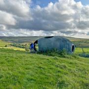
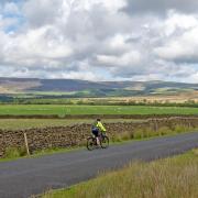
Keith Carter enjoys the sights from the heights in the hills near Hutton Roof
I have often wondered where the ‘Roof’ part of Hutton Roof came from and on looking it up in my Dictionary of British Place Names I discover that it is thought to derive from one Rolfe, a now-forgotten chieftain who settled here.
Rolf is Scandinavian so could it be that a Viking raider decided he liked it here so settled down and in due course his name lived on? The name Hutton is widely found and means a place at a ridge or hill-spur. There are several in North Yorkshire, Sheriff Hutton, Hutton le Hole, Hutton Conyers etc and we mustn’t forget Hutton, west of Preston on the Southport Road.
Hutton Roof is a hidden-away village in that hinterland country between the M6 and the River Lune, its character drawn from the limestone of Hutton Roof Crags and Newbiggin Crags that dominate the scene. The narrow lanes that bring you between high hedgerows to the village are reminiscent of Cornwall and Pembrokeshire, often not wide enough for two cars to pass abreast. You don’t want to be approaching a blind corner with anything but care when the chances are a huge tractor is coming the other way.
The village is really no more than a row of houses with no pub or shop although a Post Office continues to offer a limited service to local people from a private house. Parking is limited but you can usually find space for a couple of cars by the parish notice board at the roadside.
Our walk begins here. Walk a short distance northwards and where you see a turning on the right to Kirkby Lonsdale, a stony track departs on the left between houses. This is the Limestone Link, a cross-country trail from Arnside to Kirkby Lonsdale which makes a fine day-long expedition well worth tackling.
We go through a gate beside a cottage and begin climbing on a narrow path that climbs up to Hutton Roof Crags. Keep right at a fork and climb the open fell, as you gain height the views become wonderful. What fantastic country! As the path levels out we keep right and follow the same contour through rough scrub. If you’re lucky you may see the rare High Brown Fritillary, a butterfly confined only to this corner of the north west of Britain. On the day I researched this walk there were lots of them, but you can go on another day and see none at all.
The path along the crags becomes wooded then winds down gradually to meet a lane where we turn right. The Limestone Link leaves us at this point and we stay on the lane, keeping left at a fork and then left at a crossroads by Newbiggin Farm. We then proceed on the lane with the crags to our left, the surface once tarmac-laid but deteriorating now that the only traffic along it is tractors. It is bordered by broad banks of bracken with colourful foxgloves poking up here and there like pink and purple pennants.
On reaching a turning on the right, take this and walk gradually downhill to the bottom where a footbridge crosses a brook. There is a ford here but after heavy rain the stream was so swollen any idea of fording it was out of the question. Over the footbridge a sunken track rising along the side of a field grazed by cattle comes to the rear of a stone building housing an interior decorating business and gallery through whose yard we join the main Kirkby Lonsdale road.
Turn left and walk on the verge to The Plough at Lupton, an old-established pub that has had the benefit of a recent upgrade elevating it into the envied status of gastro-pub. This unfortunate phrase has gained currency lately but to me the medical associations with the word ‘gastro’ have me reaching for the milk of magnesia. I reflect that it takes more than stripped pine boards and sporting prints to serve a good pint but to be fair the Jennings on draught was excellent. Other beverages and products are also available.
On leaving the pub, retrace your steps as far as the ford but don’t cross the footbridge, instead, turn left along the stream, through two meadows and make for a ruined barn in the left hand corner of the second. Two off-set stiles indicate the right-of-way that follows a sloping grassy bank between barbed wire fences which narrow down to a further stile. This path is not easy to negotiate and you may need to hold onto the fence to keep your balance. Cross the next stile into a field and keep ahead along a line of wire.
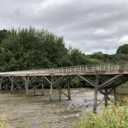
There’s a knoll to the right topped with a lone pine tree. Cross another stile then cross the next field to a squeeze stile fashioned from two blocks of limestone One last field is crossed towards a row of cottages – aim to the right of them – and reach a lane and turn right. This leads downhill to where it crosses the brook at Jubilee Bridge, a nice coincidence in this year of the Queen’s Jubilee to cross a bridge built for the last Queen’s.
At the next junction, turn left towards Hutton Roof, and look for a bridleway heading directly to the village, a bridleway which when I was there was heavily overgrown. Where this meets the lane, turn right, stay on the lane and walk past St John’s Church standing at the junction.
It has a famous former vicar, the Rev Theodore Bayley Hardy VC,DSO,MC, who was the most decorated non-combatant in the First World War who showed unwavering courage and devotion in the front lines through many battles and would bring in wounded men from No-Mans Land after an attack. It is said that his reaction on being notified he was receive the VC was to say: ‘I really must protest!’ He died of wounds near the end of the war in 1918.
His memorial can be seen in the churchyard made from a piece of local limestone and he also has a bronze memorial in Carlisle Cathedral.Passing the church on our left we continue forward on the Lupton road away from the village and once past the entrance to Pickle Farm the road bends to the right. Here we leave it and take to a bridleway on the left, walled on both sides, known as Newbiggin Lane and clearly an ancient track way.
It’s impossible to escape the conclusion that Hutton Roof is immune to the worst excesses of contemporary life. Visitors are few and caravanners have nowhere to park their vans. The word that comes to mind is timeless. Yet people make a life here and there is a strong community identity. As walkers we should feel lucky to peek into their village for a while and enjoy the peace and quiet. A village to treasure.
Compass points
Area of walk: Hutton Roof
Map: OS Explorer OL7 The English Lakes South Eastern Area
Distance: Six miles
Time to allow: Three hours
Refreshments: The Plough at Lupton
Further reading: ‘It’s Only Me’, a life of Theodore Bayley Hardy by David Raw, Frank Peters Publishing, Gatebeck, Kendal.


