

Our walking guide John Lenehan takes us on a towpath where you can see one of Lancashire’s great engineering feats.

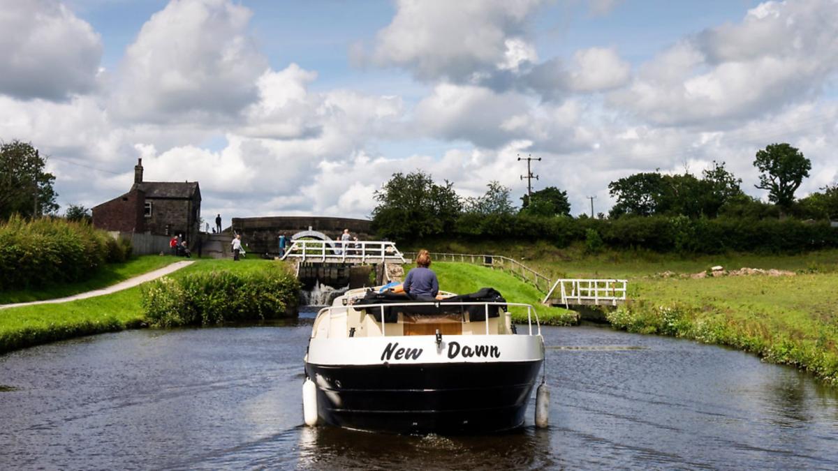
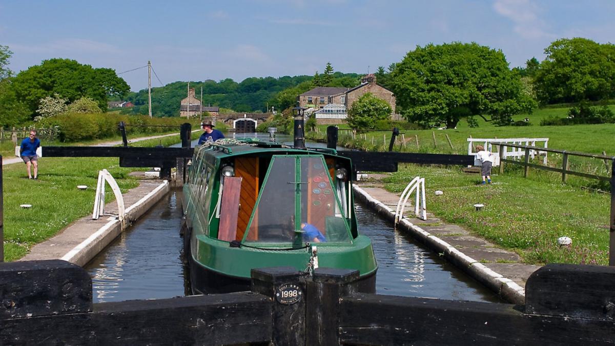
This walk along the Leeds and Liverpool Canal takes in Top Lock and includes the quite lovely staircase of seven consecutive locks at Johnson’s Hillock. It offers nice countryside views along the towpath and keep your eyes open for the wealth of wildlife that can be seen. Birds, waterfowl and ducks are plentiful but sometimes, at evening, deer can be seen in the fields. It also offers a view of the skill and ingenuity of the canal builders. I try to make my walks circular but on this one I designed the walk to be a figure eight as I didn’t want to go out and back on the same stretch. Another plus point is that at the centre of the figure eight is the Top Lock pub, great for mid walk refreshments.
ROUTE

1. If walking from the pub car park, turn left and cross the canal bridge then turn left and join the towpath. Follow this past two locks then cross the road and re-join the towpath on the opposite side and keep on this past the four locks that form the stair case.
Note: There are in total seven locks in the Johnson’s Hillock. The first one is Top Lock on the right as you cross the bridge. In total they drop the level of the canal around 66 feet from the section from Top Lock to Blackburn and from the bottom lock to the section to Wigan. They were built around 1816 as part of the last section of canal and completed its full length between Leeds and Liverpool.

At the bottom lock the towpath terminates between two bridges, a wooden one going left and a metal one going right. Go right and cross the metal bridge and once over turn left and follow the towpath under the bridge and then with the branch canal on the right follow the towpath until the canal ends then cross the stile onto the main road and turn right.
Note: It was intended that this branch would extend from the Leeds-Liverpool Canal to join the Lancaster canal at Preston. It proved to be too expensive and the branch reached eventually to a basin at Walton Summit. A tramline was built between here and Preston and crossed the Ribble. At Avenham Park it is still referred to as tram bridge.

Follow the road until it bends right and starts to go uphill and there is a track on the left with a footpath sign. Turn left into the track and follow this.
2. At this point on the OS map the track and footpath are shown as going straight on but in fact the track terminates at a house with a sign saying ‘Private’. However just prior to the house there is a stile on the left with a footpath arrow. Cross the stile and, keeping the fence on the right, cross the field to another stile. Cross this and keep right. Reach another stile and cross this and bear diagonally right and head towards the M61 Motorway.
3. The OS map shows the footpath going right at this point but it doesn’t appear to do so. The route descends very steeply downhill from here and it appears that everyone at this point has carried on to the wooden fence separating the M61 and, keeping this on the left, used it as a bannister for support on the descent. At the bottom of the hill there is a stile on the left. Cross this and turn right and pass between a steel hand rail of the bridge and the front of a tunnel under the M61. Once across the bridge cross the stile and turn right and follow the stream now on the right. Cross a footbridge and then turn left and cross a stile and follow the path as it bears right away from the stream now on the left then returns left to re-join the stream. Cross a stile then follow the path until it reaches the main road then keep right and follow the road uphill.
4. Reach the canal bridge at Top Lock but do not cross it, turn left and join the towpath of the canal and follow this past the lock on the right. Follow the towpath until the metal bridge number 85 (All the canal bridges have a number)
Note: Digging during the canal construction was started in 1770 and took 46 years to build and is 127 miles long. In the 1980s a Clayton-le-Moors Harrier called Ted Southworth ran the whole length in under 24 hours.
5. Go under the bridge then cross the stile immediately on the left then cross over the bridge and cross the stile at the end. Follow the track up hill.
6. The track reaches a gate and a small yard. Bear left and through another gate then follow the track up as it passes behind some houses to a metal gate with a stile to the right.
Note: My original intention was to bear right at point 6 then follow the public footpath shown on the OS map to a pond also on the map. Here the footpath splits with left turn to point 7. This is not the case as the footpath has been diverted I was told. The track between point 6 and point 7 is now the public footpath.
7. Cross the stile and follow the track up to the A674 main road and turn right. Follow the main road until it forks and keep right and follow Whins Lane downhill.
8. Whins Lane narrows to a single path for about 70 metres before opening out again to a full width road called Blackburn Road.
Note: The road was once the main road between Blackburn and Chorley and passed through the centre of Wheelton. The 70 metre single path section is where in the 1960s a landslide carried this section of the road away. This resulted in the building of the present A674 main road that bypasses the centre of Wheelton.
Carry on down Blackburn Road until the crossroads then turn right and follow Kenyon Lane back to Top Lock Bridge.
Watering Hole: The Top Lock
The pub has an extensive menu and the food is very good. There is also a good selection of real ales. I was told by one of the staff that they will cater for walking groups with a more walker friendly menu if given advance warning.
Tel: 01257 263328 www.thetoplockchorley.co.uk
Compass points
Walk: Top Lock and Johnson’s Hillock Canal Walk
Start and Finish: Top Lock Wheelton
Distance: 4 miles/6.4km
Time: 2 Hours
Terrain: Mostly on canal towpath and good track and road, except for the section from 3 to where the path joins the road. This can be very muddy after wet weather and required boots and gaiters the day I did it. The towpath can also be muddy after wet weather. On a dry summer’s day light walking shoes will be fine.
Map: OS Map 285 Southport and Chorley.
Facilities: There are no public toilets nearby.
Parking: Can be a bit difficult at weekends but not impossible. The Top Lock pub will allow walkers using the pub the use of the car park. Please get permission.
Click here to view other great canal walks across Lancashire


