This visit to Scorton in the beautiful Trough of Bowland recalls childhood holidays.

Scorton is a beautiful small village that attracts many visitors. It is beloved by cyclists, motorcyclists and car drivers wishing to take the road to the scenic Bowland Fells and Trough of Bowland. It also attracts a lot of walkers as there are many good walks around the village, some really good cafes and a hotel.
1. Leave the village centre and walk up the road to the Trough of Bowland, Factory Brow, and just before the left turn at Sandwell Brow there is a footpath sign on the left saying Wyre Way to Cleveley Bridge.

Note: Scorton holds particular memories for me as this area is where my grandmother’s family, the Kelsalls, came from. She brought me here when I was about six-years-old to stay in a caravan at 6 Arches Caravan site. The site is still there at the 6 Arches viaduct along Station Road, so named as up to 1939 Scorton once had a railway station on the West Coast Line that passes by the village. I distinctly remember watching the steam trains shooting past the caravan site and, at night, the glow from the firebox illuminated the engine driver’s cab and the light from the carriage windows looked like fairy lights. My family carried on the tradition and mum and dad and us four kids went on holiday there in the 1960s.
2. Take the footpath and then cross a footbridge then follow the path as it crosses a stream and goes through a gate stile. With the stream on the right, keep on the path, then recross the stream and now with this on the left keep on the path. Reach a stile and cross this then keep to the left of a ruined corrugated iron building before bearing diagonally left to reach a wire fence in front of a lake.
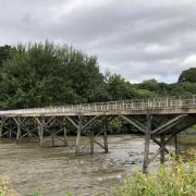
Keeping the wire fence to the left, carry on to a stile, cross the stile and carry on to another stile then, with a wire fence on the right, carry on until the path reaches a wider track. Turn right and follow the track until it reaches two gates and a stile, cross the stile and turn left and cross Cleveley Bridge and the River Wyre.
Immediately over the bridge turn right and follow the path with the river on the right. The path is now in a small wood and splits, take the left fork and carry on to a metal gate with a stile, cross the stile and cross a wooden walkway over boggy ground to another stile, cross this into a field the bear diagonally left. There is a small stream which you shuold keep on your left as you head towards the M6, then turn left and go uphill, cross a stile on the right onto a footbridge and cross the motorway and the stile at the other side of the bridge. Keep straight on to a stile and cross this and the field towards some pine trees that form the fence of a farm machinery dealer, then keep the trees on the right and head for a stile in the corner of the field. Cross this into a lane and turn right and follow the lane to Guys Farm Activity Centre.
Note: The River Wyre is quite a beautiful river as it avoids running through any major industrial areas until it reaches its estuary at Fleetwood. It rises in the Bowland Fells and is formed by two tributaries, the Tarnbrook Wyre and the Marshaw Wyre and it is around 28 miles long.
3. Enter Guys car park then turn left and there are two foot shaped signs reading ‘Footpath’, head for these and follow the path as it goes through a small tunnel under the building on the left. Pass a children’s play park on the right and carry on to a gate stile and cross that and into a field. Go straight across the field towards a caravan site and a sign that says ‘Private Land Please Keep to The Wyre Way’.
Cross the stile next to the sign and enter the caravan park then turn left along the track. There are yellow markers to guide the Wyre Way through the site but basically the track heads towards the offices of the site then a route marker guides you to go right. The track then leads into Wyreside Lakes Fisheries car park and a gate with a sign saying ‘Wyre Way’. The gate seems to have a rubber cover on it. Go through the gate then straight on to reach a lake named Fox Lake on the left.
Note: I am not much of a fisherman but it is pretty obvious that Wyreside is a popular place with people who are. I wondered what fish had been caught there so looked online at wyresidelakes.co.uk and was amazed at the photographs of the huge fish. Seeing them put the walk past the tranquil waters in a different light.
4. It seems the obvious way is to follow the track along the lake side but do not do this as this is a private track. Just to the right of the track, opposite the Fox Lake sign, is another gate with rubber on it and a Wyre Way sign leading into a wood. Go through the gate and with a tall wire security fence on the left and the river on the right, follow the path through the woods to some steps leading up to a stile, cross the stile and turn right.
Follow the road over a bridge to a gap in the hedgerow on the right and a public footpath sign. In front is a locked steel gate with a sign saying ‘Street Lake Patrolled Area’. To the right of the gate is a small footbridge crossing a stream, cross this and enter the car park of the Street Lake Fishery and keep left to a stile in the corner of the car park with a yellow arrow marker on it. Cross the stile and keep straight on to another stile and cross this and, further on, a plank over a boggy section. Keep on with a wire fence on the left and come to a stile on the left cross this then go right, into a wood there is a white post as guide. The path reaches a stream, keep this on your left as you follow the path through the woods to reach a track. Turn right and follow the track.
5. After a short distance along the track there is a yellow footpath sign on the left and a path going into another wood. Take the path and follow it through the wood, it turns right with a pond on the right, there are yellow markers as guides. Go downhill to a footbridge and cross this and up the steps on the other side and turn right and follow the path.
The path reaches an old iron gate and to the right of this is a stile in a wire fence, cross the stile, turn right and follow the path with wire fence on the right to a wooden gate stile. Cross this and turn left heading towards some cottages with a wire fence on the left to a stile, cross this and with a high wall on the right follow the path as it takes you through a ginnel to reach a yard. Go through the yard passing Fox Houses Farm on the right then go straight down the tarmac road to join a main road then turn left.
6. The road bends sharp left and at this point turn right into Arkmere Lane and follow this. The road bends left but keep straight on and in front is a sign saying ‘Wyresdale Park’.
There is a cattle grid, a gate and a stile, cross the stile the follow the track as it passes Wyresdale Lake on the left, then the Applestore Café on the right the keep on the track until it reaches the road. Then keep straight on along Snowhill Lane and follow this back into Scorton village.
Note: Wyresdale Park is the area of land around the magnificent Wyresdale Hall. It was built by the Ormrod family in 1856-1858 as was Wyersdale Lake. The Ormrod family came from Bolton where they were involved in textile production.
COMPASS POINTS
Start and finish: Scorton village.
Road side parking.
Terrain: Really good walking on footpaths and track but beware that in wet weather or just after some of the paths through the woods can be very muddy. Good boots needed.
Distance: 5.75 miles/9.25 km
Time: 3 hours
Map: OS Explorer 41 Forest of Bowland and Ribblesdale.
Facilities: Public toilets at Gubberford Lane.
Refreshments: The Apple Store Café offers fantastic home made food and mouth watering cakes. We went for a fry up before going into Scorton to start our walk. All the produce is locally sourced so the bacon, sausage and eggs taste wonderful.
01524 791011, wyresdalepark.co.uk


