John Lenehan crosses the paths of witches and Romans in a spectaular walk that’s perfect for a dry winter’s day

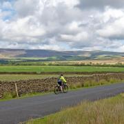
This is not the easiest of walks but it certainly has a bit of everything and a section of it traverses the Salter Fell road – also known as Hornby Road – and is spectacularly beautiful.
Part of it is a section of the Roman road called Watling Street that ran from Manchester to Carlisle and that means you will actually be following in their footsteps. The road has a darker past too, as it was along this road the Lancashire Witches were taken from Clitheroe to Lancaster to meet their undeserved fates. There is a long distance walk called the Lancashire Witches Walk from Barrowford to Lancaster that traverses the whole of the road and one of the fine marker posts is passed on my walk.

The Walk
1. Leave the Slaidburn car park and turn right towards the village centre and at the War Memorial turn right and follow the road uphill until a stile through a wall and footpath sign on the left.
Note: Slaidburn holds a particular place in my heart, as it is from where I did my first ever fell race about 40 years ago. It is also a beautiful little village that when you enter it feels like time has stood still. One could easily imagine a coach and horses pulling up outside The Hark to Bounty Inn.

2. Cross the stile and turn right then bearing diagonally left climb uphill passing the end of a wall coming up from the road. Keep uphill to another wall then, keeping this on the left, follow it for a few yards and there is an opening on the left and on the right side of this there is a stile. Cross this and the wall is now on the right. Leave the stile and bear diagonally left across the open field to a stile in a wall straight ahead.
Cross the stile and go straight across the next field to a stile in a wire fence and cross this then continue on to a stile in a wall. Cross this and the track behind it and go downhill bearing diagonally left to a stile in a wire fence. Cross it and there is a wall to the left. Keep this on the left then, as it turns left, keep straight on and pass a line of trees on the left and cross the ladder stile over a wall.
Bear left to a wire fence then, keeping this and the stream on the left, keep on until a stile in a wall. Cross this and enter a lane. Turn right and then almost immediately turn left through a stile and into a field and carry straight on to a gate stile. Cross this and bear slightly right to meet a good track. Join this and keep going straight on. Follow the track all the way to Croasdale House.

3. The track ends at Croasdale House but keep straight on across the yard and go through a gate then turn immediately left and cross the stream and follow the rough track uphill until it peters out. Follow the wire fence on the left until a stile on the left. Cross this and go downhill to a bridge over the stream. Once over the bridge keep right until a stile on the left. Cross the stile then turn right then climb the hill bearing diagonally left to reach a wall corner with a tree next to it.
Note: On the map this is shown as House of Croasdale but this has long disappeared.

Pass the wall corner keeping straight on and follow the bit of a track as it passes a wall on the right then, as the track fades, after a short distance turn left and climb straight up hill to a gate that leads onto the Hornby Road. Join the road and turn right. From here simply follow the road for approximately two miles all of it being the route of Watling Street, the Roman road.
Note: There is something else crossing Bowland near the road and it is about 80 metres below ground close to the disused Croasdale Quarry. It is the aqueduct carrying water from Haweswater in the Lake District to Manchester through what is known as the Bowland Tunnel. The quarry was used to supply stone during the tunnels construction. I believe my late grandfather worked on the aqueduct at one point.

4. Eventually, a signpost is reached on the left with Hornby Road on one side pointing straight on and Whitendale on the other pointing left. Leave the road and go downhill on a very indistinct path into the Whitendale valley. There are yellow painted marker posts indicating the route of the path as it drops to follow the river down the valley. It is a little hard going at times. Cross a stile and then after a while a second stile. After that, it becomes easier as the path widens and eventually opens into a field. There is a gap between some pinewoods and a yellow marker to the left of the wood. Pass this and cross a small bridge and go through the gate ahead. Once through there is a yellow marker post in the field, head for that then join a track and follow this to Whitendale Farm.
5. Pass the gable of Whitendale Farm and cross the small yard then immediately turn left and follow the track uphill, passing some barns on the left and across a yard to a stile next to a gate cross this and go through the next gate and enter a track. There is a signpost with a green direction panel. Follow the arrow that says Dunsop Fell but do not be tempted to carry straight on along what seems the obvious track as after a few yard a track breaks right steeply uphill. Follow this as it zig-zags uphill to a gate in a wall. Go through the gate and follow the track until it starts to bear left and at this point there is a blue marker arrow point straight on. Follow this. There is a yellow marker post on the horizon. Follow the path towards this then keep following the rough path past further markers to a pile of stones. It seems like the path stops there but it doesn’t, pass the pile of stone climb up the peat bank straight ahead and keep on until a stile appears in a wall head for this.

6. There is a Bridleway signpost with a green direction plate at the stile. Follow the arrow to Burn Side. Cross the stile then turn right and follow the slightly indistinct path as it heads downhill. Do not be tempted to follow the path down into the obvious valley but break right at the valley head and pick up a path that leads along the right hand upper flank of the valley then keep on this as it drops down hill eventually bearing right and down to a wall then right to a stile on the left in a wall. Cross the stile and head downhill, keeping a wall on the left and aim for the left side of Burnside Cottage. Cross a small bridge on the left then right and climb over the stile in the wall. Cross a small field to a gate stile and cross this. Burnside Cottage is on the right. Follow the path down hill to the left then turn right and go through a stile with a prominent old fashioned lamp post next to it. Join the lane and go straight on.
7. The lane reaches a road. Turn left and follow the road all the way back to Slaidburn.
Note: The road passes the Hark To Bounty Inn so named as after a hunt the huntsmen were enjoying an after hunt tipple when they heard the squire’s favourite dog Bounty barking louder than the rest and the words “ Hark to Bounty” were said. That’s the legend, anyway. Prior to this the inn was called The Dog. The upper floor was once used as the local courthouse.
COMPASS POINTS
Start and Finish: Slaidburn Village Car Park.
Distance: 12 Miles/ 19.3Km
Time: 6.5 Hours
Terrain: Good walking at the start through fields though paths are indistinct, and along Hornby Road. The descent down Whitendale Valley is tough as the path is narrow and in wet or after wet weather is very boggy. From Whitendale Farm to Slaidburn involves a steep climb over Dunsop Fell and again the path can be very boggy and on top the bogs can be quite deep. Boots, gaiters and good quality walking waterproofs and clothing are essential as are map, compass and whistle. This walk is fantastic in my opinion for experienced walkers but should not be taken lightly or attempted in bad weather.
Map: OS Map OL41 Forest of Bowland and Ribblesdale.
Facilities: There are public toilets on the Pay and Display car park. There are no cafes or places to eat anywhere on the walk except Slaidburn.
Watering Holes:
We started the walk fully fuelled on an excellent fry up at the fantastic Riverbank Tearooms. Bacon, egg, sausage, potato cake and toast and all top quality ingredients. All the food served is locally sourced and I have never had a bad meal here. It is one of the favourite cafes of cyclists – and they never go to bad cafes.
Tel: 01200 446398 www.riverbanktearooms.co.uk
The Hark to Bounty Inn is a building of character serving good food and real ale. Steak Pie was the choice and it was proper plate pie with chips and veg. Delicious!
Tel: 01200 446246 www.harktobounty.co.uk


