Keith Carter falls for some glorious walking country in the fells near Waddington
In my memory, two things about Waddington stand out: the long, agonising struggle to climb Tittrington Brow on my bike and an evening at The Moorcock Inn, a famed roadhouse which used to attract revellers from far and wide.
Returning to research this month’s walk, the Brow was just as steep although thankfully I was not on my bike but the Moorcock, its glory faded, was closed and neglected and only the sad creaking of its sign for an epitaph. On enquiring in the village I was told it had ‘gone bump’ some time last year and rumour had it that it had been bought by a developer for turning into flats.
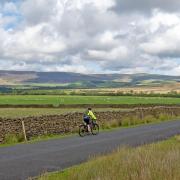
Waddington Fell has none of the many paths that you find on Pendle Hill, in fact as far as I know the summit is outside the Open Access arrangements due to health and safety concerns, because the quarry is still active. So no visit to the summit today. At the top of the brow is a cattle grid and just beyond it a wide lay-by where cars can be left. The view to the east over Ribblesdale is superb, the first of many such on this walk.
We are in genuine fell country enjoying walking that is in a class of its own for the outdoors lover with only the lonely call of the curlew and the high thrilling sound of the lark ascending for company.
Leave the car and walk on the sheep-grazed verge to the right of the road to where an obvious track departs on our right at a place called Walloper Well, a source of clear water used through the ages by travellers, drovers, pack-horse riders, horse and carts, pilgrims and tinkers on their way over the fells. The origin of the name has various explanations but folklore has it that a pedlar comes across a farmer arguing with his wife and tells him the best thing he can do is to ‘wallop ’er’. I imagine this story pre-dates Women’s Lib.
Set off on this track and head out into the wilds. Looking back the exposed rock face of the quarry scars the hillside already disfigured by a radio mast. Keep right where the path splits and by the time we meet a wall with a stile in it we will have walked the best part of a mile. Beyond the stile the path becomes narrower but is still obvious and on passing between two upright gateposts the view opens out before us in spectacular fashion.
We begin to descend and soon come to a wall-corner where a track is joined by turning right, our way continuing alongside a plantation to our left. Stay on this track which, after two gates, becomes surfaced with gravel. Head down and where you see a lone sycamore on the right by a scattered ruin, leave the track and take the path to the right across quite wet pasture land and a small plantation on the left. We cross a stile and continue on the same line along a left hand wall to where it meets a wall crossing it. Turn left and we come to a roofless ruin named on the map as Fell Side, long deserted.
Go through a gate and turn right on a path through the heather, following the line of a ruined wall then becoming enclosed until it meets a prominent hill track called Moor Lane. Turn left and follow the unsurfaced Moor Lane, gradually descending to where a gate leads onto a tarmac lane. Go right here and walk along what is an access lane to Seedalls where a notice puts us on the right path forward.
The next farm is Cuttock Clough and our route depends on finding the footpath which is not immediately obvious. At the farm buildings notice one that has a flight of stone steps outside. This is where we take a way marked path on the right taking us past a stable and over a stile into pasture. The right of way climbs gradually up following the edge of a wooded valley with a stream in the bottom, a stream that we soon cross by a ford then continue on the other side of the wood as far as a gateway.
Looking ahead across a broad meadow we see a low black and white building and this is the now closed Moorcock. Head for it, making for the left hand corner of a field where lapwings nest, their cries and acrobatic flight designed to decoy us away from their eggs.
A ladder stile brings us to the road and we turn right, passing the Moorcock and climbing Tittrington Brow, the cyclists’ destiny. At the top, passing the quarry entrance on the left we return to where we left the car. For refreshments we have to return to the village where the Country Kitchen caf� has a fine selection of snacks and meals. See if the home made scones are just baked. They’re not to be missed
Compass points
Area of walk: Rough fell country to the east of Waddington Fell
Distance: 4.7 miles
Time to allow: 2 � hours
Map: OS Explorer OL41 Forest of Bowland & Ribblesdale
Refreshments: Pubs and Country Kitchen in Waddington
Wheelchair/pushchair access: Not suitable


