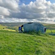
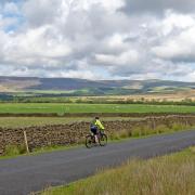
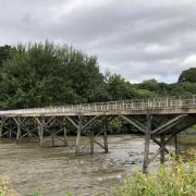
It’s a tough walk up Ward’s Stone in Bowland, but the vistas from the summit make it worth the effort
Ward’s Stone is the highest hill in the Forest of Bowland standing at 1841feet/561m above sea level. Sitting at the southern side of Ward’s Stone is the small and lovely hamlet of Tarnbrook. I thought it would be nice to design a circular walk from here to encompass the summit of Ward’s Stone. It is certainly a magnificent hill to climb from Tarnbrook and on a clear day the views are stunning. It is without doubt a long, tough walk but it is one that is certainly enjoyable.
1. Leave the car park and follow the single track tarmac road into Tarnbrook and keep on this until it finishes at a farm.
To the left of the farm building, there is a steel gate with a footpath sign and a map showing public access land and footpaths. Go through the gate and, with the farm building on the right, join a good gravel track and follow this. Ignore the track on the right leading to Gilberton and keep on to where the track forks. Straight on leads to Pea Carr Barn and left starts to climb up the fell side. Take the left fork and follow this as it climbs steeply uphill and keep on, crossing a bridge and on to where a metal gate crosses the track.
Note: The bridge crosses the Tarnbrook Wyre that rises very close to here. The Tarnbrook Wyre is one of the two main tributaries of the River Wyre. The other main tributary is the Marshaw Wyre and the two converge near Abbeystead to form the River Wyre, the estuary of which is at Fleetwood.
2. Do not go through the gate but turn left and, with a wire fence on the right as a guide, follow the rather indistinct path over peat and bogs. Keep on the path until the fence reaches a junction, turn sharp left and, with the fence on the right that eventually becomes a wall as a guide, follow the path gradually climbing up hill. The wall ends but keep going straight on following the path until it reaches the first of two triangulation pillars on Ward’s Stone. Pass this and, straight on in the distance, there is a second triangulation pillar to the left of some huge stones (Ward’s Stones). Head for the triangulation pillar, crossing rocky ground to reach it.
Note: The Ward’s Stones near the triangulation pillar make a nice shelter to eat lunch and the views to the north over Morecambe Bay, Lake District and the distant Isle of Man are particularly impressive.

3. Pass the pillar and follow the path straight on, heading downhill. The path is very indistinct on open fell but it is more walked as it is another route up Ward’s Stone from the big car park at Jubilee Tower. Keep an eye out for footprints as a guide.
4. The path meets and crosses a wide gravel track. Do not cross the track but turn left and follow the track as it goes downhill, steeply in places, passing a building called The Luncheon Hut on the left to reach a track junction.
Note: Luncheon huts probably relate to resting places for grouse shooting parties during the season.
5. At the path junction, turn left and follow another wide track and keep on this as it passes under Ward’s Stone Breast and on to Ricket Stones. Eventually the track reaches a T-junction and at this point turn right and go down hill to another path junction.
6. At the junction, one track goes left over a bridge near to another building called Luncheon Hut, the other goes straight on downhill. Follow this and go downhill, the track follows Tarnsyke Clough on the left and is very steep at times. The track eventually reaches Tarnbrook at a gate and stile, cross the stile into the road and turn right and retrace the route along the road to the car park.
COMPASS POINTS
Start/finish: The small car park on Flintron Brow, the road leading to Tarnbrook Hamlet. There is no public parking beyond this point.
Distance: 13miles/20.9km
Terrain: Most of the walk is on well made gravel tracks and, although steep in places, they make for very comfortable walking. Once off track it becomes a different proposition, as the rather indistinct footpaths are over peat fell and in wet weather they can become very boggy.
Weather: Ward’s Stone summit plateau is not a place to be in bad weather or thick mist, so choose a clear day. Navigation skills could be needed if the weather changes so a map and compass are essential as are good walking clothes and good boots.
Time: 6.5 hours
Toilets: There are no public toilets on route.
Refreshment: The starting point is remote from any nearby eating establishments and on the day it was sandwiches and a flask. I would suggest Scorton is the nearest place to eat and drink and there are some good cafes there.
Map: OS Explorer OL41 Forest of Bowland and Ribblesdale.
Lancashire walk - Scorton and the Wyre Way


