Keith Carter takes a taxing walk through the Lunesdale countryside

Nikolaus Pevsner, the great chronicler of buildings and places, described Wray like this: ‘A specially pretty village street with the houses as continuous terraces. It also has exceptionally many dated lintels. The whole is much greater than a sum of its parts; there are few buildings requiring individual mention, yet as a group they have charm and just enough variety.’
A fair-enough description, if a little half-hearted. The village has a thriving post office and shop and an excellent pub, the George and Dragon as well as a busy café which for me takes the cake, if you will excuse the pun.
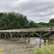
Older people may recall the great flood of 1967 which carried away the bridge and several houses and is still commemorated in the village. Downstream in Hornby, they took fish from the front rooms of houses including The Old Post Office, later the home of my late mother-in-law.
With my Last of the Summer Wine companions for company, I set off from the Bridge House Café with the weather damp and rain not far off, aiming for Low Bentham where I knew the Punch Bowl would have just what we were looking for in the way of liquid refreshment.
Turn left on leaving the café parking area and walk along the road, soon crossing the bridge over the River Hindburn, not to be confused with the Hyndburn in East Lancashire. The Hindburn is one of those rocky, shallow rivers that flow between steep banks bringing the run-off water down from the fells.
Cross the bridge and continue on the road until, just beyond a sharp right-angle bend, we see some cottages on the right and a footpath sign at the roadside indicating a right-of-way between two of the cottages, through their back yards and out of their gardens to a riverside field. How inconvenient for the householders. Keep left, heading to the left of a house ahead, then emerge onto a farm access track, turn right and almost immediately leave by a field gate on the left.
Enter a field and rise to a brow where an opening leads to the next field and our direction is to the right with the ground continuing to rise until in the top corner a gate brings us onto a lane. Turn right and stay on the lane past Four Acre Farm and Ashley’s Farm then take a footpath in the hedge on the left where a stile brings us into a boggy field, poor land indeed. Descend to the bottom corner and take a plank bridge over a ditch passing through two gates. Here we find a choice of four footpaths, ours going left on a farm track leading to Greenside Farm.
Don’t go through the yard as suggested on the OS map, but take the footpath diverted through a gate on the left rising up a field to an opening into the next one where we strike away to the right and head towards the just visible roof of a house becoming clearer as we get nearer to it. This is Hunter’s Barn. Join a surfaced track here and meet a lane, turn right to a junction then turn left on Long Lane which leads us down to Low Bentham and our goal, the Punch Bowl.
Sadly our hopes for a beer were dashed on finding the pub closed until later in the day. We weighed the option of walking a further mile and a half each way into High Bentham but decided that, given the time, our need for strong drink did not warrant going out of our way. This was decided on a majority vote.
Returning up the hill there is a footpath on the right leading to the edge of the river then crossing a plank bridge where we find an obstacle in our way, a high cliff that seems to prevent further progress. In fact steps have been built into the bank to one side of the cliff and we can climb up to the top where a stile lets us into an open field. The way forward heads away at ten o’clock over a low hill, meeting a farm track at a gate, the access to the 16th century farm of Robert Hall, once the home of the recusant Cantsfield family.
A gate to our right, in front of the hall, takes us past it and alongside a wood in which a compound has been made to breed emus. I’ve never eaten emu but they say it’s like ostrich which itself is like beef only with less fat. Continue with the wood to your left and descend the field to the gate in a dip then rise beside a right-hand hedge line ending at a stile entering a wood.
Keep left on a faint path through the wood which becomes stepped down to a plank across a ditch. We head across fields towards a group of houses, one newly built and not yet settled into the surroundings, and at a gate the owner has installed signs marked ‘FP’ to show us the way through the yard.
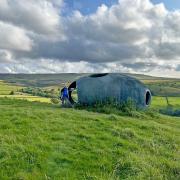
Follow a left-hand boundary and at a hand gate bear left and take a line on a house on a brow, Higher Perries where we meet a lane. Turn right and very soon take a footpath on the left with a stile leading through a dense hedge into a field. Two further fields bring us to an isolated property called School Hill in the grounds of which is a Nissen hut. One of my companions identified this as a ‘Nissan’ hut, presumably produced by the well-known Japanese car company!
On joining the road, turn right and walk past the ancient buildings of Russell’s Farm where the door lintel dates it to 1682. Follow the road to a crossroads where a road sign says its one and a half miles to Wray. Don’t worry, it isn’t, you should be back in the village inside fifteen minutes, unless your feet are beginning to drag a bit after all that rainy marching in the painful field. Time for a close encounter with a pot of tea and a piece of millionaire’s shortbread at the Bridge House Café – a welcome end to a strenuous walk.
Compass points
Area of walk: Wray, Lunesdale
Distance: 7 miles
Time to allow: 4 hours
Map: OS Explorer OL41 Forest of Bowland and Ribblesdale
Refreshments: Bridge House Café, Wray. Punch Bowl Inn, Low Bentham (check opening times on 015242 61344).
Not suitable for wheelchair or pushchair users.


