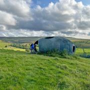
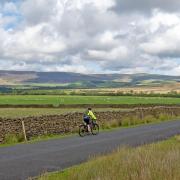
Keith Carter gets away from the crowds on a walk from Brigsteer in the Lyth Valley

The traffic heading straight for the heartlands of the Lake District on the A591 mostly ignores the hidden country to the west of the road, their minds set on better-known centres like Windermere and Ambleside. The celebrated A.Wainwright knew better and his book ‘Outlying Fells’ holds the key to places not over-run with visitors.

I am thinking of Underbarrow, Crosthwaite, Crook and this month’s destination, Brigsteer. These villages are not there to attract visitors. Even the pub closed in 2012 and, at the time of writing, plans to reopen it seem uncertain. Walkers do like a pint and I genuinely hope The Wheatsheaf will welcome the likes of us through its doors again soon.
To reach our starting point for this month’s walk, leave the A591 at the turnoff for Brigsteer not far north of the junction with the Barrow Road, the A590. The minor road, too narrow for two vehicles to pass, leads to a T-junction where a sign points left to Brigsteer and right to Kendal. Go right and in two miles look for a lay-by on the right used by dog-walkers in the main. If you find yourself crossing the bridge over the A591, you’ve gone too far.
Park in the lay-by and go through the gap in the wall into a wide grassy field where Kendal races used to be held. The passage of many boots has worn a clearly defined path across the sheep-cropped turf and we take a line diagonally to where a kissing-gate can be seen in the crossing wall.
A pile of stones on the right is thought to have been one of the race course buildings. The hey-day of Kendal Races was in the Victorian era and apart from a brief attempt to revive meetings in the 1990s, the thunder of horses’ hooves here is nothing but a distant memory. Sheep are the only four-legged animals found here now, plus dogs of course, hopefully on leads as notices sternly recommend.
Through the kissing-gate we find ourselves on a path that is bordered by coarse bushes such as gorse, blackthorn and the low-growing juniper. The path rises slowly through an area of arid scrubland rather like African Savannah with only the occasional tree to relieve the eye. This is Helsington Barrows, noted for rare species of orchid and butterfly but hard and unrelenting, offering no shelter from the wind. Where the path begins to level out we are near the top of the escarpment and the views begin to open up.
A big pile of stones marks a junction and although our way is to the left you might like to pay a visit to the triangulation column on the highest point of Scout Scar. To make this short diversion, turn right at the pile of stones and walk along the broad path that skirts the edge as far as a wall at right angles.
Follow the wall a few paces to the trig point and take in the view. The Lakeland Fells seem laid out in glory and you can play spot-the-peak and see how many you can name. Once you have ticked off the Langdale Pikes, retrace your steps to the big pile of stones and continue along the edge. Down to the right the fields seem unnaturally green after the monochrome colours of the Scar.
The path stays with the spine of the escarpment and although lesser paths strike off in places, we keep the same line. The area above us enclosed by a wall is owned by the National Trust but we stay out of it, following our prominent path leading down through some twisted cedar trees to meet the road at a gate and an access sign.
Turn right on the road and in 75 yards at a bend there is a sign pointing left to Helsington Church. A cattle grid then a tarmac access lane bring us to the church with parking spaces and a viewpoint with all the salient points identified, including the Kent Estuary and Morecambe Bay.
St John’s Helsington is a typical Lakeland Church, quite simple and unostentatious set in a churchyard which is thick with daffodils earlier in the year. The builders were in on my visit so I could not see the large mural painted on the altar wall of the nave painted by one Miss Saumarez but who she was and how she came to paint the mural needs further research.
On my visit a family were having a picnic spread out on a travel rug apparently indifferent to the cool breeze blowing the paper napkins about. We’ve all done it, resolutely eating our sandwiches while shivering in the wind.
To return to the car we can retrace our steps to the cattle grid and turn right onto the road. The village of Brigsteer is down the steep hill to the left but we go right and follow the road all the way back to the car. The urban sprawl to the right is Kendal seemingly in the shadow of the range of hills beyond, the Howgills. Cyclists, walkers, motorists, you will encounter them all on this road, sharing the wonderful vistas and the sheep-populated farmland with the call of the curlew for company.
This is an area to treasure. There aren’t many cream teas and Grasmere Gingerbreads but you don’t come to the Lyth Valley looking for those delights. I’ll be back.
Compass points
Area of walk: Helsington Barrows near Brigsteer, South Lakes
Distance: 5 ½ miles
Time to allow: 3 hours
Map: OS Explorer OL7 Lake District South East Area
Refreshments: None on the walk.
Wheelchair or pushchair access: not suitable.
For more great walks around the Lake District, log on to lancashirelife.co.uk hwer eyou can also upload your favourite routes.


