

Try this perfect springtime walking from a favourite market town

This walk was published in March 2018, so the details of the route may no longer be accurate, we do advise these articles should only be used as a guideline for any potential route you take and you should double check an up to date map before you set off.
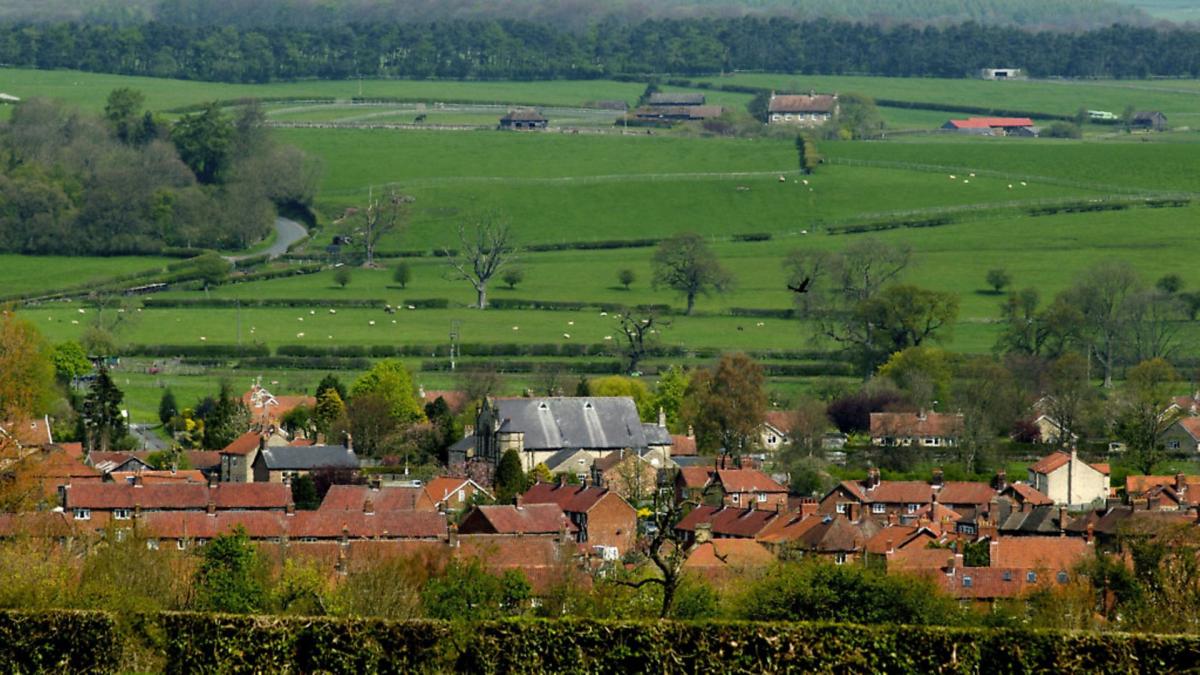
Helmsley is the uncrowned Queen of the North York Moors and as such is a magnet for visitors. On any half-decent weekend the Market Square is packed with cars while motor cyclists congregate round the Market Cross. Those with a taste for history flock to the still-impressive ruins of the castle. It was once a formidable mediaeval fortress but during the Civil War it was besieged by Sir Thomas 'Black Tom' Fairfax and the Royalists inside held out for three months before surrendering. Parliament was not risking that happening again and ordered the stronghold to be 'slighted'. Walls were destroyed and half the main tower demolished leaving the ruin we see today.

Throw in a wealth of shops and cafés and it all adds up to quite a throng and you might expect the surrounding countryside to be equally alive with walkers. Many do make their way to nearby Rievaulx Abbey but two dales immediately to the north of the town form a perfect circuit yet are almost ignored by walkers. Within a few minutes of leaving the square you are quite likely to have lovely Beck Dale and Ash Dale almost or even entirely to yourself. This makes a perfect stroll through mixed woodlands while the enfolding slopes provide shelter from any spring winds.
DIRECTIONS
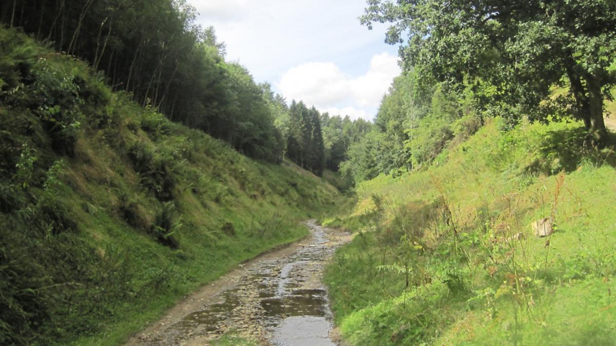
1. From the bustling Market Square take the Stokesley road almost to the edge of the village and after passing a fork marked Private Road take the next flagged footpath on the right beside a beck. Cross a footbridge and then join an unmade forest road which is followed leftwards up Beck Dale, past a sawmill and then on up the bed of the valley below wooded slopes on either side. At a junction fork rightwards following a footpath sign and at a second junction again take the right hand option. The track continues through a large pheasant-rearing enclosure - take care to leave the gates as you find them - and carries on criss-crossing the beck. Eventually, as the dale narrows, the main track is forced uphill rightwards, still signed as the footpath. Go up this to a junction and here turn left, not however, along the broad track but instead seek out a narrow dirt path leading up through the conifers. At the top of the slope the path levels out and then begins a long level section just inside the wood but following the edge of fields.
2. It finally emerges on a broader track. Turn right on this and then almost immediately right again through a gate to enter the fields. Here turn left along the field edge. This open section is in complete contrast to what had gone before and offers wide vistas over the surrounding moors and hills. Go through a gate and along the next field edge in the same line to a stile. Immediately on the other side of this turn right to follow the field boundary to a lane.
3. Turn right down this for 300 yards or so to a broad footpath on the left following the field boundary down to the trees of Ash Dale. This sister valley of the one you have just ascended forms the return route to Helmsley. Almost immediately after the track enters the wood turn right down another broad track signed to Helmsley. This is a section of the Tabular Hills Walk, a link route that was created to transform the Cleveland Way long distance trail from a horseshoe shape into a closed circuit of the North York Moors and coast. This is the start of a long, gentle descent on the forest road with no navigational problems almost until the doorstep of Helmsley is reached.
4. Where the bank on the right dwindles to almost nothing look out for a sign on the right indicating the route to Helmsley. Go down this and through a gate to escape the woods with the village directly ahead. Follow the waymarked path down the field but at the next gate turn right and then left at the following one. A large new housing estate has caused changes to the route of the path here so look out for diversion signs. Eventually it arrives at an estate road which leads to a junction. Cross straight over and go down the narrow lane opposite to reach the Market Square.
Compass points
Start/finish: Helmsley Market Square
Distance: 6 miles/10km
Ascent: 500ft/150m
Terrain: Forest roads and field paths
Time: 2.5-3hours
Parking: Roadside and car parks in village
Refreshments: Cafés and pubs galore in Helmsley
Map: OS OL26 North York Moors Western Area
You can also try these 6 great walks all starting within a 10 mile radius of Helmsley


