

Follow in the footsteps of drovers who took this North Yorkshire moorland route to drive herds from Scottish grazing grounds.

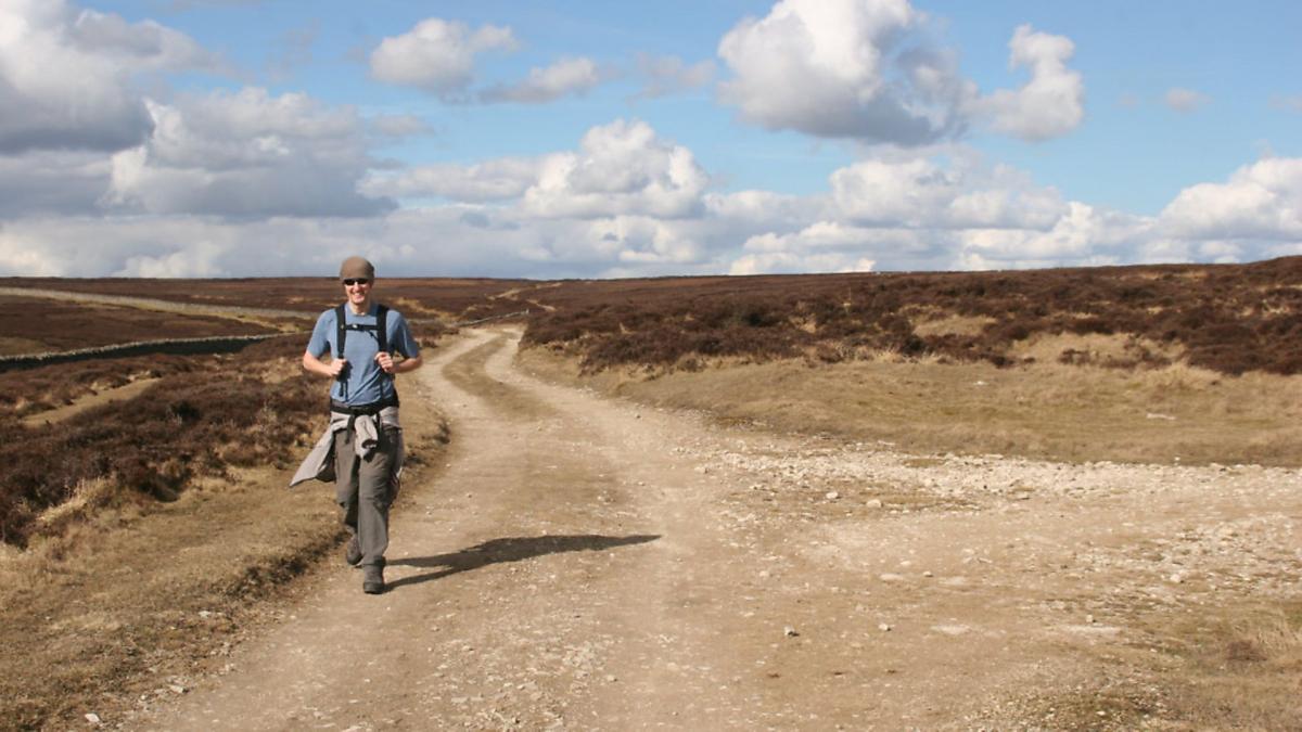
Stepping out on this walk you are in good, if ghostly, company. Its highlight – in every sense of the word – is the airy section along the rim of Black Hambleton following the centuries-old Hambleton Street drove road along the western escarpment of the North York Moors. Hundreds of years ago this was the route taken by the drovers, hardy British ‘cowboys’ who used the track to drive their herds from their grazing grounds in Scotland to the booming and ever-hungry markets of English cities spawned by the industrial revolution. It was a hard life for both man and beast. It’s small wonder there are so many Drovers Inns dotted up and down the country; they must have been welcome respite after a long day out in the wind and rain.
Today the track, now incorporated into the Cleveland Way National Trail, which encircles the North York Moors National Park, is a playground rather than a trade route, the province of the walker, fell runner, horse rider and mountain biker. However, the walk begins far below in the charming little village of Nether Silton, whose pub provides a welcoming end to the walk.
DIRECTIONS
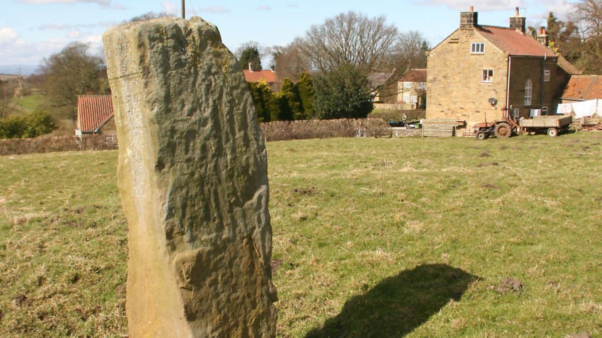
1. Take the signed footpath down the side of the tiny church of All Saints into a field which contains an intriguing standing stone. This head-high ‘Puzzle Stone’ is inscribed with a jumble of letters and the date 1765. The meaning of the markings is still debated but one popular explanation is that it marks the site of a mediaeval manor house destroyed in a fire. Head down the often-soggy pasture to a stile in the bottom left hand corner and then head away, across the next field to another stile in the far left hand corner. Cross this and turn right following field edges and through a small copse guided by yellow footpath markers and a fine collection of rickety stiles. Cross a stream by a rather moth-eaten wooden footbridge and carry on down to a plantation in a field corner and then, still following the yellow arrows, turn sharp left to enter a green lane enclosed by hedges. When the track emerges on a tarmac lane turn left for half a mile/1km or so to reach Cross Lodge on a sharp left hand bend.
2. Here leave the lane rightwards up another metalled road, signed to Nab Farm. Pass to the right of the buildings through a couple of gates and then take the continuation track, descending at first to a stream before beginning the long winding ascent to the moor top. As this pleasant track climbs sinuously the views open outwards behind across the Vale of York to the distant Pennines. Eventually the path arrives at the moorland rim to join the Hambleton Street drove road. Do not be tempted to cut the corner on this final section as there are no stiles across the boundary wall.
3. Turn left along the broad track, following the wall. The route now follows the ‘road’ for the next two and half miles/4kms or so. This is firm, flat walking allowing plenty of time to admire the vastness of the moor to your right and the endless views leftwards across the plain below to the hills of the Yorkshire Dales beyond. It is a delight at any time of year but particularly stunning in late summer when the heather is in bloom.
4. Eventually the track starts to drop quite steeply downhill with the straggling remnants of a clear-felled wood on the other side of the wall. As it drops look out for a bridleway sign pointing leftwards through a gate in the wall. This section once passed through trees and was rather more pleasant than it is today, though the felling has opened up distant views. The going is initially rough but this is short-lived before it joins a forest road. Turn left along this and follow it downhill, always sticking with the main track and ignoring junctions to left and right. Eventually the track passes a car park and picnic site and becomes metalled. Carry on straight ahead until it reaches a junction with a road sign to Nether Silton, apparently still a mile away. Don’t be disconcerted, the village is just a couple of hundred yards away around the next corner.
Compass points
Start/finish: Nether Silton, off the A19
Distance: 8miles/13kms
Ascent: 850ft/260m
Terrain: Field and moorland paths and quiet lanes
Parking: Roadside in Nether Silton
Refreshment: Pub in the village
Map: OS OL26 North York Moors: Western Area


