

Find peace in the idyllic rural valley of Rosedale which was once a noisy hive of industry.

Today most of the visitors who pour into our national parks from the surrounding towns and cities come in search of respite from hectic lives. They hope to find a few hours’ or days’ peace and quiet on the windswept moors, the sheep-cropped hillsides or colourful wildflower meadows in the dale bottoms. Many would be surprised to discover that these now tranquil landscapes were once hives of industry, even more battered and smoke-bruised than the conurbations they have fled.
For centuries quarrymen hacked and hewed at the bones of the fells and miners burrowed into the hills in search of coal and precious lead ore while smoke belched from their kilns and smelting mills. Generations of mill owners developed ingenious systems to harness fast-flowing becks and rivers that tumble down the valleys to drive the machinery that kick-started the Industrial Revolution,
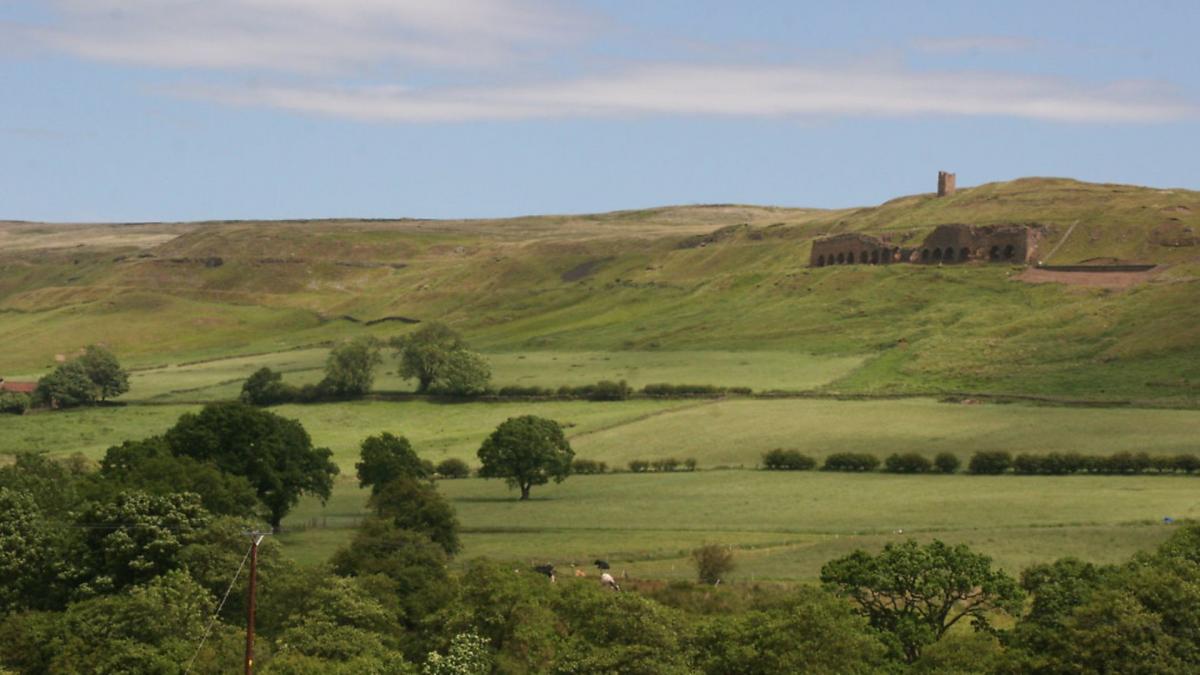
Almost every community had some kind of industry and Rosedale on the North York Moors was no exception. In the mid-19th century ironstone transformed the valley as fresh lucrative deposits were found and new mines opened. Over fifteen short years the population mushroomed from a few hundred to almost 3,000. The workings were so successful that a railway was laid right round the dalehead just to carry away the ore for processing in mills along the Tees and in County Durham.
Today the mines are exhausted and Rosedale is once again an idyllic rural valley. The old workings are inhabited only by ghosts. The rails have been ripped up but the trackbed remains to provide walkers with an easy promenade offering easy going and magnificent panoramas across the dale.

This walk begins in the picturesque village of Rosedale Abbey – itself a slight misnomer since there never was an abbey here, only a priory, and precious little remains even of that, its stones having been absorbed into the buildings that surround the village green.
DIRECTIONS
1. From the village green head through the village churchyard. Cross the road on the far side and take the discreetly-signed path directly opposite to Dunn Carr Bridge. Carry on along an avenue of trees and then cross a field to a footbridge. Cross this and go up a flight of steps to take a narrow stone-flagged trod across a field to reach a lane.
2. Turn right along this and a few hundred yards after Hobb House Farm and Thorgill House look out for a path on the left signed to Thorgill. Take this, crossing a series of pastures parallel to the lane to arrive on the edge of the hamlet. At Thorgill ignore footpath signs and instead rejoin the lane leftwards, past the houses. It becomes a track and over the next couple of miles/3kms passes a succession of farms and fields to arrive at a tarmac lane.
3. Turn left up this to the first set of farm buildings and where the road bends in front of New Moorland Cottage take a signposted track into Hollin Bush Farm. Where the track turns sharp left round the buildings take a gate and stile on the right with a sign advertising a tea shop at Dale Head Farm. Drop down the field to a footbridge across the stream and climb the field beyond, aiming to the right of the buildings of Dale Head Farm. When it joins a lane, turn up left towards the farm. Immediately before the buildings take a bridleway on the right signed to Great Fryup Dale.
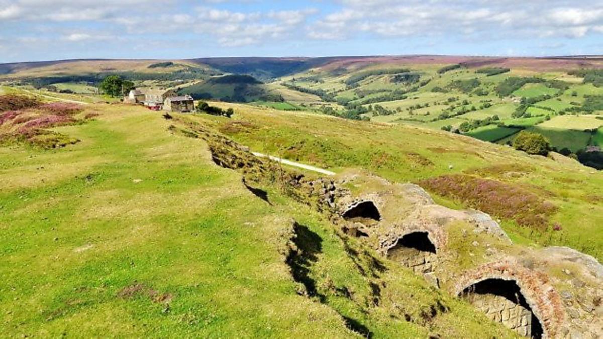
4. This climbs steeply beside woodland to reach the track of the old Rosedale Railway, built to serve the ironstone mines. Turn right along this clear track which stretches out ahead across the hillside. Along the way the path passes remnants of the old workings, the first significant being the massive remains of three enormous kilns used to ‘roast’ the ore before processing. A few minutes later you come across the even more impressive South ‘Stone’ Kilns, a row of more than a dozen arches built into the hillside.
5. Shortly afterwards the track jinks to the left of some buildings before dropping down a farm access track to a road. Go straight across and down the rough lane passing some wooden stables and horse boxes follow the signed track down to a footbridge across the stream in the valley floor. Do not cross this but instead turn left downstream following the clearly signposted path all the way back to the campsite at Rosedale Abbey.
COMPASS POINTS
Start/finish: Rosedale Abbey
Distance: 7.5/12km
Ascent: 500ft150m
Terrain: Lanes, field paths and an old railway line
Time: 3-4hours
Parking: On or off-street in Rosedale Abbey.
Refreshments: Cafés and pub at Rosedale Abbey, tea shop at Dale Head Farm
Map: OS OL26 North York Moors Western


