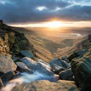
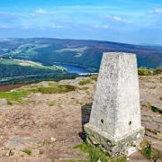
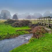
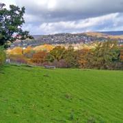
Blow away the cobwebs with Sally Mosley on this glorious hike to high ground where you’ll find spectacular views of distant peaks
This walk was published in Februay 2016, so the details of the route may no longer be accurate, we do advise these articles should only be used as a guideline for any potential route you take and you should double check an up to date map before you set off.
Distance: 7 miles

Parking: Roadside parking along the no through road at Mytham Bridge S33 0EA (please respect access to private driveways) Grid Ref: 207825
Terrain: Five gates, three stiles. Roadway without pavement. Eroded holloway which is liable to surface water flooding (alternative path through fields alongside). Livestock grazing.
Refreshments: The Angler's Pub & Rest Café, Bamford
Toilets: Public toilet on Main Road, Bamford

Map: OS Explorer OL1 (Dark Peak)
Walk highlight: All embracing views
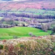
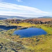
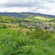
Description: After exploring the back streets of Bamford, this walk follows mainly paths, tracks and quiet country roads, ascending gradually to heady heights for panoramic views. Listen for grouse with their distinctive 'go back' call and look for remote homesteads snuggled into hollows on the fringe of wild and inhospitable moors. www.sallymosley.co.uk
1 Park considerately on the no through road to Mytham Bridge which is approached just off the A6187 by the side of the bus turning island containing tall, rounded, gritstone gateposts - similar to those at Hunter's Bar in Sheffield, as this was originally the route of the 18th century turnpike road from Sheffield to Chapel-en-le-Frith.
2 Turn left from the Mytham Bridge road to cross over the railway bridge and walk on the tree-lined pavement towards Bamford. Notice the slender 100 ft high, needle-like spire of Bamford Church which is dedicated to St John the Baptist. It was built in 1860 in a gothic revival style, designed by the famous architect William Butterfield. Just beyond Water Lane at the start of the terraced houses cross over the road to walk down Mill Lane leading to The Hollow.
3 You will pass Bamford Hall which was originally the Mill House. The first Bamford Mill on this site was for grinding corn, however, this burned down and was replaced by a cotton spinning mill, owned by the Moore family who had other similar mills in Manchester.
4 You might wish to detour slightly to see the wooden footbridge and weir across the River Derwent which, after being captured upstream by the reservoirs of Howden, Derwent and Ladybower, is once again held back where it was harnessed for energy to power the mill. Return to the fingerpost sign and ascend The Hollow passing terraces of former millworkers' cottages, finally emerging onto Bamford's main street.
5 Cross over to the paved and chained 'village green' with large stone to commemorate the Diamond Jubilee of Queen Victoria in 1897. A sculpture on the other side of the Green marks the start of the Touchstone Trail which was created by the villagers to celebrate the new millennia. Nearby are wells that in July will be decorated and dressed.
6 Head up Fidlers Well Lane but then at the crossroads beyond, turn left on Tagg's Knoll and walk past the school to the Anglers Rest. This has been owned by the community since October 2013 and contains the village post office as well as pub and café. Its sign states 'more than a pub, a community hub'.
7 Turn right and walk up Ashopton Road passing opposite the Catholic Church dedicated to Our Lady of Sorrows. Just after West Lees Road turn right up a narrow footpath between houses as indicated by a fingerpost sign.
8 Turn left after the gate at the top of the path and cross a stile in the hedgerow. Now follow the footpath through fields and gates as well as a wall stile and gradually ascend, emerging onto New Road by the drive to Thie Veg.
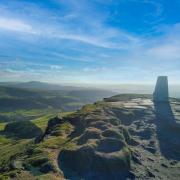
9 Turn right and follow the road beneath Bamford Edge as it gently ascends to Bole Hill. Be sure to glance behind you every once in a while to view distant peaks of the Upper Derwent Valley, dominated by Win Hill. See the Great Ridge emerge which leads from Lose Hill to Mam Tor. Most dramatic of all are the first glimpses of Stanage Edge or the sheer cliffs of Millstone Edge. Created by nature but fashioned by man, these were quarried long ago for grinding stones, their polo mint shape being the symbol of the Peak District National Park.
10 Walk down to the junction before the wooded plantation at Dennis Knoll and turn right. As you head towards Outlane with its unusual castellated roof, look down to Greens House. Dating from 1550 it is not far from Hood Brook where there used to be a mill which produced coarse brown paper that was used in shops. In the 1840s the mill was owned by Charles Ibbotson and later by a Charles Marsden before closing down around 1890. The only surviving evidence of the mill are some foundations and a mill pond hidden in trees. Beyond this is a stone archway in a field, the remains of a chapel built by the Roman Catholic Eyre family in 1686 who lived at nearby North Lees, just visible although hiding in a cluster of trees. It is thought that a medieval building once occupied this site but the present Hall dates mainly from the late 16th century, its claim to fame being that it is believed to have been the inspiration behind 'Thornfield', the home of Mr Rochester in Charlotte Brontë's book Jane Eyre. Incidentally 2016 is the 200th anniversary of Charlotte Brontë's birth.
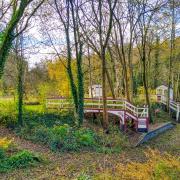
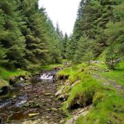
11 Just beyond a pair of roadside troughs that provided crystal clear water for passing pack ponies and cart horses, turn right and walk past The Gatehouse to descend Hurstclough Lane. Here there is an option of either following an alternative path through fields and additional gates on the left or the adventure of descending this sheltered holloway bounded by ancient hedgerows and trees whose moss-covered roots lie exposed like the twisting trunk roads on an old map. Trudge through a deep mulch of leaves beside water streaming down narrow gullies, where patches of eroded tarmac reveal old gritstone pavers and kerbstones.
This historic old track has been driven deep into the hillside over the last two thousand years - it is thought to have been the route used by Romans who had forded the Derwent from their fort at Navio before ascending Hurst Clough and heading east over Stanage Edge on the Long Causeway, eventually making their way to a fort at Templeborough in the Don Valley.
12 After crossing over Hurst Clough Brook the track goes uphill slightly and becomes a lane leading past Bamford Filters hidden in woodland up to the right. Water from Ladybower is treated here to supply Derby, Nottingham and Leicester.
13 At a road junction with a pair of impressive and ornate gate piers on your right, turn left and walk down Saltergate Lane. On your left is Sickleholme Golf Course, whilst to your right the road is lined with impressive detached houses with commanding views.
14 Turn left at Bamford Station and follow the roadside pavement to retrace your earlier steps back to the Mytham Bridge road.


