

Six miles with no stiles, yet this peaceful rural ramble passes fields aplenty in the heart of the National Park.
1. Exit the car park and cross over the large triangle of grass known as Goose Green. Use the pedestrian crossing with lights and head up Eaton Hill to the junction with Bar Road at another small village green.
2. Turn left and walk down School Lane to the junction with the A623. Carefully cross over to the church then turn right and walk to Bridge End. Head over the narrow old stone bridge above high arches with the River Derwent flowing beneath and notice the tiny toll booth where centuries ago a watchman would look out for anyone wanting to use the bridge and charge them a fee.

3. Turn right to follow Bubnell Lane passing Bubnell Hall, Bubnell Farm and Bubnell Grange, all imposing country residences. Notice lots of dolphin blue paintwork signifying which properties belong to the Chatsworth Estate.
4. The road begins to ascend and turns into Bramley Lane from where there are fabulous views over to the right of gritstone Edges with little matchbox toy cars heading through Curbar Gap. To your left a secret vale unfolds and you should be able to make out two rectangular walled plantations at the top to the right beneath Bank Wood. Their purpose will be revealed later in the walk!
After Bramley Farm, sited beside a bend in the road, look over the wall on your left to see views of Chatsworth sitting majestically on a rise beside the river with mature trees in Stand Wood as a backdrop.

5. After passing through a band of trees look ahead to see Back Dale Quarry. You will now walk over a natural bridge of geological interest, leaving behind gritstone and heading across to limestone within a matter of yards. Carefully cross over the road and head up the rough stone track opposite leading to Longstone Edge.
6. Turn left just before new farm buildings on your right and continue as the track passes along the unusually named Beacon Rod. The views from this point are stupendous and far reaching. On the skyline to the north is the prehistoric hill fort of Carl Wark, whilst to the south-west you can just make out a clump of trees marking the site of Minninglow. Between the two, on a promontory site, was the Iron Age fort at Ball Cross above Bakewell.

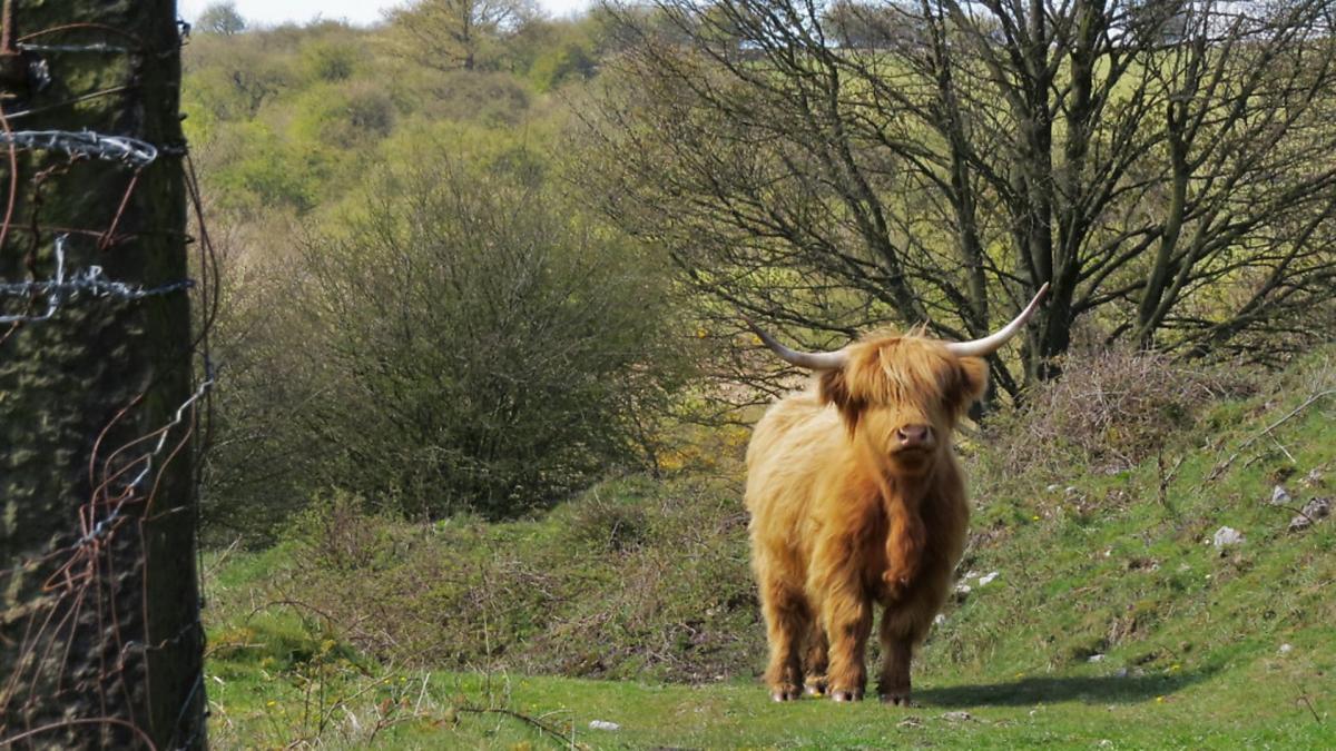
If you are fortunate enough to come across a small herd of adorably attractive and very docile Highland cattle that roam this section of Hassop Common, please treat them with respect. Do not get too close or pester them for photograph poses!
7. Follow the track downhill at the next junction, from where it becomes a more defined road that eventually leads through the little hamlet of Rowland.

8. Turn left and walk beside Longreave Lane to Hassop with a substantial wall to your right that encloses the Hassop Estate. Before reaching the village notice the high embankment on your left which is covered with wild garlic. When in flower it looks like a ground-covering of snowballs beneath the trees.
9. The classical Roman Catholic Church of All Saints at Hassop, built in 1816 by Joseph Ireland, is a most unusual Italianate style for Derbyshire. It is said to have been modelled on St Paul’s at Covent Garden (The Actor’s Church) which was designed by Inigo Jones. Stone from a quarry at Baslow was brought to construct the church using the 1765 turnpike road and toll charges are said to have amounted to £10.
A secret passageway is believed to exist which links the Church with the Hall opposite. Hassop is the most intriguing and fascinating place. The Estate was first recorded as belonging to the Foljambes. In 1399 in the reign of Richard II, an infant heiress of the Estate became a ward of the King. She was sold to Sir John Leake, then sold again, for a profit, to Sir William Plumpton and, when only a year old, her future marriage was arranged with his son.
In 1498 Hassop was bought by a member of the Eyre family of Padley. It has passed through only seven families in its 900-year history, but on occasion there have been disputes as to its true ownership. In the early 1880s Gladwin Cloves Cave travelled from Australia and took forcible possession of the Hall. His claim was based on the validity of the will written by Dorothy Leslie (née Eyre) on her deathbed. However, the courts went against him and he was evicted.
For many years Hassop Hall was a prestigious country hotel, but has recently changed hands and is now a private residence once again.
10. After the Old Eyre Arms turn right down School Lane. The isolated former schoolhouse still has its bell tower and bell that long ago would have summoned children from around the local area.
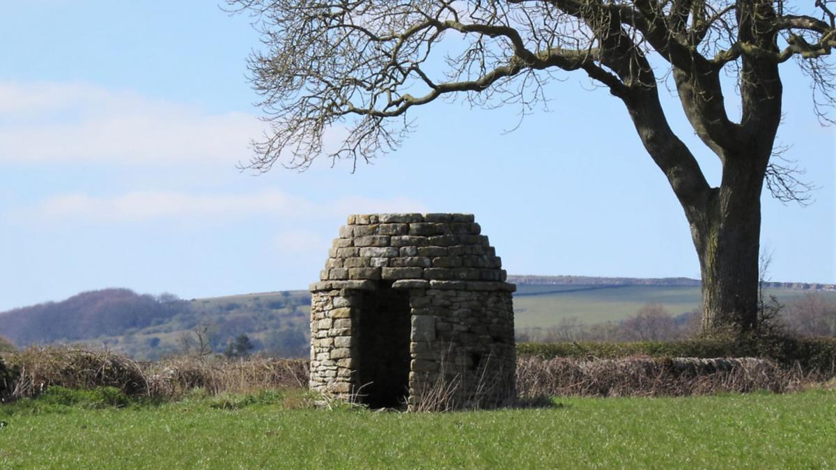
11. Continue along the quiet road as it passes Oxpasture Farm and then rises up to pass between Bank Wood and Toost Wood. Now known as Wheatlands Lane the road descends once again, offering far-reaching views to the east. Notice a quaint little pepperpot building in the corner of a field, similar in style to the old lock-up at nearby Curbar.
12. Just before the final descent into Baslow look left to see the two plantations mentioned earlier with shrubs creating the initials ER, known as The Royal Cypher.
Arriving back into Baslow at West End, turn right and head to Bakewell Road. Cross with care then follow the pavement back to the car park.
COMPASS POINTS
Distance: 6.5 miles
Parking: Nether End Car Park, Baslow DE45 1SR (pay & display)
Grid Ref: 259722
Terrain: No stiles. Two cattle grids with gates option. Roads, lanes and track with uneven terrain. Some roadway without pavement. Livestock grazing on track.
Refreshments: Various pubs and tearooms in Baslow. Old Eyre Arms, Hassop
Toilets: Nether End Car Park, Baslow
Map: O.S. Explorer OL24 – White Peak
Walk highlight: Far-reaching views from Beacon Rod on Longstone Edge
Description: Starting in Baslow, this walk quickly leaves behind the hustle and bustle of main roads to take advantage of quiet back lanes. With the benefit of easy walking, time can be spent concentrating on the fabulous views and glorious scenery. Now that spring is upon us trees are bursting into leaf, blossom adorns hedgerows and wild flowers decorate the countryside in a rainbow of colours.


