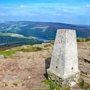
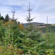
A glorious summer stroll over upland White Peak, all the while enjoying panoramic views across the National Park and beyond.

1. Make your way to St John the Baptist Church at the top of the village. At 1,200ft above sea level this is the highest parish in the Derby Diocese and the highest church with a spire anywhere in England. The tower contains a set of five bells including a treble and tenor that were re-cast in 1960 to incorporate metal from the bells of Derwent Church which was lost when the village was flooded to form Ladybower. The 15th century spire has a weathervane in the shape of a locust (the symbol of John the Baptist). Notice also the Elizabethan porch which was constructed using ancient coffin lids and sepulchral slabs dating from the 12th century.
Continue uphill on the road which will shortly become a rough track, leading past Bank Pit Spring, historically the source of Chelmorton's water supply known as 'Illy-Willy Water'.
Above you to the left is Calton Hill which is of volcanic origin. An igneous rock formed from molten lava and called basalt or toadstone can be found here.

2. Follow a path through the redundant spoil heaps of Grove Mine. From spring onwards these hillocks can be dotted with wild flowers, starting with bursts of stripy stemmed coltsfoot and progressing to crowds of yellow-faced wild pansy and jewel-encrusted spires of common spotted-orchid.
3. Arriving at Pillwell Lane, turn left following the sign for the Pennine Bridleway, heading in the direction of Chee Dale. See far-reaching views towards eastern Edges and landmark summits in the distance whilst dominating the foreground are the extensive works of Tunstead Quarry. This 'super quarry' is the largest supplier in the UK of lime and lime-based products ranging from aggregates and road surfacing to a component part of toothpaste. Between five and six million tonnes of limestone per annum are extracted from here then transported all around the UK by road and rail.

4. Just before the track descends at Pillwell Gate, you may wish to make a short detour following a concessionary path on the right to see Five Wells chambered tomb which can be identified by upright slabs of limestone on the summit of the hill at some 1,400 feet.
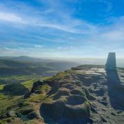
Reputed to be the highest megalithic tomb in Britain, this is where early humans buried their dead as close to the sky, heavens and stars as possible. Three upright stones mark the main chamber with the remains of a second cairn close by. Both have been dramatically reduced in size as stone was taken from the site centuries ago when constructing nearby walls.
5. Where the road bends around to the left, continue straight ahead following a restricted byway known as Senner Lane.

6. At the far end of the lay-by head over a wall stile into a small plantation, being one of 16 paired spinneys spaced out along almost a mile of the A6. Follow a footpath at the edge of this copse to another stile and then head uphill over two fields, emerging onto a rough track known as Sough Lane. Turn right and proceed up this fabulous old route following a section of the Limestone Way.
7. Arriving at Moor Lane turn right. Walk approximately 250 yards and then turn left to descend Green Lane. Be extremely careful at the following crossroads and go straight over, heading for the village of Flagg.

8. Turn right at Town Head to walk past Town Head Farm and then on the corner of Pasture Lane go through a narrow gate on the right. Head diagonally right, passing a circle of spoil heaps on your left, to a gateway and stile. Now follow the footpath through a series of fields and stiles, eventually emerging back onto Flagg Lane.
9. Turn left and walk to the crossroads which is known locally as Chelmorton Thorn.
In the Middle Ages, long before most outlying fields had been enclosed, it was a tradition to plant a thorn bush at a crossing of ways on open ground as a marker and guide. Amongst the trees in a small enclosure here are some hawthorns which could possibly be descendants of that ancient bush. Continue ahead to where the road begins to descend.

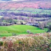
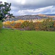
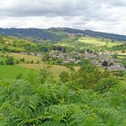
10. Turn right and walk along a lovely elevated lane with sweeping views toward the hills and moorland surrounding Buxton, whilst below is an aerial view of Chelmorton with a long line-up of thin strip fields established in medieval times, emanating from properties that line the village. Following later Enclosure Acts, fields beyond this are generally of a more square or rectangular shape.
11. At a footpath sign on the left go over an awkward stile to descend an early strip field, passing through a farmyard to emerge on the Main Street.
12. You may wish to end your walk by taking time to walk up and down the village to look at the old farmhouses and quaint little cottages, as well as more modern characterful properties.
COMPASS POINTS
Distance: 5 miles
Parking: Roadside along Chelmorton's main street (please be considerate of resident's parking spaces) SK17 9SH (Grid Ref for start of walk: 115703)
Terrain: Five gates, six stiles. Mainly footpaths, old tracks and some quiet roadway without pavement. Livestock grazing in fields. One or two awkward wall stiles.
Refreshments: Church Inn, Chelmorton
Toilets: None
Map: OS Explorer OL24 (White Peak)
Walk highlight: View down over Chelmorton's medieval strip field system
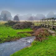
Description: You will leave behind the attractive linear village of Chelmorton, established long ago as properties were built to line either side of a natural watercourse which still flows down the hill. The walk then progresses by ascending an old miners' path to high ground for the first of many far-reaching views that will dominate the route with every step. Along the way look for distant landmarks and familiar summits on this easygoing rural amble.


