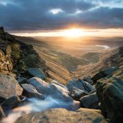
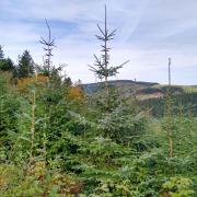
With dense pine forestation overlooked by a miniature Matterhorn mountain, on this walk you can imagine yourself to be hiking in Switzerland rather than the Peak District, writes Sally Mosley

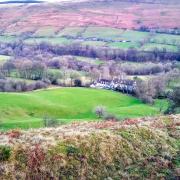
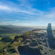
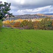
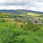
1. From the car park descend the steep path indicated by a concessionary bridlepath sign marked Saddlers Way. Look across to Macclesfield Forest which is the last remnant of the Royal Forest of Macclesfield. It is a working forest managed by United Utilities and contains mainly pine with some broad leaf trees. A herd of elusive red deer is said to roam these hills and you might also see rare breed sheep in the fields along the way and longhorn cattle grazing the slopes of Tegg’s Nose in the summer months. Look across the valley to see little homesteads tucked into the landscape. There’s often a long string of buildings following the contours of the land or a tight cluster snuggled into a sheltered hollow. Notice also the summit of Shuttlingsloe which, reaching 1,660 feet, is affectionately known as the Cheshire Matterhorn because of its distinctive shape and height in a county more commonly known for being flat.
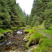
2. At the bottom of the path turn right onto a narrow lane and walk for 225 yards then turn left and follow the sign for Macclesfield Forest and Shuttlingsloe, ascending an old track past Clough House.

3. After hopping over a narrow stream trickling down off the hills, continue uphill where the track now becomes rough with loose stones. At a sharp left-hand bend stop for a while to admire the views to the west. Between Croker Hill, topped with its distinctive mast, and the promontory outcrop of Tegg’s Nose you can see through a gap to the Cheshire plain stretching away into the distance. Now follow the track around to the left and continue to ascend.
4. Follow Hacked Way Lane beyond Hardingland farmhouse for 150 yards and then go through a gate on the right to enter woodland. Follow the sign for Forest Chapel which will initially lead you to a ruined farmhouse hidden in the woods. This was the childhood home of Walter Whiston Bullock (1882-1917). His father James Bullock had built the house – his initials and the date of 1880 can be seen on the far side. The memorial to Walter states that in 1892 he emigrated with his family to Auckland and became a tinsmith. In June 1915 he enlisted in the Wellington Regiment and fought at Gallipoli and the Somme. On 4th October 1917 when leading a party of men in a successful campaign to capture a German concrete shelter, Walter was sadly killed in action. He was awarded the Distinguished Conduct Medal for showing ‘splendid courage and determination’.

5. Walk a short distance to a crossing of paths and then go over a low wooden stile following the sign for Forest Chapel. Shortly afterwards you enter a dark band of woodland, your boots scrunching on a carpet of needles as you pass through a regiment of stalwart pines. 4
6. On reaching Charity Lane – an old route over the moors that has become an eroded track hollowed away by time, travel and water to bedrock slabs of gritstone – turn right and walk down what is now part of a forest bridleway to St Stephen’s Church of Macclesfield Forest. In the distance ahead are views across to Shining Tor and the Cat & Fiddle pub, like a silhouette landmark on the horizon. The church dates from 1673 and still holds services once a month. Close by is an old school house and teacher’s cottage. In mid-August this little house of worship is packed with a very large congregation who are here to attend the annual Rushbearing Service. Before churches had solid or stone-paved floors, rushes were strewn to keep the earth surface clean and their renewal each year was a special event. In most churches this has long since ceased but St Stephen’s still commemorates this old tradition dating back centuries. On the day of the service the church is decorated with rushes.

7. Turn sharp right at Toot Hill House and follow the road around Toot Hill, said to be the site of an ancient settlement.
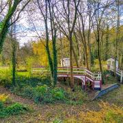
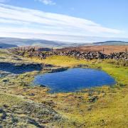
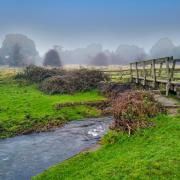
8. At a dip in the road take a footpath on the left by going through a kissing gate and follow a path downhill. Arriving at a T-junction of paths follow the sign for Trentabank. At the bottom of the hill by a pool of water turn right at the sign to cross a little plank bridge, continuing on the Trentabank path.
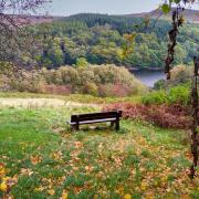
9. Arriving at a road, you can either cross over to follow a new stretch of concessionary footpath or turn right and follow the road to Trentabank car park and picnic site. On reaching the reservoir be sure to look across for signs of nesting by a siege of grey herons located in a plantation of larch trees. This is said to be the largest heronry in the Peak District, generally having more than 20 breeding pairs. Cormorants can also be seen nesting here.
10. Using concessionary paths to avoid roadside walking where possible, continue from the car park past Trentabank Reservoir which was completed in 1929. Beyond this is Ridgegate Reservoir built in the latter part of the 1800s. At a junction of roads you will arrive at the Leather’s Smithy pub. An explanation for its unusual name can be found on a plaque by the door which advises that this 18th century building was originally a smithy and that in 1821 the farrier, called William Leather, obtained a licence to sell ale and porter from the premises.
11. Follow the roadside pavement towards Langley. At the end of a row of cottages go through a gap by a footpath sign for Tegg’s Nose and walk beside Bottoms Reservoir. Whilst checking out this walk I saw a kingfisher and a great-crested grebe here, as well as other more common species of birds and water fowl.
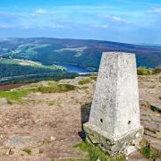
12. Walk along the dam wall and then ascend steps to pass Tegg’s Nose Reservoir and enter Tegg’s Nose Country Park. The way from here is uphill, climbing a long succession of steps and a steep path to Ward’s Knob, along a stretch of the Gritstone Trail. When you stop for a breather be sure to look to your left for distant landmarks and features such as Lovell’s radio telescope at Jodrell Bank, aeroplanes toing and froing at Manchester Airport and the Beetham Tower in the heart of the Manchester metropolis.
13. On reaching a gate near the summit turn right and follow a wide path around the top of Tegg’s Nose, passing an old quarry face on your left. Beyond this are a brightly painted old crane and a redundant hydraulic lift invented by John Smith of Keighley, as confirmed by his patent number.
14. After descending a twin flight of stone-flagged steps, go through a gate on your right to follow the path back to the car park.
DISTANCE 6.25 miles
PARKING Tegg’s Nose car park SK11 0AP (pay & display) Grid Ref: 733951
TERRAIN 10+ stiles and gates. Moderately strenuous walk with steep ascents and descents. Lots of steps. Close proximity to deep water. Woodland paths with trip hazards. Some roadway without pavement. Livestock grazing.
REFRESHMENTS Tegg’s Nose Tea Room;Leather’s Smithy pub
TOILETS Tegg’s Nose Car Park; Trentabank car park & picnic site
MAP OS Explorer OL24 White Peak
WALK HIGHLIGHT Panoramic and far reaching views
DESCRIPTION A rollercoaster walk on old tracks, woodland paths and quiet country lanes discovering remote homesteads and a run of reservoirs where herons rule the roost. Be prepared for a sting in the tail as the route ends with a steep uphill trek to Tegg’s Nose, but your reward is a breathtaking view over the Cheshire plains.


