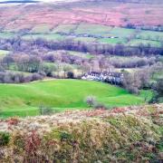
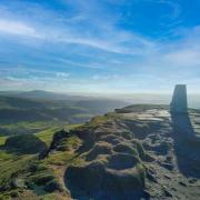
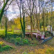
Remote and rural, Sally Mosley’s picturesque walk in the Manifold Valley takes us from from deep wooded valley to ‘big sky’ views

DESCRIPTION Long ago the Manifold Valley was a site of industry and hard work due to its unique geology but jump forward a century or two and we are able to discover peace and tranquillity in one of the Peak District’s most beautiful places.
DISTANCE 6.75 miles
PARKING Manifold Valley Visitor Centre, Hulme End SK17 0EZ (pay & display) Grid Ref: 103593
TERRAIN 7 gates, 5 stiles. Moderately easy going walk mainly along paths, tracks and quiet country lanes without pavements. Some field and stile terrain. Livestock grazing. The Manifold Way is narrow in parts and used by walkers, cyclists and horse riders.
REFRESHMENTS Wetton Mill tearoom; The Tea Junction, Hulme End (both subject to seasonal opening hours)
TOILETS Manifold Valley Visitor Centre; Wetton Mill
MAP OS Explorer OL24 – White Peak
WALK HIGHLIGHT Sitting beside the river at Wetton Mill
1 Hulme End was known as Hulme Lea before the arrival of the Leek and Manifold Light Railway which was laid in 1904 through the Manifold and Hamps valleys. It was designed to transport milk, cheese and farm produce as well as passengers to Waterhouses some 8.5 miles to the south. Along the way were simple stations or halts where there would have been a wooden shelter and bench. The railway closed in 1934 through lack of profits and all that remains is the terminus building and booking office, now used as a visitor centre and public toilets with the engine shed alongside. The disused track bed is a wonderful walking, cycling and horse riding route known as the Manifold Way which leads through spectacular countryside.
2 Follow the track leading away from the engine house and after emerging from trees at the far end of the car park glance to your left for the first view of Ecton Hill. The hill is still covered by the scars of mine shafts and spoil heaps, while within is a labyrinth of inaccessible tunnels dating back centuries. Ecton Hill contained vast deposits of copper ore, for a time making it one of the most productive and profitable copper mines in the world. The mineral rights were owned by the Dukes of Devonshire and it is reputed that the 5th Duke became so fabulously wealthy from Ecton money that it allowed him to fill Chatsworth with treasures and build the well-known Crescent at Buxton, as well as allowing him to meet the gambling expenses of his famous wife Georgiana. Between 1776 and 1817 some 54,000 tons of copper ore were supposedly mined here.
3 Look for a tiny triangle on the skyline of the hill which is the roof of the former engine house above Ecton Deep Shaft. This descended almost 1,400 feet into the ground – 1,000 feet of which was below the river level – making it one of the deepest mines in Europe.
Follow the level path as it meanders beside the River Manifold, at one point crossing over a narrow road which drops into the valley from Warslow on high ground to your right.
The valley is renowned for its geological features. As you walk along be sure to look for thick plates of bedrock which at times are slanting rather than lying flat. A hard rock called chert, discovered in the bands of limestone, was once transported to Stoke-on-Trent for use in the production of fine bone china.
4 Arriving at Swainsley Tunnel leave the trail by turning left, descending the road past the entrance to Swainsley Hall which at one time was a prestigious country house hotel.
5 Immediately after crossing over the river, turn right to walk along a gated road. This was the original route taken by pack horses and ponies carrying panniers of copper ore to be smelted at Whiston. As many as 70 or 80 ponies in a long train would have used this old road to Wetton Mill. Shortly after passing through the first gate you will come to a drainage sough on the left which emptied water from a section of the mine into the river. Around the corner from here you will catch a glimpse of Swainsley Hall up to your right, whilst down by the river nearby is an old circular dovecote.
6 Arriving at Dale Farm, turn right and walk down the road to Wetton Mill where you can sit on the purpose-built seating area upstream of the bridge for your rucksack snack or take advantage of the tearooms beyond for home-made cake and a pot of proper leaf tea.
The Manifold Valley abounds with natural caves and fabulous rock formations created over time by water carving its way through the limestone. Some caves have been the subject of archaeological excavations, revealing the bones of prehistoric animals and evidence of occupation long ago by man. These finds can be seen in both Derby and Buxton museums. A mile or so downstream is the famous Thor’s Cave, named after the Viking God of Thunder, where arrowheads, bone combs, bronze brooches, bracelets and Roman pottery have been found.
7 Cross over the river bridge and turn left to return to the track bed of the former railway line. To your left is a cliff face known as Darfur Crags, beneath which is a series of swallet holes where in summer or during drought conditions the River Manifold disappears to follow a subterranean course. It reappears several miles downstream from boil holes in Ilam Country Park.
8 Arriving at a junction where an old road into the valley descends steeply from Wetton and the Manifold Way continues ahead beside the river, turn left and walk through a small car parking area to a gate beyond which is a National Trust sign for Wetton Hills. Follow a path in the bottom of this deep valley, flanked either side by high hills where sheep generally graze and buzzards fly overhead.
9 Go through a gate to access a road at a remote area known as the Back of Ecton. You will pass Pepper Inn indicated on the Ordnance Survey map as a Manor House. At one time this was an ale house satisfying the needs of thirsty miners on their way home to the villages of Wetton or Grindon but it was also reputedly used long ago as a button making factory – the buttons were probably made of bone and then sent to Macclesfield to be covered in silk.
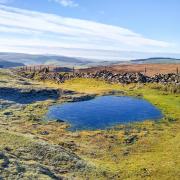
10 Follow the road up a steep hill and then bear right at a junction, passing occasional characterful cottages and farmsteads. After a steep descent you will come to a holding pond from where water once flowed in a long channel to the dressing floors of Ecton Mine, where it was used to wash crushed stone in a process of extracting the precious copper ore.
11 Arriving at a little cottage by a post box and telephone box turn right and walk on the road around a bend to Westside Mill. Observing the sign to keep to the footpath, turn after the parking area on the left and cross a footbridge over the river then bear left and walk in the field a short distance downstream before crossing diagonally right to a stile by a gate leading back onto the Manifold Way. Turn right and retrace your steps to the car park.


