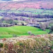
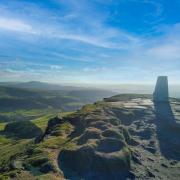
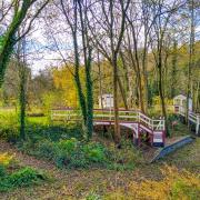
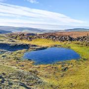
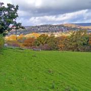
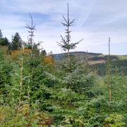
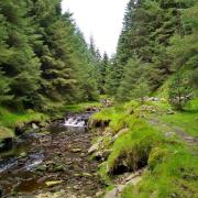
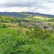
Cross a theatrical landscape etched by ancient trackways overlooked by a halo of windswept trees on this lovely winter walk.

Route
1. Exiting the car park, turn right and walk to the road junction then turn left on the road signposted for Parwich.
2. At a small crossroads turn left onto Minninglow Lane which forms part of the National Cycle Network. Your eyes will be drawn ahead toward the hilltop summit of Minninglow with its iconic cluster of mature beech trees surrounded by an arboreal halo. See also the extensive dark grey wall stretched out beneath it. This is an impressive embankment structure created in 1831 to support one of the first railway lines in the world. Peeping over the side of the hill are the outstretched fingers of a wind turbine on Carsington Pastures.

3. Turn right and proceed down the drive to Roystone Grange and enter an area steeped in history. See textured and weathered limestone in the drystone walls hereabouts, said to be some of the oldest in Derbyshire.
It is known that there was a Roman presence here, evidenced by the occasional large ‘orthostat’ stones (mostly rounded in shape) that can be found in the base of some walls. Built in as straight a line as possible, through a landscape peppered with exposed rocks, at times the walls were laid over the top of them.
4. Roystone Grange contains some lovely examples of traditional stone farm buildings, including a barn with brick pillars and stabling. Just after the last of these cross a small field on your left to a gated stile.

The building you can see beyond Roystone Grange is a restored Victorian pump house with high arched windows. This was built to house a large engine which pumped compressed air through cast-iron pipes to drive rock drills in small local quarries where stone was extracted in the construction of the Cromford and High Peak railway line.
To the rear of the pump house is a line-up of rather insignificant looking stones that are said to be archaeologically quite fascinating. They are believed to be the foundations of Roystone Grange’s original medieval hall and barn, built by the Cistercian Abbey at Garendon in Leicestershire during the 12th century, and one of the earliest Cistercian monasteries in England. Founded in 1133 in Charnwood Forest, Garendon acquired two further estates, at Biggin and Heathcote.
Land hereabouts was farmed by monks to raise huge flocks of sheep, mainly for their fleeces. There are still sheep dotted about as far as the eye can see, but the monks have long since gone due to Henry VIII and the Dissolution of the Monasteries.

5. Keeping a wall to your left, walk up a grassy track to a fingerpost sign and then cross over the high step stile in the wall. Notice how the steps contain lots of fossils including crinoids, known locally as Derbyshire screw because they look a bit like an assortment of washers and screw threads.
Head uphill through a gateway and then go under a bridge carrying the High Peak Trail above. Cross the following field by walking past an old gatepost that appears like an ancient standing stone. See how the iron hook was held in place with a large blob of molten lead.
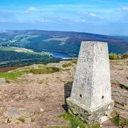
6. Go over a high wall stile and then cross the grassy lane beyond. Go through a gate to follow the footpath sign for a concessionary route up to Minninglow. Dating back to Neolithic times, this was where early Stone Age man buried their dead, as close to the heavens as possible. This ancient burial mound has the remains of five chambers which once contained numerous skeletons. The site is thought to be older than most of the Bronze Age tumuli known as ‘lows’ that sit on top of Derbyshire’s hills. It is an interesting thought that when the Romans laid a road from Derventio (Derby) to Aquae Arnemetiae (Buxton) less than a mile away to the east, this graveyard had probably been in existence for 2,000 years!

To get the full impact you may wish to do a complete circuit on the outside of the trees and admire wondrous views that extend to the south over the flat Midlands whilst to the north there are the highest hills of the Peak District.
7. Exiting on the opposite side of Minninglow to where you arrived, descend another concessionary path leading down to the High Peak Trail. Several large craters on the hillside are probably where stone was extracted for walling, whilst a quarry to the side of the trail was where stone was sourced for the incredible embankment structure nearby.
Yet more industrial heritage can be seen from the trail by looking to where Minninglow Lane disappears into a hollow where there are the remains of silica pits in what is now a conservation site. During the 19th century the deposits of high-firing silica sand found here were manufactured into refractory bricks in a brick-kiln complex to the side of the railway line. These bricks were used in the Sheffield Steel industry. Refractory bricks are still manufactured to this day, but from the Friden site of DSF Refractories & Minerals a few miles away.

8. Turn right on the trail and follow this as it guides you back to the car park. Along the way an almost aerial view of Minninglow Grange to your left provides an insight into life on a working farm. In spring and early summer these fields act as a nursery for new born lambs and cows with their calves.
COMPASS POINTTS
Distance: 3.5 miles
Parking: Minninglow car park next to the High Peak Trail DE4 2PN (nearest post code) Grid Ref: 195582
Terrain: 10+ gates & 4 stiles. Quiet roadway without pavement. Tracks, paths and fields where livestock grazes. High embankment with low sides on the trail. Awkward wall stiles.
Toilets: None available on the route
Refreshments: None available on the route
Map: O.S. Explorer OL24 – White Peak
Walk highlight: Reaching the landmark summit of Minninglow
Description: This perfect winter walk along mainly sound surfaces ambles over upland White Peak countryside where evidence exists of early farming dating back to Roman times. See jagged rocks emerge from the hilltops like bones, eroded long ago by glacial melt. This relatively easy route takes advantage of Victorian engineering when walking on a long straight stretch of track bed followed by an immense walled embankment.


