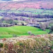
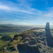
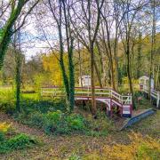
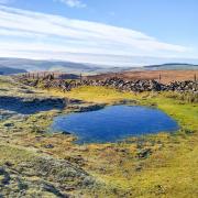
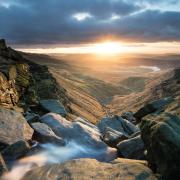
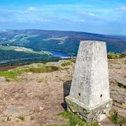
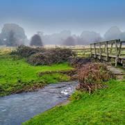
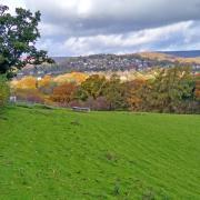
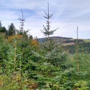
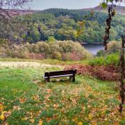
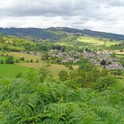
Photogenic and full of character, the dense woodland of Padley Gorge hides many secrets. These sylvan slopes are a stark contrast to the wild and exposed Dark Peak high ground above, where sheer gritstone Edges frame a rolling sea of heather clad moor
This walk was published in October 2014, so the details of the route may no longer be accurate, we do advise these articles should only be used as a guideline for any potential route you take and you should double check an up to date map before you set off.
DISTANCE 6.75 miles
PARKING National Trust pay & display to rear of Longshaw Lodge S11 7TS

TERRAIN One stile and ten gates, many steps and some uneven terrain with exposed tree roots and numerous trip hazards. Watch out for dangerous drops in Padley Woods. Some sections of road and lane walking are without pavements. Keep to the path on top of Millstone Edge and do not cross over the protective fencing.
REFRESHMENTS Station Cafe, Grindleford, National Trust Tearoom, Longshaw Lodge
TOILETS Longshaw Lodge
MAP OS Explorer OL24 - White Peak; OS Explorer OL1 - Dark Peak

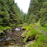
WALK HIGHLIGHT Descending Padley Gorge with its twisted oak trees and scatter cushion rocks.
DESCRIPTION Created hundreds of millions of years ago by the power of natural forces, the last few centuries have seen the rugged landscape surrounding Padley sculpted by man who long ago quarried these gritstone Edges for stone and tunnelled deep beneath the moors to drive a railway line through the hills. Now an area of outstanding natural beauty, this walk delves into the past on old paths and tracks, descends ancient woodland to discover the remains of a historic manor and ascends gradually back to the breathtaking heights of Surprise View.
1. From the car park follow the footpath to Longshaw Lodge for your first glimpse of amazing views toward distant peaks. The 'lost world' plateau is Higger Tor beyond Carl Wark, a part-fortified Iron Age stronghold. On the skyline to the left of these is a standing stone known as Mother Cap on Owler Tor. Longshaw Lodge was constructed in 1827 as a shooting lodge for the Duke of Rutland. It is now owned by the National Trust with the main building converted into private apartments.
2. In front of the shop and tearoom follow the fingerpost for Estate Walks leading past a millstone built into the wall with feature map of the National Park. Go through a gate to a canopy of yew and turn right down the path to Longshaw pond beside banks of rhododendron which in spring provide a rosy glow to an otherwise muted colouring of greens and browns.
3. Continue beyond the pond to the road where there is a building containing information about the Longshaw Estate. Carefully cross the road and pass through a gate to descend steps and bear right to a footbridge over Burbage Brook, which is on a tumbling race over rocks and boulders, to unite eventually with the Derwent in the valley below.
4. Follow the fingerpost for Padley Gorge and cross an area of open ground scattered with stones before entering woodland with the brook to your left. Up to your right are massive spoil heaps of quarried rocks, now covered in moss like giant velvet cushions. Stone quarried here in the early 1900s was taken by rail to build the walls of the Howden and Derwent dams. Look for birds as they flit between silver birch and corkscrew oak. You also pass a money tree on your right - a good luck custom utilising fallen trees and stumps.
5. Ignore a fingerpost in the woods for Surprise View and Bolehill Quarry. Instead continue downhill on a parallel path with the brook. At a junction of paths beneath a towering beech turn right and head up a long flight of steps before descending steeply to Padley, passing a barrel-topped Water Board building on your right. This is above a mains pipe laid down the valley when Ladybower Reservoir was constructed in the 1930s to supply various cities in the Midlands.
6. A steep rough road descends between houses. At the bottom turn left and walk past a former sawmill and cross Burbage Brook for a detour to Grindleford Station cafe. At its side is the entrance to Totley tunnel which is 3 miles and 950 yards long. When completed in 1893, it was the second longest railway tunnel in the UK, after the older Severn Tunnel.
7. After your detour walk back along the unmade road behind terraced houses built originally for railway workers. A short distance beyond these you will arrive at Padley Chapel, a former gatehouse. All that remains of Padley Manor itself is a jumble of rocks and foundations to the rear. In the 16th century this was the home of Catholic recusant John Fitzherbert during the reign of Elizabeth I. On 12th July 1588 the manor was raided and two priests found hiding were taken to Derby Gaol where another priest, Richard Simpson, had already been arrested. The three were tried on 23rd July 1588, found guilty of treason and sentenced to be hanged, drawn and quartered. The execution was carried out the next day at St Mary's Bridge in Derby. Robert Ludlam, Nicholas Garlick and Richard Simpson were declared Venerable in 1888 and were among 85 martyrs of England and Wales to be beatified by Pope John Paul II on 22nd November 1987. On the nearest Sunday to 12th July, a pilgrimage is held here with an outdoor mass to remember the Padley Martyrs.
8. Continue on the track for about a mile, passing through Greenwood Farm. Watch for views of Lose Hill and Mam Tor emerging at the head of the Hope Valley. Eventually you will arrive at the main road leading out of Hathersage. This was laid as a turnpike road to Sheffield. With extreme care, cross over to the former lodge on the corner and then turn up the Ringinglow Road keeping well under the side to the right.
9. At the end of the wood there is a stile leading into access land. Head up the path through Little Moor. After passing through a gate, walk steeply up through reed grass and beds of high bracken, keeping a fence to your right. This will bring you around to the top of Millstone Edge where millstones were quarried for centuries. As well as for grinding corn, they were used to grind minerals for paint, to pulp timber for paper and apples for cider.
10. This path would eventually lead you down to the road where a gap in the Edge is known as Surprise View, reputedly named when Queen Victoria came this way in a carriage from Sheffield and is said to have commented on the view: 'Oh my, what a surprise!' Do not walk all the way down to the road, turn left at a gate on your right following a path past a white painted rock in a sea of heather. This leads to the Surprise View car park.
11. Exit the car park and cross the road, then walk left on a narrow roadside path beyond the bus stop to a gate. Descend a wonderful stretch of hollowed away path which is part of an old packhorse route worn deep into the hillside.
12. On arriving back at Burbage Brook turn left and follow this upstream. Cross a footbridge, walk up a stone causeway and then turn right and walk back to Longshaw through a scattering of mature trees and an area renowned as a rich habitat for fungi in autumn. Cross the road to the lodge - notice the old guide stoop just through the gate on the right, a 300-year-old waymarker used to guide early travellers over the wild moorland. Alongside it is a modern companion stone which is part of an art project to commemorate the 300th anniversary of Derbyshire guide stoops in 2009.


