

We head for the highest point in Cheshire for this month’s walk, enjoying some panoramic natural beauty and a ruined mansion, writes howard bradbury.
Surveying what remains of Errwood Hall, you are bound to ponder at how life was once lived there.
Built in 1840 for the Manchester businessman Samuel Grimshawe in a remote and beautiful spot in the Goyt Valley, it was the centrepiece of a 2,000-acre estate which included several farms and a coal mine, and stretched as far as the Cat and Fiddle Inn atop the Macclesfield to Buxton road.
The Grimshawes decorated their grand house with works of art, mainly from Italy, and brought 40,000 rhododendrons and azalea shrubs back from their travels around the world to plant on their estate.
The family lived well; 20 ‘inside’ servants, including three French chefs, and more staff to look after the livestock. Occasionally they would share their good fortune. A grand party in January 1895 for all their tenants and the tradespeople of the district reportedly consisted of a grand spread - chicken, sirloin of beef, venison, roast turkey and pheasant, game pie, boars head, plum puddings, mince pies, orange jelly - followed by dancing until 4am.

By 1930, the last of Samuel’s descendants had died, the hall was emptied and purchase of the land by Stockport Corporation was imminent for the construction of the Fernilee and later the Errwood reservoirs.
The hall was demolished and the debris used in the Fernilee Reservoir dam. And yet the foundations were left, along with the stone window arches - a rather sad reminder of a once proud home.
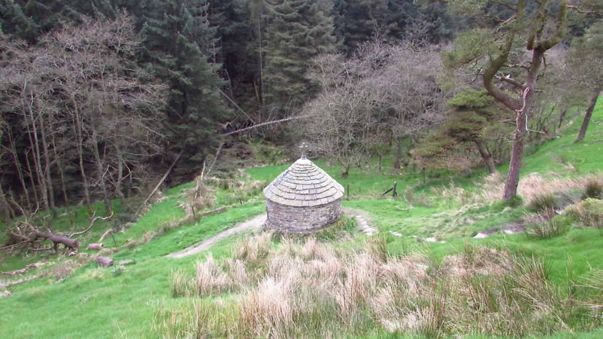
One legacy of the Grimshawes does remain intact, though, and we see it towards the end of this walk: a small shrine erected in 1889 in memory of Dolores de Ybarguen, a Spanish aristocrat who was the teacher at a private school for around 30 local children at Errwood Hall, and who died in her 40s on a visit to Lourdes.

The walk
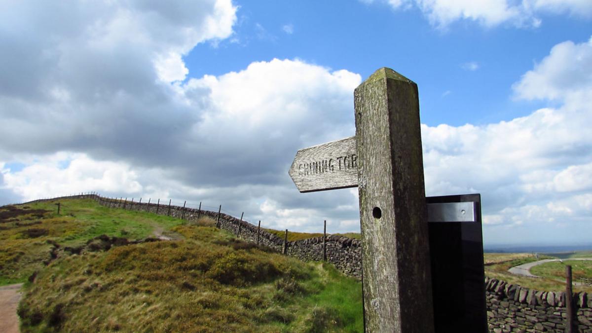
1. We start from Pym Chair car park. The postcode is SK10 5XL, but this information may confuse your sat nav, as it did mine, so I’d strongly suggest a quick consultation with Google Maps so you know the lie of the land before setting out. Head up the car park towards the road, where you will see an information sign about the Goyt Valley. Bear left on the path beside the lane and within a few yards cross over the lane to ascend a grassy bank where a waymarker to Shining Tor can clearly be seen.
2. It is a long, steady but fairly easy climb up to Shining Tor, the highest point in Cheshire. The path is well-worn and after a while it is paved with huge stone slabs which means this walk is doable even in the muddiest conditions. Ever more panoramic views open up as you go higher, and this non-ornithologist scared up several game birds which I’d hazard, from their distinctive chortling call, were grouse. At Shining Tor, you will find a trig point and a bench. If you’ve brought a picnic, this is the place to indulge.

3. From Shining Tor, take the path for Stakeside, heading left and downhill from the path on which you arrived at Shining Tor. Along the way, you may notice a large and incongruous Christmas tree which some wag had adorned with tinsel. The path continues uphill to a kissing gate. Go left here, following the waymarker to Errwood. Stick to the path running parallel with a wall. When you reach a kissing gate to the left, with a sign to Shooters Clough, head slightly right instead on a grassy path continuing downhill in the direction of the reservoir.
4. Go through a kissing gate and continue downhill as the grassy track becomes a rubbly track. Reaching a metal gate, bear left, following the track to Errwood Hall, and keep left going beside a large green metal vehicle barrier. You are now in woodland with a stream to the right. The track crosses over this stream, which is now on your left and then goes uphill. At the signpost for Errwood Hall, turn sharp right and, passing the ruins of the hall on your left, continue on the path into woodland with a stream again to your right.
5. Go down steps to a curved bridge over the stream and then climb a few yards to a junction of paths, bearing right and uphill. A few yards later, bear left following a sign to Pym Chair. It is now a long and steady trudge on this clearly-defined path. Keep an eye out below you on the left for the little shrine. Eventually, the path emerges at a lane. Turn left up the lane and a few minutes more trudging will bring you back to the car park.
COMPASS POINTS
Area of Walk: Shining Tor and Errwood Reservoir
Distance: 6 miles
Time to allow: 2½ hours
Map: OS Explorer OL24
Refreshments: The Stanley Arms Hotel, Bottom of the Oven, Macclesfield Forest, near Wildboarclough, Macclesfield SK11 0AR.


