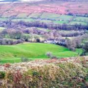
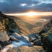
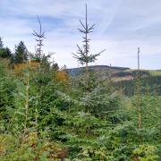
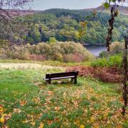
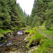
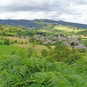
Starting on a 'high', this walk begins with a hike along the rugged Roaches escarpment offering all encompassing views before descending into Forest Woood in search of Lud's Church. Look out for wallabies - at one time occasional sightings were made hereabouts, now sadly consigned to legend.
1- After locating a parking space make your way to Roaches Gate near the bus stop and a pair of isolated roadside cottages. Go through the gate by the footpath sign and notice the information plaque. Walk up the main path heading towards the gap between Hen Cloud and the main Edge. Turn left and walk up to Rockhall Cottage built in 1850 by the Brocklehurst family of nearby Swythamley Hall for their gamekeeper. In 1992 the building was restored and leased to the British Mountaineering Council as a shelter for climbers and renamed the Don Whillan’s Memorial hut.
2- Do not go through the small gate marked private but walk instead a short distance to the left going through the third small gateway into woodland. Walk between giant boulders of gritstone used for climbing practice, and beneath pine trees. Sadly many have been brought down by gales in recent years, however, left to rot on the ground they provide shelter for small animals, a habitat for insects, and somewhere for fungi to grow in late summer and autumn.

3- After approximately 300 yards of woodland walking you will meet a path with fencing directly ahead and a gateway in the wall down to your left. Turn right and follow the path which at times ascends stone steps, leading you to the top of the escarpment. Emerge to fabulous views over Goldsitch Moss to the north-east, at one time it was an extensive coalfield with up to 15 small pits or workings, long since abandoned. Look on the horizon to the east for the silhouette of the former Mermaid Inn, a remote hostelry that must have been a welcome sight long ago for travellers by coach or carriage.
4- Turn left and follow the well-defined path along The Roaches escarpment which until 1979 was private land – in Baddeley’s Guide to the Peak District of 1939 it states ‘walkers are liable to be stopped by keepers’. This area of the Peak District National Park abounds with marsh and bog. It is designated in parts as SSSI, Nature Reserves and patches are set aside for conservation. In spring bog cotton appears like pockets of giant snowflakes wafting in the breeze whilst in autumn there are vast swathes of purple heather. Listen for cuckoos down in the trees, curlew and grouse on the moorland whilst in the skies you might see a buzzard or peregrine falcon that sometimes nest on the cliff faces. There are far-reaching views, in one direction down to Tittesworth Reservoir lying like a puddle in the Staffordshire hills. It dates from 1858 and has the capacity to deliver 45 million litres of water a day to Leek and Stoke-on-Trent.

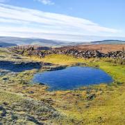
5- You will soon pass Doxey Pool, a welcome watering hole for the small mammals that haunt these moors or for passing dogs, as well as swifts and swallows which in summer months skim over the surface. Down to your left below the escarpment look for a string of rolling outcrops known as the Five Clouds whilst behind you now is the towering bastion of Hen Cloud, a name dating back to the Old English Henge Clud meaning steep rock. The name The Roaches is thought to originate from the French word roche for rock or cliff.
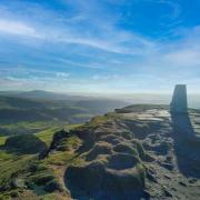
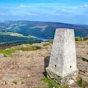
6- After passing large boulders and standing stones eroded and patterned by the force of nature, you reach the trig point summit at 1,657 feet. Look south-west beyond the reservoir to distant peaks on the very far horizon which are said to be the mountains of Snowdonia. The 238ft high Sutton Common BT Tower stands on the summit of Croker Hill to the north-west. Built in the 1950s it is one of only a few communication towers in the UK to be constructed of reinforced concrete. See also Jodrell Bank like a giant bowl on the Cheshire plains aiming at the heavens. The path will now descend gradually to Roach End.
7- Cross over the road and go through a narrow squeeze stile opposite following the sign for Gradbach and Danebridge. Immediately turn right to climb over a step stile and then descend a footpath which at times is a bit hard going due to mud and rough terrain.
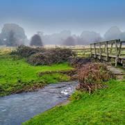
8- After crossing a little stream enter woodland and beneath towering beech trees turn sharp left following the sign for Lud’s Church and Swythamley Walk along the path at the top of Back Forest for almost a mile.
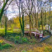
9- At the sign for Lud’s Church and Ridge turn left and head a few yards through trees to another fingerpost sign. From here you can make a short detour to Lud’s Church along a path in part laid with barge boards. Be careful when entering Lud’s Church where there is a steep descent into this chasm or cleft in the rocks. The Lollards, followers of John Wycliffe, an early reformer, worshipped here in secret during the 15th century to avoid persecution for their beliefs. It is also believed to be the Green Chapel, where the final dramatic scene in the late 14th century Middle English poem ‘Sir Gawain and the Green Knight’ was set.
10- Returning to the fingerpost sign, head uphill instructed as Ridge with a white arrow, signifying that this is a concessionary path. As you ascend look behind from time to time to see the summit of Shuttlingsloe Hill emerge in the distance. This is known as the Cheshire Matterhorn.
11- Arriving at the crest of the ridge, turn left and follow the footpath sign for The Roaches, returning you to Roach End. It is hard to imagine that wallabies were once seen roaming around these moors – Lt Col Brocklehurst of Swythamley Hall served as a gamewarden in the Sudan and returned to establish an early private zoo with deer, kangaroos, wallabies and yak. In the 1940s three wallabies escaped and thrived on the moors, living on a diet of heather, bilberries, scrub and young bracken. Breeding stock were introduced from the former Riber Wildlife Reserve near Matlock toward the end of the last century but the harsh winter of 1978/9 saw their numbers deplete. Despite occasional sightings, it is said that the last wallaby died in 2009.
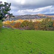
12- To complete your circular walk, turn right and pass through the gate by the side of the cattle grid to follow a quiet lane beneath The Roaches, going straight ahead at a junction by an old black and white sign where a road drops down to Meerbrook passing Roche Grange. This was part of Dieulacres Abbey in Leekfrith, founded by Ranulf de Blondeville, 6th Earl of Chester. The Abbey itself was surrendered in 1538 at the dissolution of the monasteries but is remembered in local place names such as Abbey Green and Abbey Farm. On the way back you will pass beneath the Five Clouds.
COMPASS POINTS
Distance: 6 miles
Parking: Designated roadside parking between the Roaches Team and Roaches Gate ST13 8TY (grid ref: 005619
Terrain: Four gates, Three stiles. Stone steps and areas of wooden barge board. Roadway without pavement. Close proximity to cliff edges. Very uneven terrain with rock and tree root trip hazards. Areas prone to bob and muddy surfaces. Livestock grazing.
Refreshments: RoacheS Tea Rooms
Toilets: None on route
Map OS: Explorer OL24 (White Peak)
Walk Highlight: Being on top of the world


