

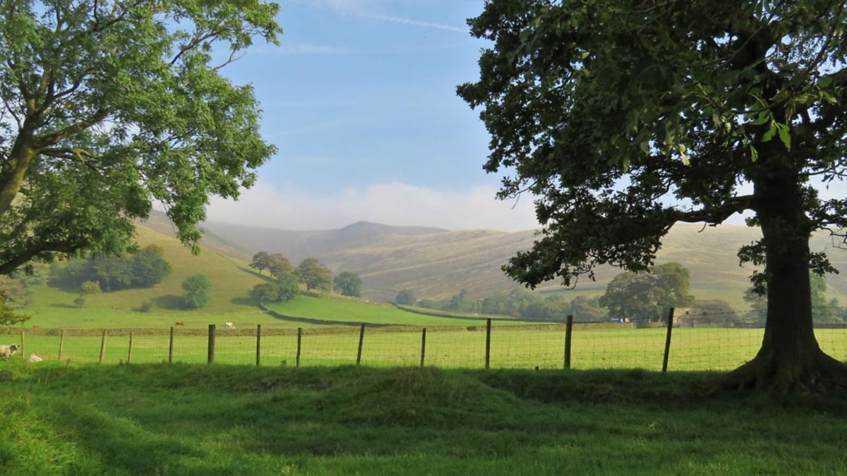
As the starting point of numerous routes, scenic Edale is one of the country’s iconic base camps for hill walkers
This walk was published in September 2018, so the details of the route may no longer be accurate, we do advise these articles should only be used as a guideline for any potential route you take and you should double check an up to date map before you set off.
Route
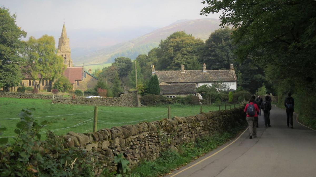
1. Exit the car park by the side of the toilet block and walk up Edale's main street with the station approach on your left. The Hope Valley line was opened in 1894 when it was known as the Dore and Chinley railway line linking Sheffield with Manchester. Continue ahead, passing Edale Church which is dedicated to the Holy and Undivided Trinity. Before the churchyard was consecrated for burials, anyone who died in Edale had to be taken to Castleton by way of a steep path over Hollins Cross. The mourners then had to enter Castleton church by the Devil's Door which was the entrance also reserved for paupers. The route taken is still known to this day as the Coffin Trail.

2. Make your way to the Old Nags Head which dates from 1577. To the left of the pub are signs and a decorated gate forming the start of the Pennine Way. This 268 mile long trail was officially declared open on 24th April 1965. It ends at Kirk Yetholm in Scotland after passing through the Yorkshire Dales and Northumberland National Parks. Walk up the fabulous old holloway lined with wizened tree roots and ancient hedgerow.
3. At the top of the holloway go through a gate on the left following a fingerpost sign for the Pennine Way. Initially paved, this well-walked footpath now passes through fields and small gates over high pasture with elevated views across the valley. It then descends to Upper Booth as a rough track, eventually leading through the yard of Upper Booth campsite.

Edale is the common name given to the whole valley. It was mentioned in Domesday Book as Aidele, but the settlements along the bottom of the vale are called Booths. This term came about in the 16th and 17th centuries when foresters and boothmen built shelters for their cattle and sheep - a booth was an enclosure rented from the Crown where a herdsman or settler could protect his stock from wolves. The shelters expanded to become clusters of permanent dwellings and then became known as the hamlets of Over Booth, Nether Booth, Barber Booth, Lady Booth, Grindsbrook Booth and Ollerbrook Booth. Grindsbrook Booth is the main settlement where the church was erected.
4. Go down the footpath to the right of the phone box with the infant River Noe on your right. This started life high up in moorland groughs on Kinder Scout before flowing down to unite with Crowden Brook that had tumbled and cascaded down a waterfall. Their combined force then flows at a gentler pace to Shatton where the Noe merges with the Derwent. Cross a footbridge and then head uphill through a short band of mature trees to Footpath Sign No. 348 indicating the route for Chapel Gate and Rushup via Dalehead.

5. After passing over a wall stile just to the right of a tumbled down barn, head diagonally right, over an area prone to mud, aiming for a fingerpost and gate. Cross a field to Tagsnaze which was used as a set in the popular TV drama The Village in 2013. This was the home of John and Grace Middleton (played by John Simm and Maxine Peake).
Be guided by footpath signs and posts leading you across the side of the hill to Cowburn Tunnel, passing close to the back of a remote cottage. See spoil heaps of stone known as The Tips, extracted to create this 3,702 yard-long tunnel which allows the Hope Valley railway line to continue through to Chinley. Immediately on your left is a stone-built ventilation shaft. Cross a footbridge beyond to access Dalehead bunkhouse and information barn.
6. Follow the drive down from the bunkhouse and on meeting a road turn right and continue to Barber Booth.

7. On the opposite side of the road junction cross a stile to follow Footpath Sign No. 22 for Castleton and Hope via Greenlands, in virtually a straight line across fields and stiles before descending into Harden Clough.
8. Turn right and walk up the narrow lane to Greenlands. Just before the house and yard go through a gate on the left, then a further gate on the left to follow the public bridleway as indicated by a fingerpost sign. This rough path on the Cold Side of Mam Tor gradually ascends towards the Great Ridge which was recently voted tenth in the UK's most favourite walks and the best of five featured in the Peak District.

9. Just before Hollins Cross turn left and descend a very eroded and steep path leading down past Peter Barn (before doing so you may wish to ascend just a few yards more to the top of the ridge for fabulous sweeping views across Castleton and the Hope Valley). Up to your right is the trig point summit of Mam Tor at 1,696 feet whilst to your left the ridge extends to Lose Hill at 1,562 feet. At Hollins Cross there is a circular stone memorial to Tom Hyett, a member of the Long Eaton and District group of the Ramblers Association.
As you descend into the Vale of Edale, glance to your right to see Edale Mill and its surviving chimney down by the river. This once historic cotton mill was built in 1795 on the site of a former corn mill and tannery. It was converted into residential flats in the 1970s.
10. On reaching Edale Road turn right and walk under the side until just beyond the derelict shell of an old farm building, and then turn left at the fingerpost sign to walk up the drive following the sign for Ollerbrook.
11. Turn left and walk through the farmyard on a path leading back to Edale.
12. On reaching Grinds Brook keep left at the sign and descend the paved path to cross a lovely old packhorse bridge and then head up to the Old Nags Head. Turn left to walk back down the village to return to the car park.
route details
Distance: 7 miles
Parking: Edale Road public car park S33 7ZL (pay & display) Grid Ref: 125854
Terrain: 10+ gates and stiles. Steps and trip hazards. Narrow footbridges. Rough and eroded steep paths. Fields with livestock grazing. Roadway without pavement.
Refreshments: The Old Nags Head and The Rambler Inn public houses. Penny Pot Café and Coopers Café
Toilets: Edale Road car park
Map: O.S. Explorer OL1 - Dark Peak
Walk highlight: A quaint narrow bridge- and cottage-lined approach to the Old Nag's Head at the end of the walk
Description: Far away from busy main roads, this undulating tour around the Vale of Edale following old paths, tracks and trails, enjoys dramatic views of distant peaks as well as offering an option to peep over the famous Great Ridge into neighbouring Hope Valley.


