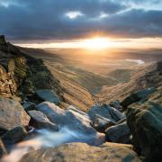
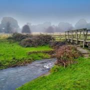
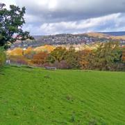
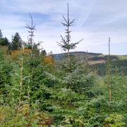
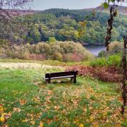
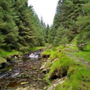
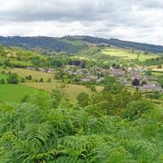
Enjoy this easy to follow amble in the Manifold Valley, a geological wonderland of towering limestone crags, caves and rock shelters.

Route
1. From the parking areas walk along the road which forms part of the Manifold Way. It follows a section of former track bed of the Manifold Light Railway, a narrow gauge stretch of line that ran from Hulme End to Waterhouses until its closure in 1936. The little steam locomotive that once operated along here was designed in a colonial style with large headlamps. It pulled a series of up to four coaches that were originally painted primrose yellow and must have been a colourful sight trundling down the line.
Notice the River Manifold flowing beneath a quaint humpback bridge leading over to Wetton Mill, whilst away to your right is a junction of roads and watersplash ford. Out of view and on private land beneath Darfur Crags to your left are swallet holes where the mystical and magical Manifold disappears in times of drought or dry weather conditions to follow a subterranean course. It reappears a few miles away from boil holes beside Ilam Hall.

2. By the time you reach the former railway bridge it is highly likely that all you will see is a dry river bed. Notice an old stone bridge on the parallel Leek Road on a route from Wetton to Butterton.
3. Where the two roads cross, head straight to continue along the trail.
Listen for eagle-eyed birds of prey that frequent the skies hereabouts, searching the sides of the valley for food. The vast swathes of ancient woodland and occasional grassy banks are a perfect habitat for small mammals and song birds. The track is lined by wild flowers, grasses and thistles that by September will be straggly and past their best, releasing miniature clouds of floating golden gossamer seeds. Berries will be forming all around and leaves beginning to change colour in readiness of their annual autumn display.

Soon you will see Thor's Cave. This imposing landmark has drawn visitors and inhabitants for thousands of years. It is known that occupants have included shepherds, miners and occasional temporary homeless persons in the last few hundred years, however, artefacts dating from far earlier settlers have been found here. In the 19th century Thomas Bateman and Samuel Carrington, both local archaeologists, discovered arrowheads, bone combs, bronze brooches and bracelets, iron adzes along with Roman pottery ware and coins. Many of these are now held at museums in Sheffield and Buxton.
The Manifold Valley in general has been an important site for archaeological finds - it is hard to imagine that mammoth, woolly rhinoceros, hippopotamus, wolves, brown bear and cave lions lived here thousands of years ago.
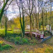
4. Walk to a footpath on the left leading down to a bridge over the river. This was the point on the old railway line where the tiny Thors Cave Halt station was positioned. It consisted of little more than a platform and a small wooden shelter.

Cross over the footbridge and begin a long but gradual ascent heading directly uphill on a footpath made easier by 'crazy-paved' steps. Emerge to cross two fields and then go through a narrow gate to arrive on the outskirts of Wetton.
5. Walk ahead up the road to Wetton Church that sits snugly in the centre of the village. It is thought that there has been a house of worship on this site since Saxon times. Whilst the tower of St Margaret's is many centuries old, the main body of the church had to be rebuilt following a devastating fire in 1820. There are six bells in the peal, each one cast in a different century dating back to the 1600s.
Over the years an unusual and ancient custom was carried out at Wetton Church, with examples found up until 1913 - some men in the parish would trace the outline of their boots in lead on the roof and then ornately decorate their graffiti using penknives or sharp tools. When the roof was restored and the lead replaced during restoration work in 2002, 219 boot imprints were removed. Some of the most fascinating examples have been put on display inside the church with an explanation as to the meaning of their decoration and identity.

A walk around the village is recommended. At one time Wetton was almost entirely owned by Chatsworth. The Estate also held the mineral rights to nearby Ecton Hill that contained huge deposits of copper ore. Some houses and cottages with 'dolphin blue' paintwork signify that they are still in Chatsworth ownership.
Ye Olde Royal Oak has a quirky claim to fame. It was here in 1974 that toe wrestling was invented by four drinkers who wanted to create a sport and to host a world championship event.
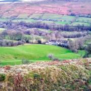
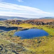
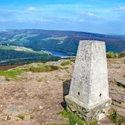
6. Return to the top end of the village beyond the church and turn left up a gravel track by Hill Farm Cottage to a green footpath sign for Back of Ecton 1½ miles. Ignore a footpath sign just beyond this and continue to follow the track which leads up to a small enclosed reservoir. Enjoy fabulous views towards the undulating hills around Dovedale. Notice wind turbines on Carsington Pasture on the horizon and the village of Alstonefield away to the east.

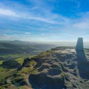
7. Go through a small disused quarry by means of narrow gates and stiles, passing a National Trust sign for Wetton Hill. To the south-west see the wooded slopes of the Hamps Valley lining the route of the River Hamps which will marry with the Manifold beneath Beeston Tor. Their combined flow then unites with the Dove beyond Ilam.
8. Walk over two fields of high pasture with a barn down to your left. After crossing a high fence stile go immediately left over a high wall stile and then descend with a wall on your right.

The 17th century property down below is indicated on the OS map as Manor House but is also known as Pepper Inn. Now a private residence, this was the 'local' long ago where a few tankards of ale would have been supped by weary miners on their way home from work after an exhausting shift below ground. Ecton Deep Shaft reached a depth of some 1,400 feet, more than 1,000 feet below the river level!
The discovery of an antler pick some 3,700 years old indicates that Ecton Hill was mined way back in the Bronze Age. The Romans also exploited the hill's rich minerals, but the first commercial workings were established here in the mid-17th century. The introduction of gunpowder led to an increase in the mines' activity and between 1776 and 1817 nearly 54,000 tons of copper ore worth £677,112 were produced with a profit of £244,734, a staggering amount of money at that time.
9. On reaching the gate by Pepper Inn turn left to follow a grassy track leading gently downhill with Wetton Hill to your left.

10. Head up a short steep footpath on your right to cross over a grassy knoll and return to Wetton Mill, emerging into the yard of the tearoom. The buildings here date from the 18th century but a water-powered mill was originally established on this site in 1577 by William Cavendish who was the second son of Bess of Hardwick. The mill belonged to the Earls of Devonshire until at least 1617 but became abandoned in 1857 and was then converted into a farm.
It is reputed that the nearby caves were the inspiration for the 14th century Middle English chivalric romance Sir Gawain and the Green Knight. u
COMPASS POINTS
Distance: 4 miles
Parking: Roadside parking at Wetton Mill (not in the private tearoom car park please) DE6 2AG Grid Ref: 094562
Terrain: Six stiles, five gates. Trip hazard paths with tree roots and loose stone. Livestock grazing.
Refreshments: Wetton Mill Tearoom, Royal Oak pub, and Old School Tearoom, Wetton.
Map: OS Explorer OL24 - White Peak
Walk highlight: First glimpse of Thor's Cave
Description: The route of this fabulous saunter is initially along a section of the Manifold Way followed by a woodland path and then fields to the upland village of Wetton. After admiring stupendous views across Staffordshire and Derbyshire hills, the return is a gradual descent beside Wetton Hill, a majestic mini-mountain of limestone that is generally found to be dotted and spotted by grazing sheep.


