Our walks writer David Dunford offers two helpings of riverside magic between Aldford and Eccleston
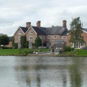
Before the Second World War, the ferry across the Dee at Eccleston, a couple of miles upstream from Chester, was a hive of activity and must have made a bucolic picture.
Estate workers from the nearby Eaton Hall used it to get to and from work, and pleasure boats from Chester stopped off to allow day-trippers to take tea and listen to brass bands at the ferryman’s cottage.
The open-sided bandstand survives to this day in the private garden. Sadly, though, the ferry is no more, which rules out an easy circular walk between Aldford and Eccleston.

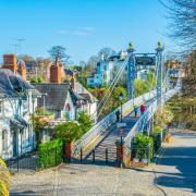
Necessity being the mother of invention, I’ve devised a route in the shape of elongated figure-of-eight, with two opportunities to enjoy the riverside section in between the two loops, using Thomas Telford’s Grade I listed Iron Bridge to cross the river in both directions. The shape of the walk offers opportunities for shortcuts if seven miles is longer than you care to tackle.
The Grosvenor name runs through this walk like the letters in an aristocratic stick of rock. Aldford and Eccleston are quintessential estate villages, both with numerous examples of the diapered brick, decorative bargeboards and diamond-leaded windows favoured by Douglas and Fordham, the preferred architectural practice of the dukes in the mid-19th century.
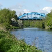
The Grosvenors commissioned new churches in both villages, and it was the 1st Marquess who had the Iron Bridge built to ease access to Eaton Hall from Aldford.

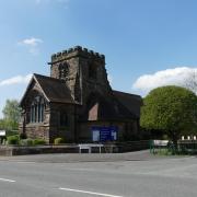
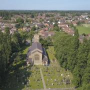
The family plot is in the churchyard of St Mary’s, Eccleston, where you will also find the remains of the old church. At Aldford, the medieval churchyard cross was restored in memory of Hugh Lupus, the 3rd Marquess and the richest man in Britain at the time of his death in 1899.
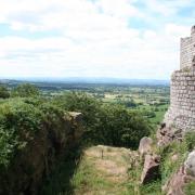
In the 11th century, the manor was owned by Gilbert de Venables, an ancestor of the Grosvenors who crossed the channel with William the Conqueror. He may have had a hand in the building of early Norman motte-and-bailey castles at Aldford and Eccleston, both of which are passed on this walk.
You could time your walk to coincide with a visit to the gardens of Eaton Hall, which are open to the public in aid of local charities on three Sundays this summer: June 26 (Cheshire Young Carers), July 31 (Cheshire Wildlife Trust) and August 28 (Kidsbank). If you prefer Peroni to perennials, you might schedule your visit for July 1 to 3, when the Grosvenor Arms is hosting a beer festival.
READ MORE: Eaton Hall opens its stunning gardens to the public

1. At the rear left of the Grosvenor Arms car park, go through a hand-gate into the green space at the centre of the village. Bear left, passing an open-sided shelter (a ‘community barn’ built in 2013 using timbers from the Eaton estate) and follow the path to the left, back out to the road. Turn right past the old schoolhouse, then right again into Green Lake Lane. Pass the village store and the end of Middle Lane until you reach School Lane.
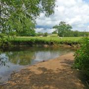
2. Turn left, then immediately right into a surfaced driveway with a footpath sign. At the end of the drive, continue straight on past a wooden gate and along the hedged track beyond. Towards the bottom, the path continues to the right of a second gate, winding through woodland to meet the riverside. Turn right and exit the trees at a metal hand-gate, with the river on your left.
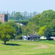
3. After a pleasant half-mile through riverside fields with views to Aldford, the Iron Bridge comes into view. Go through a kissing gate to reach the drive (you can shorten your walk to 2 miles by turning right here instead and jumping to step 7). Otherwise, turn left and cross the river. Turn right onto the continuation of the footpath to Eccleston, which soon winds its way back to the riverside. After half a mile and another gate, you pass in front of a house on the edge of the Eaton estate, beyond which the path-cum-track temporarily leaves the river to cut across a meander (the Crook of Dee).

4. Shortly after regaining the riverbank, it passes behind the Eaton stud and then the estate office, behind security fences on your left, before emerging from trees below the Eccleston approach. Pass below a belvedere then climb a metal staircase up a low sandstone cliff. Turn right and follow the path to Eccleston Ferry. Beyond the car park, continue along the riverside path. By a jetty and lifebuoy there is another opportunity to shorten your walk by turning left up to Eccleston village and jumping to step 6. Otherwise, continue along the riverbank. Ignore a path through a kissing gate on the left until you have almost reached the bridge carrying the noisy A55 over the river.
5. Just before the bridge, turn left onto a permissive path signposted to the Diamond Jubilee Wood. Cross a field to a footbridge, then follow the path ahead of you, up the hill. Just before a road, turn left along the top of the field to an information board explaining how the area was opened to the public by the Eaton Estate in 2013. Bear left below the Old Rectory to a field gate, then cross the site of Eccleston Castle, passing the old motte on the left and heading down to a gate below the manor house and adjoining cottages. Turn right and walk up the hill to emerge by the village hall. Bear left, then follow the road round to the right.
6. Walk up past the church to the shelter at the road junction by the old police house. Here, turn left and walk past the entrance to Eccleston Paddocks, a ‘petit château’ built by John Douglas in the 1880s for the Duke’s agent. At the Eaton Hall entrance turn left along the public road down to Eccleston Ferry. Turn right onto the riverside path once more and retrace your steps back to the Iron Bridge, crossing back to the Aldford bank.
7. Follow the driveway for a short distance, then turn right at a footpath sign leading to a gate. Cross the field, climbing slightly to the earthworks of Aldford Castle, also known as Blobb Hill. Continue beyond a gate, then bear right to a gateway to the right of the church.
8. Follow the road to the left (or walk through the churchyard) and turn left along Church Lane, passing Alford village hall and the phone box. At the bottom of the road, by Aldford Bridge, turn right to return to the Grosvenor Arms.

Grosvenor Arms
The Grosvenor Arms (originally The Talbot, named after the emblem of the Dukes of Westminster) was designed by John Douglas, but by common consent it’s not one of the Victorian architect’s finest works.
Nikolaus Pevsner, the esteemed architectural critic, dismissively labels it 'poor' and even the pub’s own website calls it 'not that great'. The building was considered something of a white elephant when Brunning and Price took it over in one of their earliest acquisitions, but the company has worked its customary magic: external aesthetics aside, the interior is roomy, welcoming and comfortable, and it’s deservedly popular. At busy times you’d be well advised to book a table in advance.
The pub describes its menus as modern British cooking, with a hint of the more exotic about them. From the light bites section, I enjoyed a tasty smoked haddock kedgeree, topped with a soft poached egg. I washed it down with a decent half of local bitter, one of six cask ales on offer (or you could choose from nine different lagers).
Assistant manager Sam Haughton explained to me that six tables in the taproom are generally kept free for dog-owning visitors, who are of course also welcome to use the numerous picnic tables in the large, well-kept garden at the rear of the pub. A vintage tractor at the bottom of the garden was proving a magnet for young visitors on my visit.
There’s a large car park next to the garden for patrons, but if you’re not planning to use the pub there’s also a free village car park near the church.
Compass Points
Area of walk: Aldford and Eccleston
Start point: Grosvenor Arms, Aldford CH3 6HJ
Distance: 2/6/7 miles
Time to allow: 3 hours for the full walk
Map: OS Explorer 266: Wirral & Chester/Caer
Refreshments: The Grosvenor Arms brunningandprice.co.uk/grosvenorarms
01244 620 228
Practicalities: Can be shortened to 2 miles or 6 miles, as noted in the text. Aldford is on the number 5 bus route from Chester to Wrexham. Riverside path may be muddy (or even flooded) after heavy rain. No stiles, but one flight of steps.


