Follow the River Itchen on a circular walk from Itchen Abbas
Winchester marks the western end of the South Downs National Park, and likewise the South Downs Way National Trail. But, as a glance at the Ordnance Survey map reveals, several other long-distance paths also either finish at or pass through the city including St Swithun’s Way, the Itchen Way, Allan King Way, Three Castles Path, Clarendon Way and the Pilgrims’ Trail. While each can obviously be undertaken as a linear route (either as a multi-day walking trip or on an ad hoc basis in stages) there is ample scope for devising a wide variety of circular walks combining stretches of them with other paths.
The 31-mile (50km) Itchen Way, as its name suggests, follows the River Itchen from its source near Hinton Ampner, a few miles south of Alresford, to the mouth of the river where it joins Southampton Water. Initially, the river flows northwards, then west passing the villages of Itchen Stoke and Itchen Abbas, continuing its journey south via Winchester.

Along the river are many attractive and unspoilt villages, each with its own distinctive church. This walk, which starts from the quiet village of Itchen Abbas, situated on the northern bank of the River Itchen, a few miles north-east of Winchester, takes in a few of these varied churches. As well as that at Itchen Abbas itself, the church of St John the Baptist (Norman, rebuilt in the 19th century), there is St Mary’s at Itchen Stoke (a striking Victorian gothic-style building, now in the care of the Churches Conservation Trust ), St Peter’s at Ovington and St Mary’s Church at Avington. This last, a red brick church, is virtually unaltered since its completion in 1771 and has an exceptional Georgian interior. A remarkable number of churches within such a small area.
This walk combines a fine stretch over the surrounding downland to the north of Itchen Abbas, returning along the valley from Itchen Stoke. The grounds of Avington Park, a privately owned stately home set in its own parkland bordering the River Itchen, are passed near the end of the walk. The house, grounds and tea bar are usually open to the public in the summer months.

Information
Start/finish: Roadside parking near Itchen Abbas church, just off B3047 (SU534328)
Map: OS Explorer OL32
Distance: 7½ miles (12km)
Terrain: Downland paths and tracks, riverside path, quiet country lanes
Time: 3½ – 4 hours
Refreshments: The Plough, Itchen Abbas (01962 779191). Refreshments are available to walkers at Avington Park Golf Club when open.
Public transport: Stagecoach bus 67 between Winchester and Petersfield via Itchen Abbas, stagecoachbus.com
Further information: Avington Park (01962 779260), avingtonpark.co.uk; visit-hampshire.co.uk
The Walk
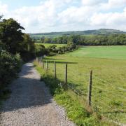
1. (SU534328) Turn left along the B3047, then first right up the lane under the old railway bridge, and immediately right along the footpath beside a drive. Watch for the path forking left after 340m across fields to Rectory Lane. Turn left to the T-junction, cross the road and continue along the track/bridleway opposite gently ascending the downs northwards.
2. (SU537356) At the T-junction at the top turn right along the track, waymarked as the Watercress Way, although shown as the Oxdrove Way on the Ordnance Survey Explorer map. (The Watercress Way is a planned 26-mile circular route but is not yet marked on the OS map. The Itchen Valley is home to the watercress industry - hence the name of the Way and, too, the heritage railway.) Follow this southeast crossing a road and keeping ahead over Itchen Stoke Down. At a path junction (where five paths meet, including the waymarked Three Castles Path and Wayfarer’s Walk) bear very briefly left then right to maintain direction to the next road.

3. (SU559339) Turn right down this quiet lane to Itchen Stoke.
4. (SU558324) Cross the B3047 and head down the lane opposite and along the path beside the River Itchen (waymarked both the Watercress Way and Itchen Way). Turn right across the river joining a lane by Bush Inn. Keep ahead to Ovington and turn right (or keep ahead to visit the nearby church if wished, then return to the junction and go left). Follow quiet Lovington Lane for about a mile (1.5km).

5. (SU547322) Turn left at a fingerpost uphill, bending right to follow the path (Itchen Way/St Swithun’s Way) to Avington Park Golf Club. Turn right down to the lane. (To visit Avington Church turn left along the roadside path for about ¼ mile, then retrace steps.) To continue the main route, turn left then immediately right along the road re-crossing the River Itchen to return to the start.


