Keith Carter goes back to Macc and reaches the summit of Cheshire’s third highest peak

The last time I came to Macclesfield Forest was in July 2013 to write up a walk from Wildboarclough and I got rather wet having chosen a day of continuous rain. I resolved to come back again in better weather and did this recently on a day that brought sunny intervals and strong winds which let me enjoy the area to the full. Shutlingsloe is classified rather dismissively as a ‘hump’ in the lists of the high points in English Counties even if it is the third highest point in Cheshire, sometimes referred to as the ‘Cheshire Matterhorn’.
Personally I can’t see why Cheshire needs a Matterhorn. It has a Shining Tor, a Teggs Nose and a Cloud beside which Shutlingsloe can hold up its head so let’s hear no more about Matterhorns. The name derives from the person’s name Scyttel and the suffix ‘loe’ which in the Peak District usually means high, similar to ‘law’ in Scotland. Don’t ask me who Scyttel was, a local chieftain I expect. The height above sea level is 506 metres which is not very high for staunch walkers but looking up from the road near the Crag Inn it looks rather daunting.
I mention the Crag Inn for a number of reasons, not least because it’s an excellent establishment and worthy of all men to be revered. I wish it was my local. The trouble is its miles from anywhere and I would have to go all round by Bill’s Mother’s to get there from where I live. You can park in the Crag Inn car park but be sure to nip in for a pint on your return.
1. Leave by turning left on the road and soon take a turning on the left where a narrow road goes uphill towards Bank Top Farm. As you come to the stone gate posts to the farm a path strikes off to the left and heads to the summit of Shutlingsloe, steadily gaining height until you tackle the tumbled rocks surrounding the summit.
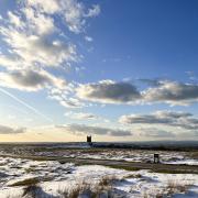
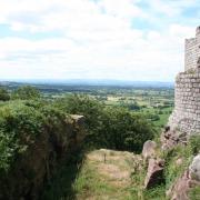
From the trig point the view of the Clough Valley is magnificent with the scattered farmsteads and isolated plantations here and there and the fields neatly divided up by stone walls. There are a number of thin coal seams in these hills, some only a few feet thick, but working them would no longer be considered an economical proposition.
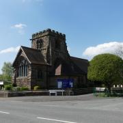
The land was granted to the Stanleys by Henry V who lost ownership then regained it, later when they were the Earls of Derby. By the 18th century the power of the water coming down Clough Brook was put to use by one George Palfreyman who established a works printing calico and built Crag Hall for his own use. The advent of steam power put an end to his endeavours and the workers moved away to more built-up areas. The then Earl of Derby visited and decided to put money into reviving the area, restoring Crag Hall as his summer residence. He had the church built in thanksgiving for the safe return of all his sons from the Boer War.
The valley was hit by a flash-flood on May 24th 1989 when a torrent swept down carrying all before it. Walls, trees, bridges and even the post box were carried away and it took months to clear up and restore cattle to their rightful owners. The post-box has not been seen since.
2. Leave the summit by a clear path descending to the north, steep in places, and join a line of stone flags laid for our benefit alongside a wall. At a kissing-gate, bear left on a path signposted to Langley and cross the deserted expanse of Piggford Moor where golden plovers are said to nest. On reaching a wall we enter a plantation by a gate and descend on a clear path to a fork.
Take the right through a gate, the sign indicating Trentabank. Continue making your way downhill, occasional signs drawing us towards Trentabank by which they mean the forest car park and visitor centre, only manned in the holiday season when there is also a kiosk here for teas and coffees.
3. Our path meets the road and we turn right for the return to Wildboarclough. Trentabank Reservoir is known for the heronry which has become established there which can be observed from a viewpoint by the road. Up to 24 nests have been counted in recent times. Initially the road rises to a brow but you can walk on a footpath beside it which avoids the traffic.
Off-season mid-week it’s quiet here but at weekends things get a bit hectic with walkers and cyclists. Continue walking along the road and at a junction turn right. You can see the distant Cat and Fiddle Inn high on the skyline, the second highest pub in England with Tan Hill Inn in the Yorkshire Dales the highest. The A537 Macclesfield to Buxton road is known as the Cat and Fiddle and is usually the first to be closed whenever there’s a snowfall.
The way back to Wildboarclough is on the quiet road, a remote and peaceful valley with only Nature for company. My return visit was everything I had hoped for and I don’t doubt I’ll be back again soon for more of the same.
Compass points
Area of walk: Macclesfield Forest and Wildboarclough
Distance of walk: 4 miles
Time to allow: 2½ hours
Map: OS Explorer OL 24 The White Peak
Refreshments: Crag Inn
Accessibility: Not suitable for wheelchairs or pushchairs


