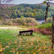
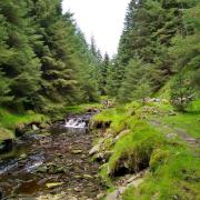
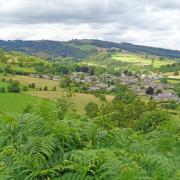
This walk explores Sheffield’s leafy suburbs before dipping into the village of Dore and on to a corner of the National Park for a hike over high, heather-clad moors

This walk was published in August 2019, so the details of the route may no longer be accurate, we do advise these articles should only be used as a guideline for any potential route you take and you should double check an up to date map before you set off.
1. Carefully cross over the main A625 road to a footpath behind the bus stop. Go down steps and walk ahead keeping to the left of the recreation field. Notice an information board about Whirlow Mill. Thought to have been constructed as early as the 16th century as a corn mill, it became redundant and ruinous in the early 1900s.

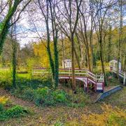
2. In the bottom left-hand corner go through a wall stile to enter Ecclesall Woods, Sheffield's largest tract of ancient woodland dating back to 1317 when Robert de Ecclesall created a deer park. It contains a wealth of archaeological features hidden beneath a complex mix of trees, providing one of the richest habitats in Britain for wildlife. Turn right and follow a stone-lined pathway towards Abbeydale Road South. Away from the hustle and bustle of the city, the woods are a haven of peace and tranquillity.
3. Arriving at a T-junction with a sign, turn right on the public bridleway for Limb Lane. Notice the remains of Ryecroft Mill which dates from the 17th century. Initially associated with the lead smelting industry it later reverted to milling grain before becoming abandoned in the late 1800s.

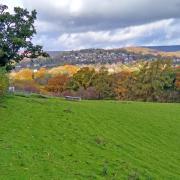
4. Emerging onto Limb Lane cross over and follow the pavement into Dore. The road is lined with grand houses, many of which have been built within the last hundred years, interspersed with an occasional tucked-away old cottage. Dore is proud to consider itself an independent village, divided from the metropolis of Sheffield by a farm and woods.
5. Use the island at the junction to cross over the road and then follow High Street into the centre of Dore and make your way to Christ Church which was built in 1829.

6. Head along Church Lane and then turn right up Drury Lane. Notice a little plaque on the wall to the side of Oxen Green, one of several erected by Dore Village Society in 2018. This plaque states that the once much larger Green was used as a resting place for plough teams going to and returning from the fields.
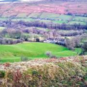
7. Turn left up Townhead Road where there is another plaque, this one for The Cockpit where villagers held cock fights in years gone by. After a little rise you will catch your first glimpse of high moorland in the distance.

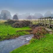
8. Keep well into the side when the road narrows to become Whitelow Lane, crossing Redcar Brook on a sharp bend. Turn left along Shorts Lane and at the end of the road follow a bridleway sign for Blacka Moor, keeping to the right of the brook.
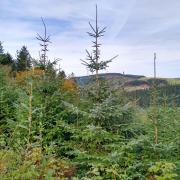
9. Ignore the stepping stones on the left but continue on the bridleway and then turn right to cross a plank bridge following the sign for Devil's Elbow Gate. Head up through a woodland nature reserve that in parts has been designated as SSSI. The whole area forms part of the Eastern Peak District Moors, and is managed by Sheffield and Rotherham Wildlife Trusts.
10. Emerging onto Hathersage Road turn right and walk approximately 300 yards, going past the millstone sign that marks the boundary of the Peak District National Park. On reaching the junction with Whitelow Lane, carefully cross over the main road to a footpath sign and little gate.
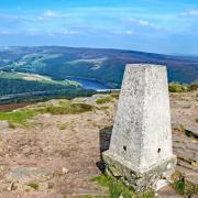
11. Follow a narrow and eroded path up through heather, bracken and bilberry. Keep glancing behind for spectacular views across the valley to Dronfield and beyond, with Sheffield lying mainly to the north-west.
12. On reaching a concrete post keep straight ahead on the more defined path which crosses access land to a rock formation and then continues to a broken down wall.
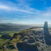
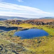
13. Turn right and follow the wall to a gas pipeline sign. Go through a gap in the wall and walk the short distance to the wide track over Houndkirk Moor, arriving at the highest point where wondrous views are far reaching and breathtaking.
14. Turn right and follow this old coach road over Houndkirk Moor. At a bend and bridge crossing Sparkingson's Spring where a little roadside cottage once stood, there are several old gateposts. Just beyond this see a weather-worn and battered milestone on the left showing the distance to Tideswell and Buxton.
On the final stretch of this ancient highway Sheffield will appear before you as an attractive panoramic scene of high rise blocks surrounded by tree-lined streets and avenues with a periphery of large houses peeping out from swathes of woodland - all set before a backdrop scattered with distant wind turbines and power stations.
15. Ringinglow was established as a settlement when the turnpike road from Hunter's Bar to the Hope Valley was laid around 1858. It was named because from these heights it was, and still is, possible to hear church bells ringing low down in the city.
Just before the junction with a hexagonal toll house and The Norfolk Arms, turn right in the dip to cross over a stile and follow a footpath on a stretch of the Sheffield Round Walk.
Go through gates at one point and descend the Limb Valley following Limb Brook, which years ago formed part of the boundary between Derbyshire and Yorkshire.
An area of spoil on the north bank hereabouts is the remains from a shallow drift coal mine worked by a small number of miners until the second part of the 19th century. Towards the bottom of the valley you will pass a fabulous bank of mature beech trees, their roots appearing like wizened old fingers clinging on to the earth.
16. On reaching Footpath Sign No. 475 cross the wide stone bridge and follow the path ahead to emerge at Whirlowbrook Hall. This was built in 1906 by Percy Fawcett as a private residence but is now used as a venue for weddings, conferences and events. End your walk with a little wander around the beautiful grounds with flower borders, ponds and numerous pathways that are open for the public to enjoy.
COMPASS POINTS
Distance: 7 miles
Parking: Whirlowbrook Park, Ecclesall Road South, Sheffield S11 9QD. Grid Ref: 308828
Terrain: Two stiles, three gates. Numerous sets of steps. Trip hazard paths with tree roots and loose stone. Livestock grazing. Some roadside walking without pavement. Care required when crossing main roads. Section of 'access land' path over Houndkirk Moor.
Refreshments: Various pubs and a coffee shop in Dore. The Norfolk Arms at Ringinglow
Toilets: No public toilets
Map: OS Explorer OL1 - Dark Peak
Walk highlight: All-encompassing views from Houndkirk Moor
Descriptions: Try to choose a clear day for this walk of contrasts - for a time wandering through woodland before stepping over a sea of heather. After passing select country houses and characterful old cottages, be prepared for 'big sky' vistas from high ground and then descend into the enjoyable enchantment of the Limb Valley.


