
Enjoy beautiful views, woodland, and wildflowers on this circular downland stroll with Hazel Sillver
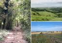
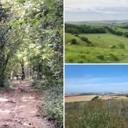
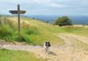
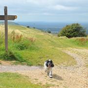
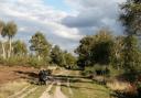
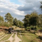
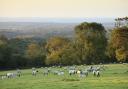
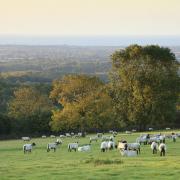
Harting Down
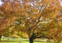
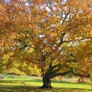
This 550-acre section of the South Downs is a nature reserve and a Site of Special Scientific Interest, managed by the National Trust. The fragile, beautiful, and rare chalk grassland here provides a vital habitat for wildlife: in summer, the abundance of wildflowers attracts a wealth of bees and butterflies; grasshoppers and damselflies roam the meadows, and the sound of skylarks fills the air. As well as the high downland that provides dramatic views over the Weald, there are tranquil wooded valleys that harbour ancient yew trees – one of the yew woods here are known as ‘the darkest place on the downs’. Harting’s high ground has a rich history: Beacon Hill was once an Iron Age hill fort, and there are remnants of cross ridge dyke ditches that are thought to have been a checkpoint on the old transport route that ran along the ridge. Long ago, the downland here would have looked and felt very different: coated with a dense forest that was inhabited by wild boar, lynx, and wolves. For further information, go to nationaltrust.org.uk/harting-down.
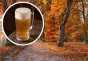
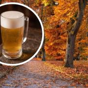
Where to refuel
The White Hart inn (GU31 5QB; 01730 825124; the-whitehart.co.uk) in South Harting serves delicious à la carte restaurant food, as well as hearty pub fare, sandwiches, and a children’s menu. There is also the nearby Royal Oak pub just off the B2141 at Hooksway, as well as the White Horse pub further south on the B2141.
Information
Location: South Harting, near Chichester, West Sussex
Distance: 3.7m (6km) – an hour to 90 minutes walk
Terrain: lots of up and down; grass, dirt, and chalk paths
Where to park: In the National Trust Harting Down car park just off the B2141 south of South Harting village.
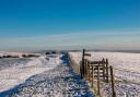
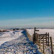
The walk
1) From the car park, head east across the wide grass and go through the gate. Head straight on, but very soon bear left on a narrow path, before continuing east upon a chalk path towards a clump of trees.
2) Stay on this path, which eventually leads downhill through trees and scrub.
3) At the bottom of the hill where paths cross, maintain direction, heading straight on up the steep hill, eventually going through a gate.
4) At the top of Beacon Hill, keep walking east. Then at the bottom of the hill, where paths cross, head right. Eventually, the wide grassy path runs alongside fencing towards trees.
5) At the sign, head right on the South Downs Way. The path eventually takes you through a gate, and between hedgerows.
6) At the signpost, head left on the bridleway. The wide grassy path leads downslope.
7) At the bottom of the hill, where paths cross, head uphill on the narrow path into woodland, soon passing old yew trees.
8) At the beech tree and the signpost, turn right. Ignore the path heading left, and keep straight on through the gate. The path leads between woodland and a field. Eventually, go over the stile on your right, and head left, walking along the edge of the field.
9) Go through the gate on your left (putting roaming dogs on leads because the road is now close), and head right on the winding narrow path that leads through trees, back to the car park.