
Two walks – one short, and one long – lead along the towpath of the Wey and Arun Canal, and through the fields and woodlands of Loxwood. Words by Hazel Sillver
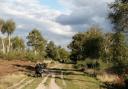
The Wey and Arun Canal
This partially restored 23-mile canal runs south from the River Wey at Shalford in Surrey to the River Arun at Pallingham in West Sussex. In its heyday it included the Arun Navigation, which opened in 1787 and ran between Pallingham and Newbridge Wharf, and the 1816 Wey and Arun Junction Canal, which linked the River Arun at Newbridge to the Godalming Navigation near Shalford, south of Guildford. It ceased to operate in 1871 because it carried too little freight traffic for the authorities to justify its existence and over time it became derelict. Interest in the old canal was sparked in 1965 by the publication of P A L Vine’s book London’s Lost Route to the Sea. The Wey and Arun Canal Trust was formed in 1970, and has since restored several miles to a navigable standard. The end goal is to restore the entire waterway. When it’s complete, narrowboats will be able to travel from London, via the River Wey and the River Arun, all the way to Littlehampton. Boat trips are available on the restored stretch during the summer.
For further information, go to weyandarun.co.uk
Where to refuel
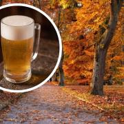
• The Onslow Arms (01403 752452; onslowarmsloxwood.com; RH14 ORD) is situated at the start and end of the walk on the Wey and Arun Canal in Loxwood village. Traditional pub food is served in the cosy 17th century building, which has a log fire and welcomes families and dogs.
• Sir Roger Tichborne pub (01403 751873; thetichborne.co.uk; RH14 0QS) in Alford Bars serves a tasty mixture of modern and traditional hearty food, including vegetarian options, and welcomes families and dogs. To find it, head right out of the car park, through Loxwood village, on the B2133 for a mile.
Route
• Location: Loxwood, near Billingshurst, West Sussex.
• Distance: 2.5m (4km) or 5.6m (9km) – an hour to two-and-a-half hours to walk.
• Terrain: the walk is mostly on the flat, but paths can be uneven and muddy.
• Where to park: In the canalside car park behind the Onslow Arms pub, in Loxwood village.
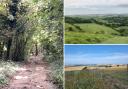
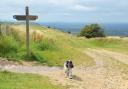
The walk
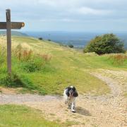
1. From the car park, head up the bank and onto the canal towpath. Follow the towpath east, ignoring paths that lead off it, for just over a mile.
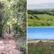
2. Head left over the stone bridge and then, opposite buildings, head left at the signpost. The path leads past a pond. At the next signpost, maintain direction straight ahead into woodland. The path leads over two footbridges, and eventually across fields.
3. Ignore the path heading right. Carry straight on, and then at the lane turn left. Walk over the bridge and head right onto the canal towpath. Retrace your steps back towards the car park.
4. At the bridge, head right upslope into a field. Turn left, walking through the middle of the field and then through a gate. Carry on through the middle of the next field towards another gate.
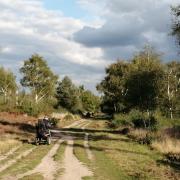
5. If you wish to walk further, continue straight on along the towpath past the Wey and Arun Canal Trust visitor centre. Head under the bridge, and up onto the towpath on the other side, heading west. Continue along the towpath for almost a mile and a half, ignoring all other paths, until you reach the Sussex Border Path sign.
6. The path leads through a spinney, and between fencing across fields.
7. Go through the gate and bear right, heading along the wide hard track between hedgerows.
8. As you come into Loxwood village, head right at the signpost beside a tree. The path leads between housing, and then runs between fields.
9. Cross over the bridge and then head left, back onto the towpath, and retrace your steps back to the car.