Best boots on for this month's walk, which covers some potentially muddy terrain around Tarporley.
As you clump down Tarporley High Street at the start of this walk, you tread a well-worn path.
This street is thought to have been part of the Roman road Via Devana, from Chester to Colchester.
A millennium later, perhaps William the Conqueror's forces passed this way in the 'harrying of the north' to subjugate those in his new domain.
Then for centuries after that, High Street would be an important thoroughfare in this large village surrounded by farmland.
If you had need to travel between London and Chester in the age of the stagecoach, you would likely stop for refreshment at The Swan, an imposing grade II*listed building dating back to 1769.
Like The Swan, the village's commerce developed along this important artery, hence the description, 200 years ago, in Ormerod's History of Cheshire of Tarporley as 'one long street'. It remains so to this day, with lots of places to eat and drink, and a rich variety of independent shops catering for life's inessentials.
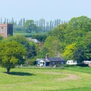
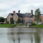
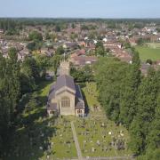
You pass The Swan at the start of this walk, along with the 15th-century St Helen's Church and the timber-framed 16th-century Manor House. The walk then crosses arable fields to Tiverton, following the Sandstone Trail for a while through fields that were very boggy on my visit.

On the road back into Tarporley, look out for another little bit of history: Salters' Well was used until the end of the 18th century to water the horses lugging loads of salt from Northwich and Middlewich and Nantwich to Chester and North Wales.

1. We begin in High Street, Tarporley, and you will find a car park behind the Rising Sun pub, postcode CW6 0DX. Walk back up to High Street and turn right along it, passing The Swan, Tarporley Baptist and Methodist Church and the Foresters Arms. Cross over Birch Heath Road, and just a few metres later, look out for a narrow entrance to a footpath, on the right, next to 22 Nantwich Road. Go down here. At the stile, keep ahead, passing through a street of new houses to a metal gate. Take the steps down to the A49, cross with care, and climb the steps on the other side.

2. Head across the next field, keeping to the right of the big tree. At the next double stile – which lacked any surrounding fencing on my visit – head slightly left into a field with a hedge at its right edge and follow the well-worn path beside the hedge. At the end of the field, look for a stile a few metres up the hedge on the left. Cross the next field to a metal kissing gate, then keep ahead in a shrub-lined path until it brings you out at Huxley Lane, Tiverton.
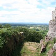
3. Turn right along the lane, passing Tiverton Hall after a while, then go right into Pudding Lane. Signage tells you that you are now on the Sandstone Trail. Glance to the left, and Beeston Castle rears up in the middle distance. Follow Pudding Lane until its T-junction with Crib Lane. Cross over and, just a few metres to the right, follow the Sandstone Trail sign into the field, go round the tree and through the metal kissing gate, following the right-hand edge of the next field.

4. Cross a little bridge over a ditch with metal gates at either end, then follow the right-hand field edge to the next gate, then keep to the Sandstone Trail through the next three crop fields until you reach woodland with a signpost for Clotton and Tarporley. Go left for Clotton. At the end of the field take the kissing gate and then head left up an overgrown and potentially muddy path.

5. Reaching a signpost pointing left for the Sandstone Trail, keep ahead instead. Eventually, the path meets a wider track. Go left here, then left again following the restricted byway until you reach the A49 again. Cross to a gate onto the restricted byway and head left. You soon reach Rode Street. head right along here, passing Salters' Well on your left after a while, and you are soon back in the centre of Tarporley.
Area of walk: Tarporley and Tiverton
Distance: 4 miles
Time to allow: 2 hours
Map: OS Explorer 267
Refreshments: The Swan, High Street, Tarporley CW6 0AG; Rising Sun, High Street, Tarporley CW6 0DX.


