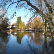
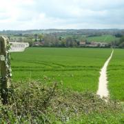
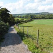
Enjoy views of the beautiful chalk streams of the rivers Anton and Test on a walk that also takes in the pretty village of Wherwell
Wherwell is one of the most picturesque villages in the Test Valley, and has some of the finest timber-framed thatched cottages in the county. An abbey was founded here in the 10th century by Queen Elfrida, who became the first abbess.
It was destroyed after Henry VIII's Act of Dissolution in 1539 and the estate subsequently passed through various hands. The large white mansion, Wherwell Priory, which exists today was built on the site of the abbey. Privately owned, the estate is sometimes used as a wedding venue.
On the other side of the Test Valley to the south, separated from Wherwell by both the river and Cow Common, is the village of Chilbolton. The Test Way - a 44-mile long-distance path which runs from Inkpen Hill in Berkshire southwards to Eling where the River Test flows into Southampton Water - passes through both villages, crossing the common en route.
Downstream from Chilbolton the River Anton, which rises to the north of Andover, joins the River Test; both chalk streams are renowned for their fishing. Like the Test, the Anton also has a waymarked walking route, the 10-mile River Anton Way, but unlike the former, it is not yet marked on the OS map.
This attractive walk follows a stretch of the River Anton Way for the initial section of its outward leg, then heads to Wherwell, joining the Test Way for the return. Both rivers are crossed a number of times providing some beautiful views from the footbridges. The walk starts and finishes near the popular riverside pub, The Mayfly, whose terrace overlooks the River Test.

Information:
- Start/finish: West Down Nature Reserve car park off Coley Lane, close to the junction with the A3057 (SU383389)
- Map: OS Explorer 131
- Distance: 5? miles (9km)
- Terrain: Old railway track, field paths, village roads.
- Time: 3 hours
- Refreshments: The Mayfly, Fullerton, White Lion Inn, Wherwell
- Public transport: Wheelers bus service 15 between Andover and Stockbridge via Fullerton, Wherwell and Chilbolton, wheelerstravel.co.uk
The walk:
1) (SU383389) Exit the car park and cross the road to the path opposite signed the Test Way, very soon reaching the old track bed of the former railway line, known as the Sprat and Winkle line, which ran from Andover to Redbridge.
2) At the T-junction turn right, signed for Andover, leaving the Test Way which goes left under the brick railway arch towards Stockbridge. Now on the route of the River Anton Way, follow the track, crossing the River Test, before long continuing on a Tarmac lane passing the Old Railway Cottages on the right. This was originally Fullerton Bridge Station, and later Fullerton Junction Station, where the main Sprat and Winkle line connected with the new branch line.
3) (SU379395) Before reaching the main road, turn left along a path which leads under the road bridge emerging on the Fullerton road, not far from its junction with the A3057. Turn right over the bridge crossing the River Anton, with a view of Fullerton Mill on the left. Continue along the road to where it forks, keeping ahead/right signed for Red Rice and carry on uphill for a further 380m.
4) (SU374395) Turn right along a track/public footpath opposite the entrance drive to Fullerton Manor on the left. The track runs along the top of the field beside the hedge on the left, the Anton Valley below to the right. Keep the hedge to your left in the next field to reach a kissing gate. Now with a fence on the left the path heads downhill and bears left along a track at the bottom to a gate across the old track bed.
5) (SU366407) Turn right through a kissing gate into a field and follow the path which crosses a river channel and then bears round to the right to reach a footbridge over the River Anton. Cross and continue through the trees to the edge of the woodland.
6) Parting company with the River Anton Way, bear right along the field edge to reach a gate and the A3057. Cross the road to a gap in the hedge, go through the gate and follow the path/bridleway that leads up the open grassy hillside, bearing round to the right alongside a fence on the left.
7) Continue along the path, which becomes enclosed, the view opening out again at the top, from where the Chilbolton Observatory may be spotted in the distance. The bridleway now turns left down the field edge and then bears right continuing downhill.
8) (SU384404) Before reaching the road, turn left along a footpath, joining the route of the Test Way which heads along the bottom edge of a sloping field. On reaching the B3420 at the bend in the road bear right and follow the road down with care to Wherwell.
9) Ignoring junctions, continue on the B3420, which bears right passing the White Lion Inn, then left. Carry on to the Church Street turning on the right at a triangular green, where the war memorial is situated, a row of picture-postcard thatched cottages behind it.
10) Turn right to visit the 19th-century church, passing more pretty thatched cottages along the way. Outside the church is a Victorian mausoleum, with gargoyles set under the eaves.
11) (SU391408) Retrace your steps from the church, turning left at the T-junction, but when the B3420 turns right at the White Lion, keep ahead along the Fullerton Road for 540m.
12) (SU385405) Rejoining the signposted Test Way, turn left crossing the long wooden footbridge over the River Test and continuing across Chilbolton Cow Common. Cross another footbridge, then bear right along a track and right again.
13) At the cattle grid and kissing gate leading into the Memorial Playing Field, go right still following the Test Way. The path, which becomes enclosed, leads to a small green with a bench and the road.
14) Turn briefly left, then right at an access road and right again through a gate into the West Down Nature Reserve. The site, which comprises a variety of habitats, is open to the public so you can walk anywhere. Continue along the hillside parallel to the road below back to the car park.
More…
- Where are the best walks in Hampshire? - With the New Forest, South Downs and a picturesque coastline, Hampshire is an amazing place for a walk. We round up a few of our favourites


