Keith Carter takes a walk from Willaston village. It’s perfect for walking off festive excesses.

My useful reference book ‘A Dictionary of British Place Names’ sometimes throws up unintentionally amusing suggestions for how places got their name. When in doubt it likes to imagine that in the dim and distant past what is today a thriving metropolis was once a farmstead owned by a minor chief after whom the name derived. Hence Willaston might have been a farmstead owned by a chap called Will. By the same token, Hooton was run by somebody called Hoot and Neston by Nest or Nesta. I leave you to work out where Titwell comes from.
Willaston-in-Wirral is not to be confused with the other Willaston, near Nantwich, renowned for the mysterious art of worm-charming. Look it up if you don’t believe me. It was once one of seven townships in the parish of Neston until becoming established in its own right in 1865. It is said the first entry in the parish register was that of a gypsy girl called Charity Taylor who died while her family were camped in the area.
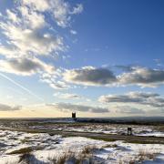
Willaston takes as its motif a windmill, having the tallest one in the Wirral. Built in 1800, it was used in World War Two as a lookout by the Home Guard. The village is now home mainly to commuters, judging by the extensive car park at Hooton station on Merseyrail’s network with frequent trains to Liverpool. Originally a line ran from here to West Kirby and the course of it now forms the Wirral Way, a fine amenity for cyclists and walkers.
1. Our walk starts at Hooton station, a convenient place to park and cheap at 80p for the day. Go up the steps to the road, turn left across the bridge over the railway and on the far side take the footpath on the left with a signpost indicating Wirral Circular Trail, Neston 4m and Willaston 1½. Take the Wirral Way for the next hour of easy, level walking, this part of the walk suitable for wheelchair users and buggies.
The first point of interest is Hadlow Road Station which has been preserved as it was when the line closed in 1956. When we were here the platform had been taken over by a film crew on a fashion shoot. We were willing to model our outmoded walking gear dating from a bygone era, but found no takers.
2. Once past Hadlow Road we go under Chester High Road then look for leaving the Wirral Way just past a wooden footbridge, a path going down the embankment on the right to a gateway where we turn left onto a narrow path. This takes us through to a picnic area and we join the road, turning right to walk along it to a T-junction. The bushes beside this stretch of road had a greenish, plum-like fruit on them, just sweet enough to eat apart from their tough skins. I think these were the ‘bullace’, a kind of wild plum. This year wild fruit has been plentiful thanks to the warm summer. Damson trees have been full of fruit and I have picked easily 30lbs from the trees in my garden. Mrs C has called a halt. We have enough jam and jelly in the event of a nuclear war.
3. Having turned left at the T-junction, the pavement brings us to a crossroads where the Hinderton Arms pub stands. We never seem able to walk by on the other side. The spirit may be willing but the promise of a pint is strong. At the crossroads turn right and take Quarry Road slightly uphill as far as the right hand bend in the road at which point keep forward on Bluebell Lane past a sandstone house with a tower, Rose House. A narrow path leads to a lane which then turns right then left on to Willaston Road. There is a wide enough verge to avoid the traffic along here for the few hundred yards before a bridleway sign on the right. Somebody had fly-tipped a TV set here. You wonder how that can have been any less easy that taking it to the local tip.
4. The path through a wood comes to a meeting of ways and we take the right turn towards Willaston then at the next junction the left to Benty Heath Lane. In 200 yards at a kissing-gate, keep ahead via a series of similar gates then enter a wood. Turn right inside the wood and follow a path to where it meets a lane. Besides the plentiful blackberries this year, rowan trees have been laden with their red berries. They can be used to make a jelly that goes well with game but making it is hard work. Traditionally a heavy crop of rowan berries has been an indicator of a very cold winter although in Scandinavia a rowan cannot bear a big crop of berries and a heavy fall of snow in the same year, so folklore as usual hedges its bets on this topic. One other use for the wood from the rowan, according to Harry Potter – it makes excellent wands
Keep forward on Street Hey Lane as it becomes tarmacked and houses begin to appear and we come to a junction with the main road and turn right, bringing us back to the railway bridge at Hooton Station in half a mile.
Compass points
Area of walk: Willaston, Wirral
Start and finish: Hooton station
Distance: 7 miles
Time to allow: 4 hours
Map: OS Explorer 266 Wirral and Chester
Refreshments: Coffee at Hooton station, otherwise theHinderton Arms pub at about halfway.
Accessibility: Wheelchairs and buggies can be used on the Wirral Way.


