

Save this walk around Buckden for a clear day so you can enjoy the wonderful panoramas.

This walk was published in March 2017, so the details of the route may no longer be accurate, we do advise these articles should only be used as a guideline for any potential route you take and you should double check an up to date map before you set off.
If you were determined to find fault with the Yorkshire Dales it might be that they lack many distinctive summits. With notable exceptions like the Three Peaks and the flat-topped fells of Wensleydale and highest tops of Swaledale, it might be said that for the most part the valleys are defined by ridges rather than shapely peaks. Buckden Pike at 2303ft/702m does, however, enjoy a lonely splendour which makes it an excellent viewpoint for the valleys that radiate from it.
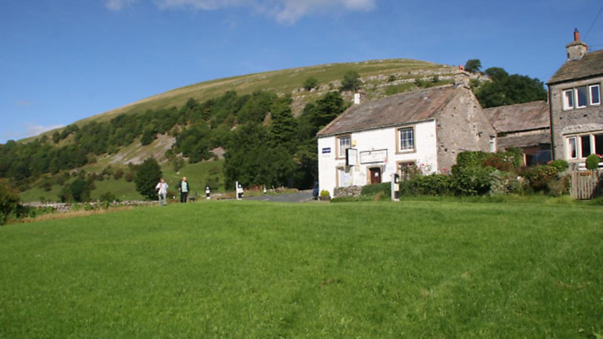
This walk starts at its feet from Buckden, the last sizeable community before the road up Wharfedale begin its climb into Wensleydale. Along the way it also visits one of Yorkshire's loneliest and most poignant war memorials.

DIRECTIONS
1. From the car park, take a pedestrian gate in the north wall and follow the broad rising track of Buckden Rake. As it climbs through the trees the views southwards down the valley improve with every step while in front the dalehead and the branching valley of Langstrothdale are laid out. A gate at the top of the slope provides a handy prop to regain breath and admire the dale, whole classic U-shaped floor betrays its glacial origins in the last Ice Age.
The continuation path is flatter for a while until a fork breaks off rightwards uphill to begin the long climb of Buckden Pike through pastures and wall gaps in a rising traverse across the slopes before turning more steeply uphill. In former years this was a vile quagmire of a path but has been laid with flagstones and harder surfaces to make the going easier
|
||||||||

2. The summit is crowned by an elegant cairn, a squat trig point and a tall marker post. The views all around are superb. Out to the west, the distinctive flat top of Ingleborough and the crouching lion profile of Penyghent, two of the Yorkshire Three Peaks, sit on the horizon while to the north the views extend to Mallerstang, the flat summits of Wensleydale and down into the shy Walden Valley.
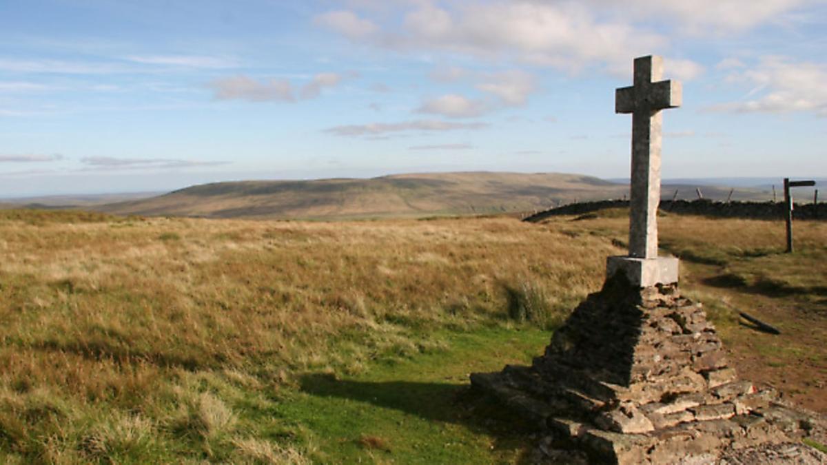
Once you have drunk it this most wondrous of views - it really is worth saving for a clear day - leave the summit by heading southwards beside the wall following a sign 'Suggested route to war memorial'. It crosses a ladderstile and continues beside the wall for 800 yards or so. The path can be boggy in places but has flag stones over the worst sections. At a wall corner a ladderstile crosses the wall to the 'Fox' War Memorial.
3. The cross commemorates five Polish crewmen of a Wellington bomber, which crashed into the mountain in a blinding snowstorm in January 1942. Four were killed outright and a fifth badly injured, However, the rear gunner Joe Fusniak survived because his rear turret snapped off the fuselage and was thrown clear. One by one he found his dead companions and then his surviving comrade who he wrapped in a parachute against the cold. Then, despite having a broken ankle, he set off for help. Initially he went in the wrong direction but spotted the tracks of a fox in the snow. Knowing the animal would go to a farm in search of food, he began an agonising crawl downhill tracking the fox.
He eventually reached the White Lion pub in Cray, where he was initially mistaken for a German flier before convincing locals he was RAF and persuading them to launch a rescue attempt for his comrade. But it was too late. Joe was instrumental in having the cross erected on the fell and included a fox's head in honour of the creature that saved his life.
From the memorial, carry on southwards along the wall dropping into a dip. This section is over peat and can be very sticky in wet weather though the firmest going is usually beside the wall. At a wall corner the path meets a broad track coming up from the Walden Valley. This is the Walden Road, an old packhorse route over into Wharfedale. Go through the gate in the wall and follow the road westwards down into Wharfedale. 'Road' is rather a flattering name for what is essentially a bridleway, by turns, grassy, rocky and muddy, though it is easy enough to follow and gradually improves as it descends.
4. The road is followed all the way down to Starbotton, an attractive village with its own pub. At the main road, turn left to the end of the village and there take a signed, enclosed footpath on the right, which leads down to a footbridge over the Wharfe. Once across this, turn right up the valley following the Dales Way long distance path.
This leads easily upstream but when almost opposite Buckden look out for a finger post on the left of the track, which points rightwards down towards the riverbank. Follow this to Buckden Bridge and then turn right up the road to the village green.
Compass points
Start/finish: Buckden
Distance: 8miles/13km
Height gain: 1540ft/470m
Terrain: Fell and moorland followed by riverside path
Time: 4 hours
Parking: Pay and display in Buckden
Refreshments: Pub and cafés in Buckden
Maps: OS OL30 Yorkshire Dales Northern and Central


