

Head for the peace and quiet of the hills above the ever-popular Yorkshire Dales village of Malham.

This walk was published in January 2017, so the details of the route may no longer be accurate, we do advise these articles should only be used as a guideline for any potential route you take and you should double check an up to date map before you set off.
Malham is one of the most visited villages in the Yorkshire Dales and it would be a rare day when it is not thronged with hikers and sightseers yet this walk among the nearby fells is never busy and it is not unusual to have it completely to yourself.
For lovers of peace and quiet there are field paths, tree-lined lanes and high moorland with extensive views to enjoy. It also throws in a little history for good measure with a remnant from pre-Reformation days when the Abbot of Fountains was a power in the land as well as a more modern addition from the Industrial Revolution when canals were the lifeblood of commerce and the builders created upland reservoirs to keep them flowing.
|
||||||||

DIRECTIONS
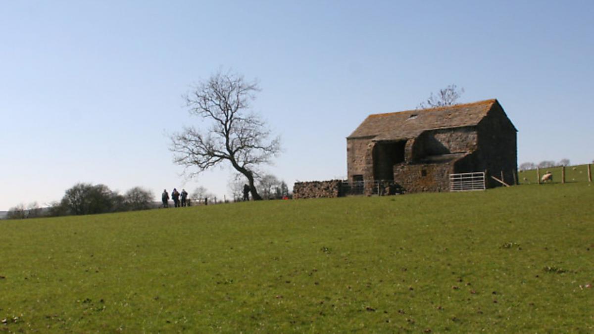
1. Start in the neat hamlet of Calton and walk to the top of the single street. Turn right onto an unmade lane, passing a farm and shortly afterwards an isolated barn. Carry on to where the track forks by a modern, low barn. Here go left on a track signed to Cowper Cote, which soon leads into a field. Carry on along the bottom edge of the field, first beside a wall and then a straggly line of trees, before rising slightly to go through a gate and on towards the lonely barn of Farlands Laithe. Pass to its right and then carry on aiming for the obvious buildings of Cowper Cote Farm on the hillside opposite beyond a shallow valley.
2. Arriving at the farm go through a gate above the buildings to enter a field. Ignore the stile ahead and instead climb the field up a very faint track. At the top of the hill aim slightly leftwards, still on the track to go through another gateway in a stone wall in the corner of the field.
Beyond the gateway the path continues through reeds and rough grass, staying parallel with a fence and low earth embankment to the right. The track improves slightly as it crosses more rough pastures to arrive at a barn. Pass to the right of this and then cross a footbridge aiming for the gap between two strips of woodland, one deciduous trees the other conifers. Once past the trees cross the wall on the right by a ladder stile and then continue in the same direction along the other side. After a couple of gates in quick succession carry on along the left hand edge of a large field to the isolated Smither Gill House (marked as Laithe on the OS map). Pass to its left and follow the access lane to a junction. Here turn left towards Way Gill but just before entering the farmyard take a path on the right signed to Cow House.
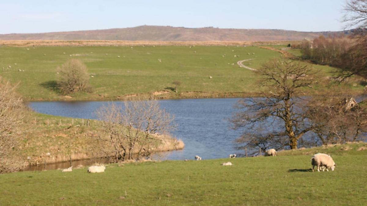
3. Go through a gate and then turn down the hedgeside to reach a lane. Turn left along this but, again, just before reaching the farm buildings of Cow House take a stile on the right which leads down to the shore of Winterburn Reservoir, built not to slake thirsts but to feed the nearby Leeds-Liverpool Canal. Carry on leftwards along the shoreline path to reach a sturdy stone bridge at the very head of the reservoir. Do not cross it but instead turn sharply leftwards on a track signed to Malham. This is the start of the long climb to Weets Top.
4. The climb is fairly unrelenting though never particularly taxing, the path eventually becoming clearer and easier to follow as it rises until by the top it is unmissable. As it crests the ridge views open out over Malhamdale and the western fells, including Ingleborough peeping through a gap in the ridge opposite. Finally it arrives at a gate close to the trig point of Weets Top itself. Just beyond the gate is Weets Cross, a mediaeval landmark that is not a cross but a simple stone column mounted on a plinth. It once served the dual purpose of a boundary stone for five townships that meet at this point as well as a waymarker on the route from the Malham Moor sheep pastures to Fountains Abbey. There is some doubt as to whether this is the original stone but it is certainly well-weathered.
5. Having examined the cross go back through the gate and take the signed track to Calton 2 3/4miles away with the great whaleback of Pendle Hill ahead. The long descent stays parallel to the wall to the right for most of the way, seldom straying far from it with more excellent views into Malhamdale, including the uppermost rocks of Malham Cove.
Finally the houses of Airton come into view ahead and, after crossing a couple of transverse walls. the right hand wall begins to curl away. When it does so, stay on the track, still aiming more or less for Pendle Hill. The bridleway eventually become a farm track and curls leftwards crossing the hillside with a wooded gill down below to the right before going through a gate to enter a tree-lined green lane which is followed all the way back to Calton.
COMPASS POINTS
Start/finish: Calton, near Airton
Distance: 8miles/13km
Height gain: 1100ft/335m
Terrain: Field paths and moorland tracks
Time: 4 hours
Parking: Roadside
Refreshments: None en route
Maps: OS Outdoor Leisure OL2 Yorkshire Dales (South and West)


