

Take two summits in your stride to enjoy wide fell views, says Terry Fletcher.

Pen-y-ghent is one of the most famous hills in Yorkshire. Together with Ingleborough and Whernside, it makes up the county’s Three Peaks and forms part of a classic 26-mile outing that challenges all but the strongest walkers. Its much-photographed ‘crouching lion’ profile also makes it one of our most recognisable tops and a magnet for walkers in its own right.
This walk links it to the neighbouring Plover Hill, which is often overlooked by walkers but together the two summits add up to a fine day out, offering wide views of the surrounding fells and finishing along a rugged track which clings to the skirts of the mountain before delivering you back neatly to Horton-in-Ribblesdale, tired, satisfied and ready to make full use of the village pubs and cafés.
DIRECTIONS
|
||||||||

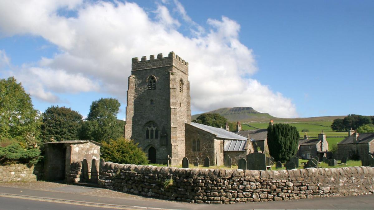
1. From the Three Peaks Café walk down the main road towards Settle and follow the road past the church to admire the classic view of Penyghent behind the church tower. Take the first lane on the left, passing a row of cottages and then cross the beck by a footbridge. Once across turn left past the school and follow the tree-shrouded lane round to Brackenbottom Farm. Immediately before the farm buildings take a path on the left signed to Penyghent, a steep one and three quarter miles away. The path climbs steadily towards the skyline and in its upper levels once-boggy sections now boast a flagged path, which has been laid by the national park teams to replace the old scruffy duck boarding which used to scar this section.
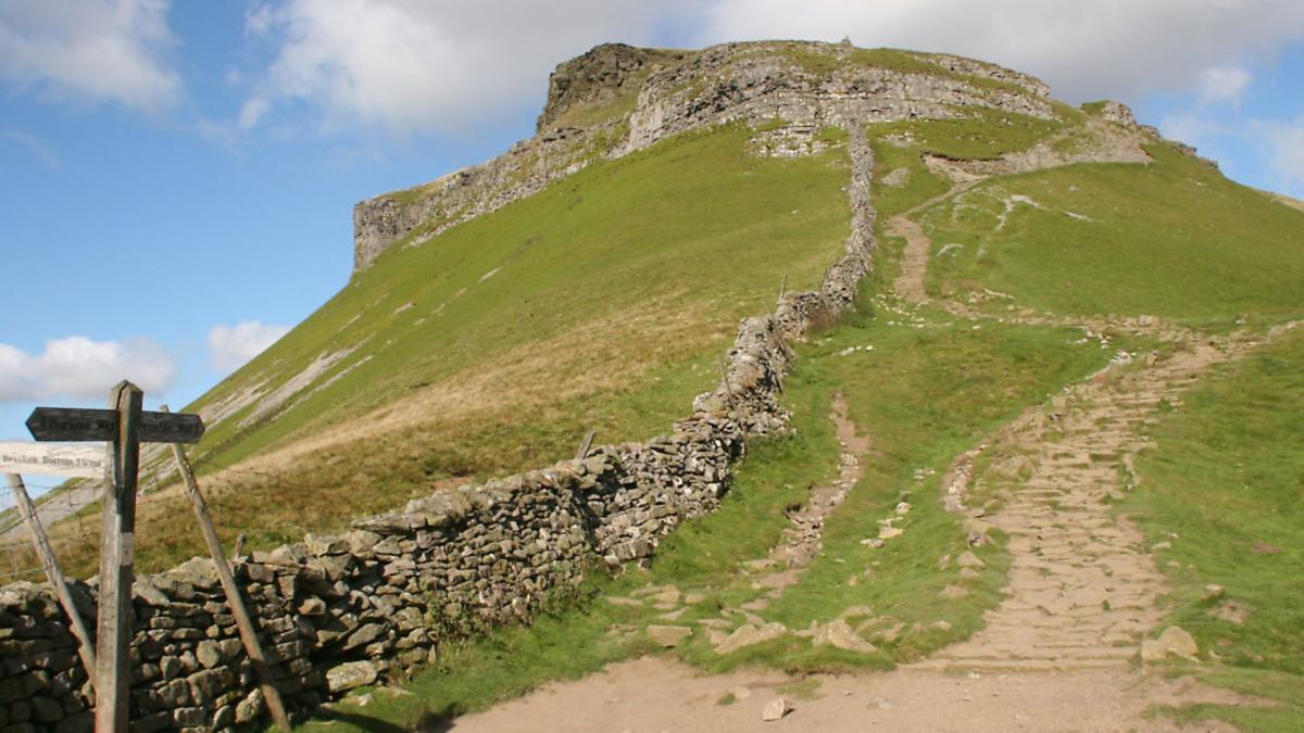
2. At a wall on the skyline the path meets the Pennine Way and turns left to follow it up the craggy nose of the mountain. This is an intimidating sight but in fact the path weaves through two rock bands, with only a short rock stairway giving any problems before it arrives on the summit. This wide wind-scoured plateau is crowned by a serpentine wall which provides shelter no matter which way the gusts are blowing. It’s the perfect spot to sit for a refreshment break and from which to savour the views across to the other two members of the Three Peaks triumvirate, Ingleborough and the more distant Whernside.
3. From the summit the main path, which is also part of the Pennine Way, heads away from the ridge back down to Horton, and it will be the route taken by most of your fellow walkers. However, having gained this height it seems a shame to go down quite so soon. So instead continue to follow the wall along the ridge, signed to Plover Hill a little over a mile away but do not be surprised if you have this section all to yourself. This section is in stark contrast with the main route which delivers walkers to the summit on solid ground. The dip between the summits of Penyghent and Plover Hill is often wet and care is needed to pick a way across dry shod. The wall, however, is a constant companion so navigation is not a problem even in mist.
4. When the track reaches the large flat top of Plover Hill it arrives at a complicated junction of several walls and a step stile. Go over this and then turn half left to a stake on the rim of the plateau. From here a stony path heads away diagonally downhill. Follow this and where the slope steepens still more a flight of rough gritstone steps makes the going easier, eventually meeting a green, grassy track crossing the lower slopes. This is the Foxup Road, though it is a road in name only; the reality is that it is a track and will be followed all the way back to Horton.
As the track traverses leftwards round the foot of the mountain with the flat top of Ingleborough directly ahead it becomes wider and clearer to follow. At a crossroads by a wall end a more obvious track comes down from Penyghent. Ignore this and carry on directly ahead. The path here is less clear for a while but faith is rewarded as it reasserts itself.
5. Follow this past Hull Pot to when the wide Pennine Way track comes down from the summit of Penyghent to a gate. Beyond the gate the track is a rocky enclosed track signed to Horton one and a half miles away.
COMPASS POINTS
Start/finish: Horton-in-Ribblesdale
Distance: 8.5miles/11km
Height gain: 1775ft/540m
Terrain: Fell paths and stony tracks
Time: 4-5 hours
Parking: Pay and display and roadside in Horton-in-Ribblesdale.
Refreshments: Pub and cafés in Horton-in-Ribblesdale
Map: OS OL2 Yorkshire Dales (Southern and Western Areas)


