

Enjoy the views into the Yorkshire Dales and, dare we say it, towards Lancashire during this lovely walk

This walk was published in December 2018, so the details of the route may no longer be accurate, we do advise these articles should only be used as a guideline for any potential route you take and you should double check an up to date map before you set off.
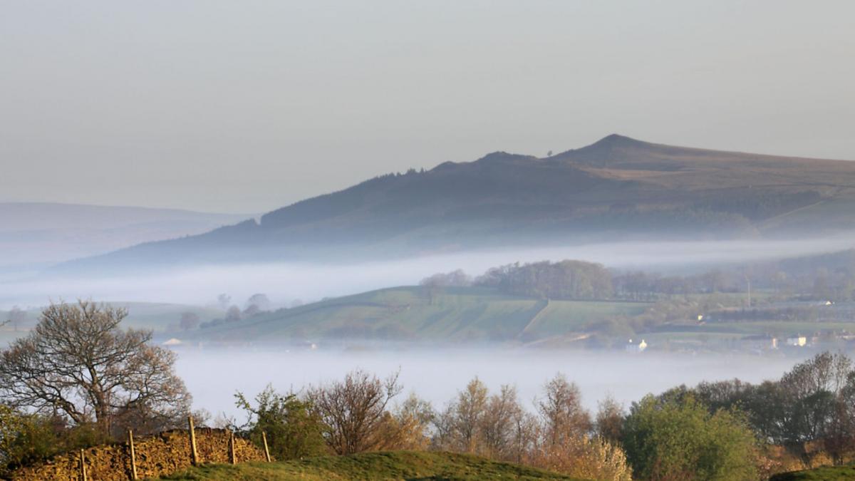
Even the most starry-eyed local might struggle to christen Sharp Haw 'Skipton's Matterhorn' but there is no denying that its conical summit does draw the eye on the approach to the town up the Aire Valley. In a landscape marked by long ridges and rounded grassy tops, Sharp Haw's pointed crown stands out and demands attention. With its nearby rockier sister Rough Haw - appropriately pronounced Sharper and Rougher in these parts - it makes up the isolated bulk of Flasby Fell. Although relatively low even by Yorkshire Dales standards, its position provides surprisingly extensive views into the Dales and across to the Forest of Bowland.
This walk starts from Bog Lane above Skipton, climbs over the summit and drops down to the hamlet of Flasby before returning by the flank of the fell. It starts high up at a prominent unmade parking area on a right angle bend (see directions below) and is quickly out into open moorland before the character changes to gentler woodland and pastures once the highpoint is passed.
Directions
1. From the parking area, go through the gate along a farm track signed to Flasby and aiming towards the distinctive top of Sharp Haw. The track passes through two gates and shortly after the second one it is time to veer off diagonally rightwards along a broad green path signed as a bridleway and part of the Dales High Way long distance route.
Shortly after passing a finger post the right of way veers off rightwards to pass between Sharp Haw and its northerly neighbour, Rough Haw. However, this is open access land and there is a clear track leading up to the summit of Sharp Haw, which offers a much more appealing route.
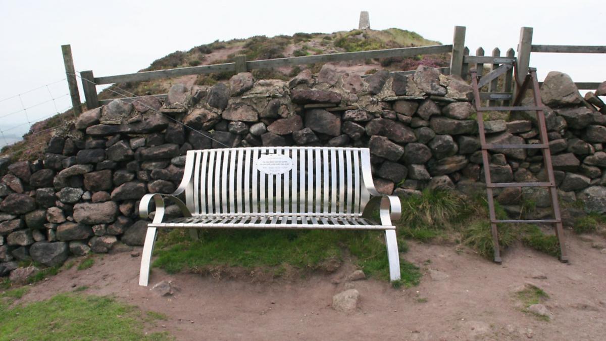
The summit is marked with a trig point but also a fine metal bench, a memorial to five local people, which provides a handy place to rest and admire the expansive views over Skipton and down the Aire Valley. The views to either side are equally impressive with the long ridge of Cracoe Fell and its obelisk war memorial to the north east, while looking towards Lancashire the huge whaleback of Pendle dominates the horizon.
2. From the summit take a few paces along the ridge path but then follow a track which drops rightwards down the slope towards Rough Haw. It rejoins the main bridleway and passes through a gate in the wall before heading immediately leftwards to skirt the summit, though this can be collected with very little extra effort.
Otherwise carry on along the track, which soon begins to drop towards the hamlet of Flasby in the valley below. The route, signed by blue-topped marker posts, weaves its way through the bracken and into an attractive wooded valley to leave the access area at a gate in the wall and heads off diagonally leftwards down a sloping meadow to another gate. Beyond this an enclosed green lane leads all the way to Flasby.
3. This delightful hamlet would make an ideal mid-way rest stop but unfortunately can offer neither pub nor café. So after reaching the first farm buildings take a tarmac lane on the left, signed as a private road but it is a public footpath. The landscape here is a miniature masterpiece with the summit of Sharp Haw above the wooded lower slopes.
Continue along the road passing farm buildings after which it goes through a gate and begins a curving climb through meadows and into woods. At a fork marked by another metal bench, the twin of the one on Sharp Haw's summit, take the right hand branch, which continues at the same level but after a few yards at another fork go left along the signed footpath. This quickly joins a farm road at a T-junction. Turn left uphill.
Soon the track levels out, contouring across the hillside on what was once a very enclosed path, hemmed in by trees but in recent years felling has opened up the views across the slender shining ribbon of the Leeds-Liverpool canal in the valley bottom to Pendle and the Bowland hills beyond. With all navigation decisions behind you it is now possible to stride out and enjoy the views as the track is followed all the way back to Bog Lane and the car.
COMPASS POINTS
Start/finish: Bog Lane, Stirton
Distance: 6 miles/10km
Ascent: 850ft/260m
Terrain: Moorland paths and farm roads
Time: 3 hours
Parking: Roadside. From the Grassington roundabout on the A59/A65 Skipton bypass take the B6265 towards Grassington. After 0.9m turn left into Bog Lane and park on a sharp left hand bend 400yds further on
Refreshment: None on the route but pubs and cafés in Hetton, Cracoe, Gargrave and Skipton
Map: OS OL2 Yorkshire Dales Southern and Western Areas


