


A walk from Fridaythorpe which explores Yorkshire’s biggest collection of dales.

This walk was published in June 2017, so the details of the route may no longer be accurate, we do advise these articles should only be used as a guideline for any potential route you take and you should double check an up to date map before you set off.
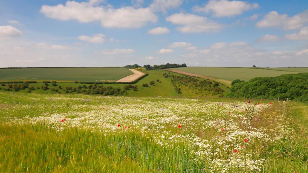
The great valleys of the Pennines, such as Swaledale and Wharfedale, may be better known and the North York Moors has its own collection too but if you want dales galore then head east to the rolling chalklands of the Wolds. Here is Yorkshire's biggest collection of dales - the word the Norsemen gave to the clefts in our hills. It could, not unreasonably, be argued that the Wolds cheat a bit, of course. Here valleys change their names more often than on-the-run criminals and even a quite insignificant nick might have two or three titles before they are done.

That does not stop many of them being quite delightful, suddenly opening up at your feet as you cross vast fields dotted with chalk and flint. The Wolds have a topsy turvy form of agriculture. Elsewhere hardy sheep graze the high ground and the valleys are reserved for protecting tender crops. Here the tops are given over to growing crops while the sheep nibble dry valleys whose sides are too steep to take the plough.
This exploration of a whole clutch of dales begins in Fridaythorpe, a claimant to the title of the Wolds highest village at 561ft (171m). It takes its name from the Norse goddess Frigg or perhaps an Old English farmer called Frigedaeg and was old long before the Normans arrived and built St Mary's tiny little church. Like many Wolds communities it boasts an attractive village pond and that is where this walk starts.
DIRECTIONS
1. Head up the street with the pond on your left and at the end of the houses, just before the grain depot turn left along a track marked as the Wolds Way to Thixendale, which the route follows for its first 1.5miles (2.5km). After a little over half a mile (1km) go through a signed kissing gate on the right and angle down the path to the bed of the dry valley of Brubber Dale, Turn right along the valley floor for a few yards and take a kissing gate ahead. Go through this, still following the Wolds Way and climb the valley leftwards to follow paths to the neat Gill's Farm.
At a road, cross straight over still on the Way. The track soon curls round into Thixendale and in the valley below are puzzling grassy earthworks, which at first glance might seem pre-historic but are actually a modern landscape sculpture, Waves and Time (originally called Time and Flow) by Chris Drury.
2. Carry on past the sculpture, where the route finally leaves the Wolds Way. At a gate ahead, go through and bear right along the valley bottom following the path into Bradenham Dale. Soon the landscape changes and enters woodland. Where the dale splits take the left hand fork into Wayrham Dale.
3. At its end the quiet valley meets the busy A166 York road. Cross with care and go through a narrow strip of wooded verge to a minor slip road. Turn left to pass the Wayrham picnic site and car park, then quickly bear right along the lane marked to Huggate. This is a fairly quiet lane with wide verges but keep control of any children or pets.
Carry straight on at a crossroads, following the road for more than a mile. All along the road are scattered a selection of rotund stone 'daleks', around waist high. Some are engraved with names, others with what might be Latin or dates. At first glance they could be old boundary markers but the occasional strange inscription, such as 'Keep Britain Tidy' hints at their true, more modern origins, dating from the 1960s when a local farmer put them up for his own amusement.
4. Pass a tall wind turbine on the right and then a road junction on the left before coming to the entrance of Wold House Farm, marked by a covered reservoir. Enter the farmyard and bear diagonally left to a gate in the far corner with a discreet yellow arrow. Carry on along the main track, through fields before eventually arriving at a kissing gate at the head of Holm Dale.
Do not drop into the valley but instead follow the contour of the road leftwards to soon reach another gate now back on the Wolds Way. Go through this, ignoring the first lane immediately left (Cowpasture Road), and instead take the second one which leads swiftly back to Fridaythorpe.
Compass points
Start/finish: Fridaythorpe
Distance: 7.5 miles/12km
Terrain: Field paths and stony tracks. A couple of short climbs
Time: 3 hours
Parking: On the street in Fridaythorpe.
Refreshments: Pub in Huggate, 4 miles away
Map: OS Explorer 294 Market Weighton and Yorkshire Wolds Central


