
Discover some of this area’s fascinating social and economic history on this easy coastal walk
Distance:3¼ miles/ 5.25 km Time:2½ hours Exertion:Quite easy Start:Olympic Rings viewpoint, Yeates Road, Portland (Grid Ref: SY688730) Map:OS Landranger Sheet 194 Public Transport:First 1 from Weymouth Dogs:On leads in urban locations and where livestock is and in accordance with specific notices encountered on the walk and The Countryside Code Refreshments:White Stones Café Gallery, Easton Street for coffee and lunches

_______________________________
1. Walk from the Olympic rings towards Yeates Roundabout. 20th -century re-alignment has obliterated the start of Merchants' Railway twin-track tramway route from Priory Corner. Turn down the footpath-arrowed 'Private Access' road. Pass a left footpath overlooking New Road. Looking far forward-left, see the stone tunnel where Verne Citadel's approach road crosses Merchants' Railway en route to the Castletown incline. You are on the Merchants' Railway now, and the overgrown lower level heading for the tunnel is still Merchants' Railway, on the same level as you are. The fenced level above it comes from Waycroft, Withies Croft and Inmosthay Quarries and joins Merchants' level before the tunnel. Continuing across Old Hill, pass left Old Rectory and several garages into the fenced grass track. Join Verne Hill Road. Merchants' Railway performed a left 'hairpin' around the hillside behind the later excavated garage-area to your left.

2. Continue up Verne Hill Road and over the Lower incline bridge of three. This 1875 incline lowered trucks from the single-track shared between Withies Croft, Inmosthay and Independent Quarries. In the present garage area, the incline track joined Merchant's tramway. Up to Verne Citadel embankment, bend right up the road and round the right hairpin, signed left 'High Angle Battery'. To visit it now, go up the facing path, explore and come back here. Continue up the road for 110 yards to the Upper incline bridge. Take the left footpath-signed path. A few yards further on, another bridge crosses the tramway from Waycroft and Withies Croft Quarries before it bends 90º to cross the Middle incline bridge and bend left to Verne Hill's fenced-level line we saw earlier. Now, down into the incline, turn right. Follow the path through a deep gulley into a clearing and, with Waycroft Quarry's embankment right, to an open area. Between two boulders, join the Coast Path track by the animal farm fence. Waycroft, Withies Croft and Inmosthay Quarries' tramway ran alongside the right embankment towards their incline.

3. Turn right, with Grove Prison ahead. Continue to twin boulders and a facing rock 'wall' with Waycroft Quarry view right. Around the left bend, meander to a T-junction. Turn left for 'Coast Path'. Through boulders, keep straight on, opening out before the facing Engine Shed. At the footpath-post, bear half-right. Cross Admiralty Incline road and grass and follow the right wall to a gap. But first, cross Admiralty Incline to the information boards for superb coastal views over Portland Breakwater. Through the gap, follow Grove Prison fence. Bend right onto the 'Coast Path' with left stone wall and right Prison fences and walls. Pass the left 'Coast Path' pointer. At the end T-junction, continue right around the Prison wall.

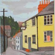
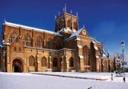
4. Pass left Grove Prison Museum in the old Deputy Governor's residence, right offices and the ornate 1848 Prison gateway. Continue around Grove Road corner. Pass right Alma Cottages for warders and schoolmasters, the School and Old School House. On the left bend is St Peter's Church, also built by convicts. Behind the graveyard's north wall, tramways carried carts from Admiralty Quarry to the Prison stone-yards for working, then to Admiralty Incline. Continue along Grove Road with Admiralty Quarry wall right. Pass left Augusta Road, right Old Vicarage and Quarry House (now Ivybank House). Pass left Clifton Hotel, Old Presbytery and Clifton Cottages. Pass the right entrance to Portland United FC's ground. Pass left West Grove Terrace, sports field and Fire Station.

5. Reaching Easton Street, cross over into the service road. Turn left passing the Salvation Army citadel and 'Wakefield' cottage. Take right Victoria Place. Go straight on between houses. The Easton and Church Hope Railway, opened in 1865, terminated in the steel-fenced yard on your right, still called the 'Coal Yard' locally, where freight trains unloaded coal for refuelling the company's own trains. The left low-stone wall overlooks the reclaimed and fenced siding site. Continue along the path. Past a footpath signpost, keep all house gardens left. Up a 'Pedestrian' rocky path above Inmosthay Quarry, continue along the left wire-fence and emerge into 'Reforne' at the YMCA. Turn right. Pass right St George's Centre, left Jacobean George Inn and right football pitch with Inmosthay Quarry, now Jordans Mine, beyond. At Weston Road/Wide Street junction, with St George's Church opposite, turn right.

6. Cross left into the signed footpath right of Bowers Quarry and Mine roadway, previously Trade Quarry. Follow the path along the right perimeter fence. When this ends, the stony track ascends before becoming Trade Quarry's only tramway - leading to West Cliff rubble dumping point. Join the Coast Path coming up from your left, with wheeled-cart grooves. On the left, in the stone blocks on the precipitous cliff edge, see slots cut for the tramway. From now, all cliffedge Coast Path grooves are from iron-rimmed cartwheels. Another dumping track's supports stand alongside your path ahead. At the next pair, the Coast Path diverts due to cliff falls. Go up the bank onto the dumping-cart track. Through Tout Quarry Sculpture Park, turn left along the quarry's meandering Coast Path track. Passing left 'J C Lano 1854' dry-stone arch, continue around bends to the T-junction, signed 'King Barrow Quarry Nature Reserve' right. A shared tramway through Tout Quarry from neighbouring Inmosthay and King Barrow Quarries went left to Priory Corner.

7. Go right, past information boards. The grooves and drilled holes in the track-shoe stones show the shared tramway's route. Continue to the sign-posted tunnel. Under Wide Street, keep following the tramway stones, then through banks and over to the T-junction. Keep left (right comes from Inmosthay). Past scant remains of an old crane, cross the open area into Easton Street opposite Portland Lodge, signed back 'Public Footpath'. Cross and turn left. When the road bends left, keep straight along the right wall into Yeates Road, passing King Barrow Nature Reserve's entrance and left octagonal reservoir. Continue to New Ground with Old Hill opposite. Turn left back to the start.