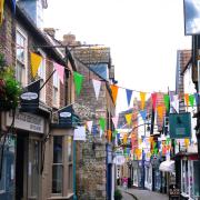


Chris Gladstone discovers some fascinating tales from across the ages
The Somerset Levels covering about 160,000 acres, is an area rich in history and legend. Lying only a few metres above mean sea level and bordered by several rivers, the vast flat plains have been prone to flooding for thousands of years.
This very fact though has ensured that human activity in the area has evolved in a unique way and has spawned some fascinating tales.

A soggy start
Survival on the Somerset Levels has always been a challenge and it was no different for our distant forebears.
In the Neolithic period 6,000 years ago small settlements hugged the few areas of raised land in the marshes, connected by timber trackways across the marshes. The most well-known of these is the Sweet Track, a timber walkway across the marshes discovered by Ray Sweet in 1970, that ran for almost 2km between Westhay and Shapwick.
Settlements from the Iron Age period have also been discovered, notably the Glastonbury Lake Village and two villages at Meare Pool. Built on an artificial mound, the Glastonbury site was home to up to 200 people and abandoned in about AD50 due to rising water levels.
Treasure at Shapwick
West of Glastonbury lies the village of Shapwick where, in 1998, metal detectorists discovered a Roman hoard consisting of 9,262 coins.
The largest Roman coin hoard of its type to have been discovered in Britain to date, it was found buried in the corner of a room of a villa.
The Romans settled extensively in the area and made valiant attempts to tame the Levels by building flood defences and ditches for drainage. However, their efforts were in vain as rising water levels eventually defeated their hopes, symbolised by the abandonment of a Roman settlement at Alstone near Highbridge.
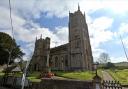
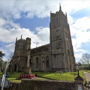
Abbeys, A Hero, and Cake
The Somerset Levels are renowned for their ancient abbeys at Glastonbury, Athelney and Muchelney.
Of these abbeys, it is the history of Athelney Abbey which is perhaps the most enthralling.
Alfred the Great (AD849-899) was King of Wessex at a time when the Viking King Guthrum ruled the Danelaw in the north. Guthrum had his sights on Alfred’s kingdom and so, in January 878, his army attacked Alfred’s castle at Chippenham, forcing Alfred to flee westwards.
He took refuge on the small island of Athelney where he spent four months planning his campaign.
In May, Alfred’s army defeated Guthrum at the Battle of Edington and peace reigned. In recognition of his victory, Alfred founded Athelney Abbey on the island in 888.
It was when Alfred took refuge during his flight to the Levels that he famously burnt the cakes while deep in thought.
A variety of fungus is known today as King Alfred’s Cakes and this is similarly round, black and inedible.

The Alfred Jewel
Discovered in North Petherton in 1693, the Alfred Jewel is one of the most stunning artefacts to have survived from the Anglo-Saxon era.
Made in the late ninth century from enamel, rock crystal and gold, the teardrop-shaped Jewel is about 2.5 inches long and is believed to have been the end of a pointer, used to follow the script in a gospel book.
The inscription AELFRED MEC HEHT GEWYRCAN (Alfred ordered me to be made) seems to indicate that the artefact was sponsored by Alfred The Great who lived in the area for a short while.
Now on display in the Ashmolean Museum in Oxford, the enigmatic Jewel did make a brief journey home to Somerset in 2015 where it was on display at the Museum of Somerset in Taunton.
Curry and Bishops
The study of place names can often provide tantalising clues to the ancient history of settlements.
In the west of the Levels are a plateful of Currys; North Curry, East Curry, Curry Rivel and Curry Mallet. The origin of this Curry is not certain although it is likely that it was named after St Cyrig, a pre-Saxon Celtic bishop who was associated with the area.
An alternative theory is that the name derives from the ancient British word cors or cos meaning marsh or fen.
As for Episcopi, this comes from Latin, meaning ‘of the bishop’. So Kingsbury Episcopi means ‘The King’s Manor of the bishop’ from its early possession by the Bishop of Bath, whilst Huish Episcopi means ‘a measure of land that would support a family of the bishop’, this time referring to the Bishop of Wells.
Something Fishy
At Meare exists the only surviving monastic fishery building in England. The Fish House was built in the 1330s by Glastonbury Abbey as a residence for the official in charge of the fishery nearby, a freshwater lake that provided a plentiful supply of food to the abbey. The Fish House was in use until the Dissolution of the Monasteries but, following conservation, can still be visited today.
The importance of fish in the diet of Levels dwellers still continues today. Young eels move up the river Parrett into the Levels where they stay until maturity, a plentiful supply that is still used today. Smoked eel, a culinary tradition that may go back many centuries, is still available in the area, at Brown & Forrest’s smokery in Hambridge.

The Last Pitched Battle
On 6 July 1685, the Battle of Sedgemoor, the last pitched battle on English soil, took place close to Westonzoyland.
It was the culmination of the Monmouth Rebellion, an attempt by James Scott, Duke of Monmouth, to seize the crown from his uncle King James II.
The Royalist army won the day, with only about 100 Royalist fatalities against more than 1,600 of the rebels.
Monmouth himself was captured at the battle and later executed, with hundreds of his supporters also meeting a similar fate when they faced Judge Jeffreys at his Bloody Assizes.
Spooky and Spectres
Our forebears may seem a distant memory but, if you want to meet one on the Levels, you may not have far to look.
As well as sightings of forlorn lovers in the Priest’s House in Muchelney and the George and Pilgrim Hotel in Glastonbury, perhaps the saddest tale comes from the site of the Battle of Sedgemoor.
A young girl witnessed her lover being captured by the Royalist forces and, to save his life, he was ordered to run as fast as a galloping horse.
He succeeded but was then shot in front of his lover. In dismay, the young girl drowned herself in the river Cary.
Her wandering spirit has been seen at the site, as well as the spectres of galloping horsemen.

The Girt Dog of Langport
If you look closely at a map of the Somerset Levels, you can see the Girt Dog of Langport.
Described by topographical features, the nose of the dog is at Burrow Mump - a ruined church atop a Norman motte - its ear at Earlake Moor, its tail at Wagg Drove, and its belly along the river Parrett.
It is said that the hound, five miles long and one mile wide, defends the town of Langport and is the 13th sign of the Glastonbury zodiac.
The earliest reference to the dog though is in a wassailing song first recorded in 1895.
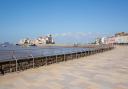
Murmations in the Wetlands
Modern visitors flock to the Levels to enjoy the RSPB reserves at Greylake, Ham Wall, West Sedgemoor and Swell Wood, where the wetlands attract a huge variety of birds.
West Sedgemoor is a Site of Special Scientific Interest where, as well as having the largest lowland population of breeding wading birds, water voles and otters breed too.
At Ham Wall you can witness one of nature’s truly stunning sights – the vast flocks or murmurations of starlings congregating and swirling in the winter evening skies before settling down to roost in the Avalon Marshes.