
Take a peaceful walk round Nynehead, where the landscape has some old tales to tell, with Simone Stanbrook-Byrne

West Somerset boasts some networks of beautiful footpaths and the area around Nynehead is no exception. A walk-through history lesson is tucked into the landscape surrounding the village; add in great views and a fairly level route and you have a near-perfect short ramble with lots of interest on the way. Go!
The walk:
1. From Nynehead Memorial Hall turn left out of the car park and walk down the road. This soon becomes a deep cutting beneath towering walls, a dramatic and rather extraordinary stretch of lane which, it is believed, was cut out by the Sandford family (the spelling of the name varies) who owned Nynehead Court from the late 16th to the 20th century. The cutting afforded easier access to the house for their servants who lived at East Nynehead.
Follow the lane for just under half a mile, ignoring any turns, until you reach the main entrance to Nynehead Court on the left.

2. Walk through the large entrance gateway and look for the multi-way fingerpost just inside near a willow stag. A footpath is clearly signed along the surfaced drive, bearing right from inside the gate and passing the various buildings in the environs of the Court.
The path passes parking areas and the main house will be seen over to the left. Recorded in the Domesday Book, the dwelling that has occupied this site has changed vastly over time. During medieval times it was in the ownership of the de Wyke family and was subsequently held for several centuries by the Sandfords, during the course of whose occupancy the house was largely rebuilt and extended. In 1949 it became a care home and continues as such today, with residents both in the house and in mews properties within the grounds.
Follow the drive until the tarmac runs out, then keep ahead on the unsurfaced track, passing parking areas and leaving the buildings behind as the path curves gently left round the periphery of the Court. When you reach a fork go left – there is a yellow arrow on a post to reassure – and in about 30m you reach a metal kissing gate beside a fingerpost.
Pass through into the field and pause to enjoy distant views ahead towards Wellington Monument. This was built to mark the Duke of Wellington’s victory at Waterloo; construction started in 1817 but due to a lack of funding wasn’t completed until 1892, 40 years after the Duke’s death.

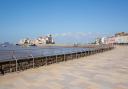
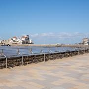
3. Cross the large field in the direction shown on the fingerpost; we were walking through wheat here but a clear and pleasing path had been left through the crop for walkers. Ahead a stone bridge spanning the River Tone comes into view and you may hear trains in the distance as they travel between London and the West Country.
At the far side of the field cross the bridge, pausing to admire the river on both sides. This is an idyllic spot; an elegant family of mute swans wafted beneath us like feathered ‘poo sticks’. At one time the carriageway to Nynehead Court crossed this bridge. In the early part of the 19th century the Sandfords constructed a weir across the river to create an impressive body of water in their parkland and also to provide work for local men. A new, three-arched bridge was built to take the carriageway across, although the river subsequently silted up, reducing its width again.
At the end of the bridge go through a metal gate, swiftly followed by a wooden kissing gate, on which a yellow arrow points the way, bearing right on the public footpath across the field. Follow this, but first glance left at the avenue of young trees, planted in 2011 to mark the line of the original avenue along which the old carriageway passed. Follow the footpath across the field heading for a point between two pylons. This line passes beneath the wires and reaches a metal gate. Go through, crossing a small bridge and entering under trees.

4. The lovely sunken path now goes through the verdant woodland of Stedham’s Covert; follow it, ignoring any animal paths going off. The path bends right then left, and in less than 200m emerges from the trees. Ignore a right fork (if you see it) and stay ahead on the path, which gradually bears left then swings more distinctly left. To the right of the path is a treed boundary with a field beyond and houses on the outskirts of Wellington beyond that. You may also spot a passing train.
The path you are now following is the route of the former Grand Western Canal and part of the West Deane Way. The canal was once part of a waterway scheme that aimed to link our north and south coasts, avoiding the difficult sea journey all the way round the south west peninsula. This canal linked with the Taunton & Bridgwater Canal but the arrival of the railway challenged its commercial viability and the Somerset section of the Grand Western Canal closed in the late 1860s. What remains is a beautiful (and dry) footpath, graced by the trees of Long Copse with perhaps the lingering ghost of an old boatman.
Gradually the path comes close to the well-screened railway – any trains are barely visible – and, about 750m from joining it, the once-canal swings left, away from the railway and crosses an old aqueduct.
Pause here. To the left is the other end of the avenue of young trees; to the right you can look down on the remains of the carriageway that once led to Nynehead Court. The bridge over to the right was built by Brunel to carry the railway over the carriageway. The aqueduct on which you are standing was part of an elaborate feat of engineering, which lifted the canal and its boats up and over the carriageway.
5. Cross the aqueduct and follow the footpath as it drops downhill. At the bottom of the slope go left to find a notice board, situated beside historic remnants of the canal’s lower pond and lifts, which explains the engineering in fascinating detail.
Study the technology then leave the board, walking away from it with the water to your left and passing a tall bench on the right. The path reaches a metal kissing gate opposite Wharf Cottage. Emerge from the path with caution and cross the road, going diagonally left to rejoin the path through a wooden gate beside the cottage.
Walk ahead through the field, boundary to your right, leaving the road behind. You soon pass through a scrubby field boundary. Keep on in the same direction beside the right-hand hedge, passing beneath the electricity wires. Near the end of the field the path continues in the same line, going beneath trees in the field corner to reach a kissing gate. Find someone to kiss, as appropriate, then continue as before, re-crossing the River Tone.
Go through another kissing gate, swiftly followed by yet another. Walk through the next field, still beside the right-hand hedge, towards a small but perfectly-formed sewage works – sorry!! (It is very small, as was the whiff when we passed). Pass this works on your left and go through the gate just beyond it.
6. After the gate turn left, leaving the West Deane Way and now following the left-hand hedge towards red-brick houses at the far end of the field. Potatoes were about to be harvested when we came through, the big crates awaiting them declaring, interestingly, ‘Cotswold Potatoes’. The path becomes surfaced and soon reaches the houses and the lane. Pause to look behind you; these houses enjoy splendid views.
Turn left on the lane and you find yourself back at the Memorial Hall.
Compass points:
Map: OS Explorer 128 Taunton & Blackdown Hills 1:25 000.
Directions to start: Nynehead can be accessed off the A38, just over 6 miles west of Taunton
Start point & parking: If there is space at Nynehead Memorial Hall they are happy for walkers to park there, but please be considerate towards other users. Postcode: TA21 0BH; Grid ref: ST145229
Distance: 2.75 miles / 4.4km
Exertion: Easy
Terrain: Field paths and tracks, quiet lane
Dog friendly: Yes, but animals likely to be grazing
Refreshments: None en route. Nearby are The Anchor Inn, Hillfarrance, TA4 1AW; 01823 461334 (3 miles) and The Martlet Inn, Langford Budville, TA21 0QZ; 01823 400262 (just over 2 miles)