
What could be better than a barefoot walk by the water’s edge in the height of summer? Robert Hesketh offers up his top picks of beach-themed walks designed for all ages and abilities
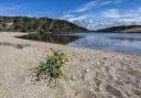
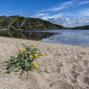
Trevone Bay
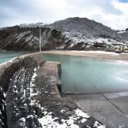
There are splendid and fairly easy coastal walks in both directions from Trevone’s large sandy beach. Follow the Coast Path east for 2½ miles (4km) to the daymark at Stepper Point to enjoy wonderful views of the coast, the Camel estuary and inland to Bodmin Moor. Alternatively, a 1¼ mile (2km) walk westwards leads to beautiful Harlyn Bay. Stepper Point has a Coastwatch Station, where (operational duties allowing) visitors are welcome. The volunteer Coastwatch team liaise closely with the Coastguard and the Cliff Rescue Team. Backed by a range of modern equipment, including radio, radar and CCTV, they provide an invaluable service in making the coast a safer place.
This coast was well used by smugglers during the 18th and early 19th centuries – despite the Revenue having a Custom House and a cutter at nearby Padstow. In 1791, the Revenue cutter Dolphin confronted a large smuggling vessel with 50 men and eight large guns aboard. After firing on the cutter, the smugglers, in a show of superior strength, demanded Dolphin’s mate come aboard. A subsequent £100 reward for help in arresting the smugglers fell on deaf ears.
Fact file
Terrain: Gentle coast path
Dog friendly? Dogs are banned from the beach in the summer.
Refreshments: Trevone Bay Café/Restaurant; Well Parc Pub/Hotel, Trevone
Public Toilets: Trevone Bay
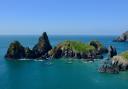
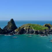
Polkerris/Gribben
Polkerris is a sheltered cove with a sandy beach and its own small harbour. West facing, it is particularly delightful on a summer’s evening. Enjoy a drink, and a meal, either at the Rashleigh Inn or Sam’s on the Beach and watch the sun set over St Austell Bay – but first sharpen your appetite with the stimulating two-mile (3km) walk along the coast path to Gribben Head.
This starts with a steep zig-zag path, but the effort is amply rewarded: Gribben Head is one of the finest viewpoints on the Cornish coast. It’s crowned with an 84ft tall daymark, built in 1832 to guide ships safely into Fowey Harbour. You can climb to the top on summer Sundays (National Trust, book ahead 01726 870146).
Bring binoculars as Gribben Head is also a splendid place to watch birds. Look out especially for birds of prey, including kestrels, buzzards and peregrines, as well as many seabirds and migrants, which use the headland as a guidepost on their remarkable journeys.
Fact File
Terrain: Clifftop coast path
Child/dog friendly: Yes
Refreshments: Rashleigh Inn; Sam’s on the Beach, both in Polkerris
Public toilets: Polkerris
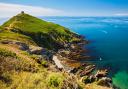
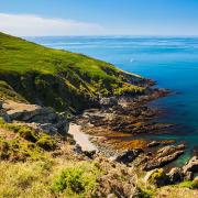
Sennen Cove
Sennen Cove’s lifeguarded, mile-long sandy beach is deservedly popular with families. Low tide is ideal for a walk or paddle north along the sands to Gwynver Beach, with the coast path through the dunes as a high tide alternative.
Extend your walk for ½ mile south along the strand from the car park to the Lifeboat Station. This is open daily and has a viewing gallery. Continue to the Roundhouse and Capstan Gallery, a Grade II* listed building with a wide variety of art in many media and a huge man-powered capstan wheel, once used to winch boats up and down the slip. Divert along the Breakwater for a superb view of Sennen and then follow the coast path to the Old Coastguard Lookout. Longships Lighthouse stands 116ft tall, two miles south-west. A mile further along the path leads past the Irish Lady to Land’s End.
Fact File
Terrain: Sandy beach and gentle coast path north; rockier coast path to Land’s End
Dog friendly? Dogs are banned from the beach 8 am - 7 pm in summer
Refreshments: Choice of cafés, restaurants and pubs in Sennen Cove
Public toilets: Sennen Cove
Bude
This short but interesting walk leads across Bude Canal to Compass Point and superb coastal views. Turn left out of the car park and cross Summerleaze, a fine sandy beach popular with families. Cross the bridge on your left. Turn left, then right up steps. Cross Bude Canal by the sea lock gates. Built in 1823 to take sea-sand inland to fertilize fields, the canal has two further locks and six incline planes. Mount the steps on your left and turn right along the lane. Climb the steps and turn right onto the coast path.
Continue to the former Coastguard lookout on Compass Point. Known as the ‘Pepper Pot’, it was designed by George Wighwick in 1835 for the wealthy Acland family. Constructed of local sandstone, it is modelled on the Temple of Winds in Athens, with the points of the compass inscribed on each face.
Fact File
Terrain: Sandy beach, tarred and grass paths. Short flights of steps. No steep slopes
Dog friendly? Limited dog restrictions
Refreshments: Wide choice of pubs and cafés in Bude
Public toilets: In the car park
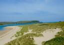
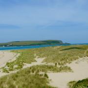
Daymer Bay
With its gentle tides, Daymer Bay’s large sandy beach is ideal for children and the views over the Camel estuary are idyllic. Northwards, a mile along the low cliff path leads past Greenaway to Polzeath and another fine beach. To the south, an easy walk through the dunes or along the beach at low tide takes you to the village of Rock. En route, a 400m diversion leads to St Enodoc church, which was buried in wind-blown sand between the 16th and 19th centuries and known as ‘Sinking Neddy’. To maintain the tithes a service had to be held there once each year. The problem was solved by lowering the vicar and his parishioners into the church through a hole in the roof. It was not until 1864 that St Enodoc’s was fully unearthed, and the dunes stabilised. Poet Laureate John Betjeman (1906-84) is buried in the churchyard. He loved this part of Cornwall, celebrating it in many poems. Indeed, we walk in Betjeman’s footsteps, through Trebetherick Golf Course, over the dunes and cliffs he knew and loved so well.
Fact File
Terrain: Low cliff path to Polzeath; gentle dune path (or beach) to Rock
Dog friendly? Dogs permitted
Refreshments: Daymer Bay Café; pubs, cafés and restaurants at Polzeath and Rock
Public toilets: Daymer Bay
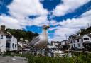
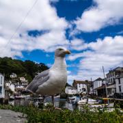
Cawsand
Both Cawsand and neighbouring Kingsand beaches are popular with families; well sheltered and good for swimming and rock pooling. Explore the narrow, winding streets, chosen for their unspoilt period charm to represent Margate in the film Mister Turner and stop off at one of several cafés or pubs for refreshment. On a wall opposite the Halfway House is the old Devon/Cornwall boundary marker, a reminder that Kingsand was part of Devon until 1844.
Continue eastwards onto the gentle coast path for great views over Plymouth Sound and the constant interest of ships coming and going. Many are warships, which makes the flourishing 18th and early 19th-century contraband trade of Cawsand and Kingsand all the more remarkable, as the Navy was charged with suppressing smuggling and the Revenue had their Custom House on Plymouth’s Barbican. Contraband was traded on a generous scale: in 1804, the Plymouth Collector of Customs estimated 17,000 casks of spirits were smuggled into Cawsand annually. Three-masted luggers and the bigger smuggling cutters carried up to 800 eight gallon spirit casks, plus tea and tobacco. Fifty smuggling craft were in business at Cawsand by 1815, and a similar number were still employed on French runs in the early 1840s.
Fact File
Terrain: Quiet streets and gentle Coast Path
Dog friendly? Dogs permitted on Kingsand beach but banned from Cawsand beach in summer
Refreshments: Pubs and cafés in Kingsand and Cawsand
Public toilets: Cawsand