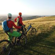

Between Dursley and Uley a cluster of little hills stand apart from the Cotswold escarpment. All of them are garnished with folklore, but one more evocatively than the others. Of course that’s the one it’s hardest to get to! We’ll explore the folklore in the course of a walking route around the hills. The grey wintry weather on the day I did the walk only made this landscape seem all the spookier.
After the steep descent down the Cotswold Way from the layby on the Crawley Hill section of the B4066, you pass through Hodgecombe Farm, where several notices, including grisly photographs, beg dog walkers to keep dogs on leads because of ongoing incidents of dogs chasing and killing sheep. As I continued up Cam Long Down opposite, two dog walkers were ahead of me, both of whom had their dogs off their leads – in spite of the sign on the stile and the flock of sheep alert on their feet in the same field. I was sensitised to this situation because a friend of mine, who co-owns a flock of sheep in Oxfordshire, recently lost one of them to a dog attack. She sat with the wounded sheep for two hours while waiting for the vet to come and put the animal to sleep.
Cam Long Down is a narrow curved hill, half a mile long, wooded round the bottom, with open scrub on the top, from which there are fabulous views west to the Severn, south to Downham Hill – of which we’ll hear more – and east to the long wooded line of the escarpment. The folklore is that this hill may be the site of Camlann, King Arthur’s last battle, in which he slew his son Mordred and was mortally wounded in return. ‘Cam Long’ sounds a bit like ‘Camlann’ – are you convinced? – and the place fits the geography of invaders pushing from the east and Arthur’s troops arriving from Caerleon in Gwent. The rival location in Cornwall has received stronger publicity but seems a remote spot for so momentous an event.
 Anthony Nanson")
THE DEVIL, THE COBBLER AND CAM PEAK
You can stay on the Cotswold Way or take a more adventurous path into some woods on the right and then descending a steep cleft of which there’s no hint on the map. Either way, you come to the footpath that hikes up to the grassy summit of Cam Peak – or ‘Peaked Down’ as the OS map calls it. This hill’s conical shape arose from its erection from a large wheelbarrow of earth the Devil dumped here. You see, the Devil was annoyed there was too much God in Gloucestershire, especially in the holy city of Gloucester with its beautiful cathedral. So he came with a wheelbarrow of earth so he could dam the Severn and thereby flood the whole Vale behind it, including Gloucester. However, when he asked a cobbler how far it was to the river, the quick-witted cobbler told him it was so far that walking from there he’d worn out all these shoes in his bag. In a fit of pique the Devil upended his wheelbarrow – and thus Cam Peak was made. The same thing has happened in a few other places, producing for example Cley Hill in Wiltshire after the people of Marlborough had recruited the Devil to destroy Devizes.
If you descend the western side of Cam Peak, you’ll find a footpath running from behind a house and along the bottom of the hill back to the Cotswold Way. Just below this path I noticed a hollow way that must have been the original right of way. Because that looked more interesting, and because I can be bloody-minded, I decided to go this way instead. I soon discovered why the right of way had been moved; the mud was so deep it’s a wonder it didn’t suck off my boots!
THE LOST INN OF DOWNHAM HILL
After a short stretch of Cotswold Way, you can then bear left on the paths, via Coldharbour Farm, around the base of Downham Hill.
The story goes that one night a traveller, caught in a snowstorm and having lost the road to Stroud, took refuge in an inn he discovered on top of Downham Hill. He was served by a silent stable groom and equally silent serving-woman, both of them dressed in green. Waking an hour before dawn, he was tempted to stay another an hour in his warm bed rather than brave the cold outside. His conscience galvanised him to get on his way because he knew his friends awaiting him in Stroud would be worried he’d failed to arrive through the snow. The inn was completely silent and there was no one around, so he left two gold guineas on the parlour table as payment.
Riding Stroud-wards, on what today is the B4066, he met his friends riding out in search of him. One of them, the husband, refuses to believe there’s any inn on a hill just above Dursley, but the wife feyly suggests it must be Downham Hill. With his friends, the traveller retraced his steps all the way back to the top of the hill. There’s no sign of the inn. Only two gold guineas in the snow. The wife explains that ‘they’ never take payment and ‘they’ like to appear on stormy nights but ‘they’ never stay out after sunrise. The traveller realises that maybe it’s just as well he didn’t linger another hour in bed.
You may wonder whether there’s any connection between this tale and Downham Hill’s other name, Smallpox Hill, after the smallpox hospital said to have once resided on its summit. I recently heard someone who grew up in Dursley speak of stories of mass graves in the hill where the smallpox victims were buried – excavations that may in fact be evidence of the rabbit warren established here in the Middle Ages. But facts about the smallpox hospital aren’t easy to pin down either. Is it, too, a legend? Whatever the truth, the association in this place between a deadly disease and enigmatic fairy folk offers a hint of how stories of fairies may have developed from stories about spirits of the dead.
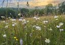
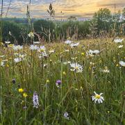
Downham Hill is shaded on the map as access land where you have the right to roam. However, there’s no right of way to get there through the fields that encircle it. This tantalising circumstance only adds to the hill’s enigma. I could just make out a tyre hanging from one of the beech trees silhouetted on the summit. So somebody’s going up there! A sign on a gate one field away from the start of the access land warned, ‘No public access.’ It’s frustrating to be barred from visiting such an interesting place. But then the problem of dogs worrying sheep may give the farmers good reason to want to keep people out. It may be good for nature too. The vegetation up there looked varied and vibrant, even on this wintry day. I saw crows and buzzards above the hill – and, briefly, a hovering kestrel.
After crossing a lane, a footpath leads up steeply through some woods to the ramparts of Uley Bury – the last of today’s four hills, albeit one closely tethered to the escarpment. It’s a major Iron Age hillfort, a large flat enclosure defended by earthworks and steep slopes on all sides. A bridleway all the way round will take you back to the layby on the road. If Cam Long Down was the site of Camlann, then I can well imagine Mordred ensconced here with his army the night before. Uley Bury is higher than the other hills we’ve visited and gives you a splendid view down upon them. And is that not a path I see snaking up through the bracken on the eastern side of Downham Hill?
 Anthony Nanson")
COMPASS POINTS
Distance: 4 miles.
Duration: 3 hours.
Level: Moderate walking with steep inclines and muddy paths.
Parking: Layby on B4066, grid reference 787994.
Toilets and refreshments: Afterwards: the Old Crown Inn in Uley.
Further reading: Gloucestershire Folk Tales by Anthony Nanson; The Folklore of the Cotswolds by Katharine Briggs.
Route: https://gb.mapometer.com/walking/route_5490313.html
Anthony Nanson is based in Stroud and available as a storyteller and speaker. His books include, among others, Gloucestershire Folk Tales and (with Kirsty Hartsiotis) Gloucestershire Ghost Tales and Gloucestershire Folk Tales for Children. Anthony also runs the small press Awen Publications.