Chagford is a delightful historic stannery town, which once served as an administrative centre for the tin industry. Today, old cottages and historic town houses rub shoulders with an abundance of lovely places to eat, galleries and independent shops that are crying out to be browsed – and this is from someone who doesn’t relish shopping. If you get no further than an exploration of the town, you will still have had a good outing.
Now is the time of year when it’s all too easy to not venture forth into the fresh air: too gloomy, too wet, too muddy... But, believe me, once you’re immersed in it, the great outdoors feels much better than you might expect, your winter-induced slough will be lessened and you’ll have earned your tea and cake.
This walk WILL be muddy in places, so wellies are advisable in winter, and the end section crosses open moorland, which is easy to navigate but please pick a clear day. Country paths are interspersed with quiet roads, giving respite from the slush. And remember, ‘when gorse is out of bloom, kissing is out of season’ – there’s masses of glowing gorse along this route, so take lip balm.
The walk:
 Simone Stanbrook-Bryne")
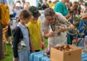
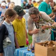
1. We start from the attractive octagonal Market House in the town square. This dear little building was built in the 19th century on the site of an older building which was thatched with open sides. The lady who sold me a lush box of fruit and veg said she was very glad of the modern-day windows – and it’s probably one of the most picturesque locations for public loos in Devon.
From the Square walk along Mill Street, which heads north-west past the fabulous Bowden’s hardware shop on the left and Chagford Inn on your right. Views to the moor are ahead – this road is part of the recently designated Dartmoor Way. About 150m from the Square, just after the bowling club, the road forks and here we take the right-hand option signed for Gidleigh and Throwleigh.
The road drops steadily downhill – if it’s icy try not to sit down. In about a third-of-a mile we reach a crossroads with the entrance to Gidleigh Park hotel opposite.
 Simone Stanbrook-Bryne")
2. Turn right here, approaching the old stone Chagford Bridge, its ancientness indicated by the wobbly writing on the map. This bridge is thought to have been built in 1590 and has ‘refuges’ above the cutwaters that allow people to get away from traffic. From one of these we spotted a kingfisher, flying brightly up the River Teign.
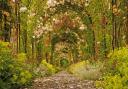
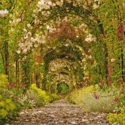
Cross the bridge and take the footpath beyond, heading right off the road with the river over to your right. There is now almost a mile of very appealing ambling ahead of us, generally following the Teign to Rushford Bridge, although the river meanders alongside and then away from the path from time to time. The way passes majestic trees, some surrounded by their own personal walls, presumably to protect their roots from erosion or grazing. Early spring flowers, and the promise of more to come, brighten the riverbanks.
After a quarter-of-a-mile the footpath veers left into a field via a yellow-arrowed gate, cutting off a meander, but soon rejoins the riverside path. It then passes through a pocket of woodland near a noisy weir, after which the path runs alongside a small tributary stream as the river has wandered off. A rich area for wildlife, the trees can be dripping with birdsong.
At a three-way fingerpost (which shows that this is part of the Two Moors Way, with an M above a W) keep straight on, soon crossing a footbridge. Beyond this cross the field on the well-trodden path to reach a gap in the hedge about 80m away. After this the path heads across the next field towards Rushford Bridge. When you reach the road turn right across the bridge.
 Simone Stanbrook-Bryne")
3. Immediately after the bridge go left across the low-level stile and follow the narrow path beyond, looking out for Exeter City FC memorabilia. The path soon ends at a gate, passing beneath an old goal post. From here head straight across the next small field to a wooden kissing gate. Slosh along the path beyond to reach the road – grab dogs and look out for traffic, as you emerge quite suddenly.
Turn left and in 80m, at the speed-limit signs, turn right up Broomhill – an old fingerpost shows that you’re heading for Adley Lane. Within 100m a two-way fingerpost directs through an arrowed gate and along a narrow path, running beside the fence of a house called Landfall – don’t accidentally wander up their drive.
 Simone Stanbrook-Bryne")
4. Cross the stile at the end of the path and head slightly right across the middle of the field, possibly passing ponies. At the far side cross a small stream followed by a stile with a fingerpost. Continue in the direction of the onward finger, climbing away from the stream, which is down to the right. This line brings you into the field corner, cross the stile and follow a short track to reach the road. Turn right along it.
Follow the road through Adley – if you’re lucky you may find free range eggs for sale, laid by ‘much loved hens who live out their natural lifespan’, At Westcott Cross turn right towards Chagford and in another 150m, after the road bends past Westhill House, look for the rising footpath going left, signed for Nattadon Common.
 Simone Stanbrook-Bryne")
5. Follow this, ignoring another path that goes immediately left, and keep plodding uphill along this green lane. On its right-hand side the hedge had just been immaculately laid when we passed, a traditional form of skilled management that creates a still-growing stockproof field boundary and maintains good wildlife habitat, unlike so much of the ‘sledgehammer’ flailing that we see.
It’s a puffy climb. Mercifully, the steepness reduces fairly soon, though we’re still ascending. It’s a lovely old way, marred, sadly, by an unexpected dumping ground for plastic farm waste in a dell on the right. Just after this the way bends right and passes through a gate.
Keep going, admiring the moss-upholstered trees and boulders flanking the path; many have passed before us. The path winds about a bit while generally keeping in the same direction. You leave the tree cover – keep ahead through the field along its right-hand boundary, with woodland a field away to the right. Lichen festoons the nearby trees, evidence of the clean air conditions. The path bends occasionally around stone outcrops and scrub, but maintains the same direction, and after about 120m through the field, as the ground levels out, a two-way fingerpost points you straight on, still along the right-hand hedge of the same field – don’t be tempted to slip through any gates to the right here.
6. In another 100m cross the stile in the corner and continue along the right-hand hedge, now walking along the top of an orchard. As you cross the stile notice the hedge going down to the left, a pleasing example of one laid some time ago, with all the fresh growth springing from the horizontal ‘pleachers’.
You’re now following a high path with big views to the left and behind – Castle Drogo is prominent in its commanding position on the other side of the Teign Valley. At the end of the orchard a view-rich bench beckons – make the most of it.
Cross the stile to the right, a little way from the bench, and follow the track out to the lane.
 Simone Stanbrook-Bryne")
7. Turn left on the lane, soon crossing a cattle grid. We’re now on the open expanse of Nattadon Common and you’ll see a fingerpost just ahead. After the cattle grid turn right, there’s a car parking area here, and our way now lies across the common, following the line of its right-hand boundary. The rising land to the left is the site of an Iron Age hillfort; this is all access land so you can explore if you wish, but return to this path alongside the right-hand boundary, which acts as a good guide for our return to Chagford.
As the path forks keep to the right. Huge views open up westwards, across the higher moorland of Meldon Common and Meldon Hill.
The boundary path starts to descend significantly – keep knees in gear and (I have learned from Clare Balding) if you keep your weight on your toes it feels less slippy. We managed this without scrambling the box of eggs we’d bought in Adley, which wouldn’t fit in the rucksack, so it can be done.
The path is clear and ever-downward, although it sometimes leaves the right-hand boundary. Near the bottom it passes two benches and soon bends right, winding down through trees to cross a small stream – I did say wear wellies – but even after rain it was only ankle deep. Just after this is a two way, yellow-blobbed fingerpost.
8. Pass through the gate and follow the descending path, soon arriving on residential Nattadon Road. Turn right, then bend left with it in 100m. At the junction with Meldon Road turn right – Chagford’s church tower is visible ahead. The road passes a trough on the right, filled by a rushing spring, and soon brings you back to the church, not far from the market square where we started.
 Simone Stanbrook-Bryne")
4 things to do while you’re in the area
1: Explore Chagford. It would be a missed opportunity not to immerse yourself in everything this lovely town has to offer: history, galleries, foody places and a wonderful richness of independents – do your week’s shopping here!
2: Castle Drogo, England’s youngest castle, is in the custodianship of the National Trust and is less than four miles away.
3: Stone Lane Gardens is one of my favourite places: a sculpture garden and arboretum with a National Collection of birch and alder. Open all year and less than four miles from Chagford.
4: Fingle Bridge Inn sits deeply in the Teign Valley, less than five miles from Chagford, with glorious riverside walks from its gardens and open fires in winter.
Compass points
Start point: Chagford Market House: postcode: TQ13 8AB; grid ref: SX700875
Parking: Well-signed car park near health centre and parish church
Map: OS Explorer OL 28 Dartmoor, 1:25 000 (this scale shows greater detail than the map printed here)
Distance: Just over 4½ miles
Terrain: Field and woodland paths and tracks, some open moorland, quiet lanes. Rough underfoot at times, also expect mud and streams – wellies advisable in winter
Note: The walk crosses a short section of open moorland so clear conditions are necessary
Exertion: Apart from one strenuous uphill and one steep descent, the walk is relatively easy
Dog data: Animals grazing; some stiles. The walk follows some lanes.
Refreshments: An abundant variety of very good (and cosy) places to eat in Chagford
Toilets: in Market House
Public transport: Buses call at Chagford
Look out for:
Historic sites in Chagford
Views to Castle Drogo
Wayside stall
Early spring flowers
Walking 1000 miles: During 2023 Simone is walking 1000 miles to raise funds for Devon Wildlife Trust. If you’d like to help support this charity and the Big Walk, please visit: justgiving.com/page/simone-stanbrook-byrne-1678009505575