


Autumn is often regarded as one of the best times for walking: not too hot and (tempting fate) not yet swampy; and as the days shorten, it can also be a bit of an uplift. So, pick some, or all, of these suggestions and make the most of the county over the coming season

Noss Mayo
(OS OL 20 South Devon 1:25 000)
Down on our south coast there are many options for walking. One glorious 5.5-miler starts from Stoke Point car park, marked on the map between Stoke Cross and Netton Farm (SX555465). Take the permissive path coastwards, then, if you want to visit the ruined church of St Peter the Poor Fisherman, head north along the coast for a there-and-back section. Return along the coast continuing on the South West Coast Path, part of which is called Revelstoke Drive – it was built to accommodate the 19th century landowner’s carriage! Take the footpath that heads inland from above Blackstone Point. Paths cut through Brooking’s Down Wood, then it’s lanes and short bits of footpath back to the start.

Lynton & Lynmouth
(OS Outdoor Leisure 9, Exmoor 1:25 000 )
An outstanding five or eight-mile route exploring a section of Exmoor coastline, wooded river gorge, the Valley of Rocks – and some tragic history as it passes through the area of the 1952 Lynmouth Flood. From Lynmouth’s Esplanade Car Park (EX35 6EQ; SS719498) walk through the village and follow the riverside path to Watersmeet Tea Gardens. Follow footpaths up through Myrtleberry Cleave to join the Two Moors Way/Tarka Trail heading west back to Lynmouth. For a longer walk, take the Cliff Railway (or follow steep path) up to Lynton. Follow the road west into the Valley of Rocks. Join SWCP near Castle Rock, heading back eastwards, finally following a path off the SWCP descending to Lynmouth.

Welcombe Mouth & Marsland
(OS Explorer 126, Clovelly & Hartland, 1:25 000)
A sublimely remote spot, so far up in the north-west of Devon that, for a short stretch of the five-miles, you’re in Cornwall. Steeply rugged coastline, sequestered sylvan combes, few people and plentiful wildlife. Start at Old Smithy Inn, Darracott, Welcombe (EX39 6HG; SS231178). Head west on footpaths through Mead to the coast, high above Welcombe Mouth, then south along the ‘diamond line’ of the South West Coast Path, past poet Ronald Duncan’s hut, towards Marsland Mouth. Head east past West Mill to eventually join the footpath through the Marsland Nature Reserve, visited by David Attenbrough in 1997. Then go north on the track past Leddon Farm and back to the start.

Raddon Hills
(OS Explorer 114, Exeter and the Exe Valley 1:25 000)
A short, 2.5-mile version of a longer favourite. Start from the small parking area at grid ref: SS889032, just west of Raddon Hills, between Thorverton and Stockleigh Pomeroy. Follow the footpath east – there are views to Exmoor and Dartmoor – until you reach the iconic lone pine.
Hug him, then enjoy the panorama before following the path towards Raddon Hill Farm, then heading north-west towards Kitlake. From their gateway follow the track/lane back to car.

Bolham/Knightshayes
(OS Explorer 114 Exeter & the Exe Valley, 1:25 000)
Enjoy parkland, woodland and countryside around the National Trust’s Knightshayes Estate. They tell me that ‘all the footpaths are permissive rights-of-way, and the parkland and woodland are free to access’. From Knightshayes car park (EX16 7RH) walk back down the drive and take the path south-west through the parkland to Bolham. Head north on the footpath to Firebeacon, then east for a short way to join Sustrans Route 3 heading south, back to Knightshayes.

Drewsteignton
(OS Outdoor Leisure 28, Dartmoor 1:25 000
A hilly, 6.5-mile walk starts near the pub in Drewsteignton (EX6 6QN; SX735908) and heads south on the Two Moors Way. Follow the Dartmoor Way above the Teign Gorge, passing below Castle Drogo and descending to a marked footbridge at SX721895. Follow the river through the gorge to Fingle Bridge and its inn, then it’s steep paths up through Drewston and Rectory Woods to return to the start. Alternatively, for a 3.5-mile walk, park at Fingle Bridge (EX6 6PW) and walk along the river to the footbridge on one side, then back on the other.

Culmstock Beacon
(OS Explorer 128, Taunton & the Blackdown Hills 1:25 000)
An old favourite of mine. Start from the war memorial in Culmstock (EX15 3JH. ST101136). Follow the road north then east briefly to reach the footpath through Dalwood Farm, then on to Blackdown Gate. Take the track up to the common – explore and find the old beacon hut at the south end. From the common follow the track through woodland past Little Thatch. From Culm Davy follow lanes, tracks and footpaths to Pitt Farm, then south to join the footpath along the river back to Culmstock. To make this six-miler into almost 12, from the common follow the track and road to Wellington Monument (in Somerset!); then the gorgeous footpath south before following lanes past Culm Pyne Barton. Footpaths and lanes lead west, back to Culmstock.

Sidmouth & Salcombe Regis
(OS Explorer 115 Exmouth & Sidmouth 1:25 000)
A five-mile walk with an abundance of fine views. Lots of refreshment options in Sidmouth. Wherever you park, find your way to the eastern end of Sidmouth’s Esplanade, near the Lifeboat Station (SY128873). The walk follows the South West Coast Path up onto the cliffs before heading north through woodland to Salcombe Regis. Return along footpaths south towards Salcombe Mouth – keep to the western side so you don’t have to descend into it unless you want to. It’s a steep climb anyway, heading back along the coast until you eventually retrace your steps down into Sidmouth.

Wistlandpound Reservoir
(OS OL 9 Exmoor 1:25 000)
Inland areas of North Devon have a lot to offer. This lesser-known, view-rich reservoir is superb for birds. There’s a car park at the south-west corner (EX31 4SL; SS639415) and the lake’s sub-two-mile perimeter path is well-surfaced, with lots of picnic spots and reasonable gradients, so is ideal for buggies and mobility scooters. To extend the walk to about five miles, follow footpaths south, through Twitchen to Rye Park; then head north again past Hunnacott, South and North Thorne, back to the reservoir.

Black Dog & Washford Pyne
(OS Explorer 114, Exeter & the Exe Valley, 1:25 000)
A lovely four-miler in a tucked-away, elevated part of Devon between Dartmoor and Exmoor, so the views are glorious. From Lower Black Dog follow the Two Moors Way through farmland and dappled woodland to Washford Pyne, for a picnic on the memorial bench in their idyllic churchyard. Retrace along the lane to the bend, then head south, joining the footpath past Lower and Higher Gatehouse, then another path west back to Lower Black Dog.
Bolt Head and Salcombe area
(OS OL 20 South Devon 1:25 000)
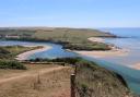
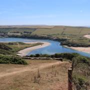
A bit of a classic walk of almost five miles with superb views. This one starts at the car park shown on the map near Bolt Head Airfield (SX712375) – there’s a bit of Second World War history around here. Follow the footpath through East Soar Farm – their Walkers’ Hut is a fabulous pause point. Continue with the path as it heads up and round Sharpitor before joining the South West Coast Path. Go south to Sharp Tor, round Starehole Bay, then west until you reach the footpath heading north through Middle Soar and back to the start..
All Saints
(OS Explorer 116 Lyme Regis and Bridport, 1:25 000)
A five-mile walk of pastoral loveliness in an easterly nugget of Devon, starting from the village hall – please put a donation in their letter box if you use their car park (EX13 7LX; ST305011). Follow footpaths north all the way to the lane near Birchill. Then follow the road north-west towards Reeds Hill Farm. Where their drive meets the road, take the footpath heading south-west. Then follow footpaths (mostly) south-east to Churchill, along lanes through Churchill then a footpath south towards Smallridge. Follow the road through Smallridge, back to the village hall.
Bere Alston
(OS Explorer 108, Lower Tamar Valley & Plymouth 1:25 000)
On the western edge of Devon the countryside around Bere Alston offers some good walking. This seven-mile walk, starting from Station Road (PL20 7EJ; SX446668), encounters the beautiful viaduct with views to Kit Hill and Caradon Hill en route. Follow roads to Lockridge Bridge, then the footpath heading through Lockridge Farm towards the Tamar. Join the footpath heading north and follow this as it meanders east, passing the viaduct near Ferry Farm. Footpaths head south, then east, to cross Tuckermarsh Bridge; then follow the road back into Bere Alston.

Brent Tor
(OS Explorer 112, Launceston & Holsworthy 1:25 000)
On the western edge of Dartmoor, the once-volcanic Brent Tor is an iconic sight, with St Michael de Rupe, the smallest and highest complete parish church in England, gracing its top. This 5.5-mile walk starts in North Brentor. Head south to South Brentor, from which there’s a mile each way on a there-and-back section to visit the tor. Then, from South Brentor, follow the track, then the moorland road, heading east. Before the cattle grid take the bridleway that isn’t the West Devon Way, and follow this north-west to reach the road near Wortha Farm; then it’s a quiet road back to North Brentor.
Before you leave...
Routes are précised, so use the relevant paper map, which shows paths in proper perspective and full context, or the excellent OS Maps App (which may not work if you’re out of signal range).










Share