Enjoy a winter’s walk followed by some Christmas cheer in a cosy country pub
Buriton and the Five Bells
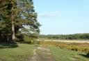
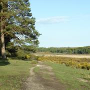
From the pretty village of Buriton with its picturesque pond and Norman church this walk heads up through the Chalk Pits Nature Reserve to join the South Downs Way at the top. From here it explores some of the woodland trails in nearby Queen Elizabeth Country Park. A warm welcome, excellent food and good service at the recently refurbished Five Bells awaits you at the end.
The walk
1 (SU739200) Turn left out of the car park along the road beside the pond on the left. Take the first left, South Lane, which leads past a row of thatched cottages and becomes a track passing under the railway line. At the Buriton Chalk Pit Local Nature Reserve sign ignore the path forking left and keep to the main path beside the fence on your right. Pass another information panel on the right, keeping ahead uphill beside the fence up to the top. Turn right crossing the road to the Halls Hill car park.
2 (SU734198) Immediately turn left through a gate along a footpath. This leads across fields and up into woodland where you reach a crossing track. Cross this diagonally and follow the path down through some trees to join another track, bearing left. This leads to a car park and the Forest Drive, which loops round at this point. Keep ahead to the left of the Drive soon forking left along a path that runs parallel to it to the Gravel Hill car park.
3 (SU719182) At the far end of the car park turn left onto the Drive and immediately left again by a barrier onto a gravel track. Follow this for 100m, then turn left along the waymarked South Downs Way (SDW). The path leads up through the woodland, with waymark posts from time to time, then down to a track where you bear left. Continue along the SDW descending to reach Halls Hill car park. Retrace your steps to the start.
Compass Points
Start/finish: Village car park adjoining pond and church (SU739200)
Map: OS Explorer OL8
Distance: 4 miles (6.8km)
Terrain: Woodland paths and tracks
Time: 2 hours
Pub: The Five Bells, Buriton (01730 263584), fivebells-buriton.co.uk
 Fiona Barltrop")
Fritham and the Royal Oak
Peacefully situated in the northern half of the New Forest, Fritham is well known for its award-winning pub, the charming 17th century Royal Oak. The village was once home to the Schultze Gunpowder Factory, which manufactured smokeless gunpowder, used for sporting guns - man-made Eyeworth Pond provided water for the manufacturing process. There is good walking to be had around here taking in both heath and woodland scenery.
The walk
1 (SU230140) Return to the car park entrance where you turn left, but just before the road note the small information panel about the black metal post box behind it. Follow the road down passing on the right of Eyeworth Pond. Continue past Eyeworth Lodge to Oak Tree Cottage and carry on along the path to the right of the barrier heading northwards through Eyeworth Wood. Emerging from the wood the path continues north-east across Homy Ridge heath to a junction by a Scots Pine on the right. Bear left here heading north-west gently downhill and up again to the Telegraph Hill car park.
2 (SU228166) Turn left at the road and almost immediately left again along a track which leads over the heath in a southerly direction towards Amberwood Inclosure. Just before it note a small brick building over to your right. Inside this former World War II observation shelter there’s an information panel about the bombing range for which this peaceful heathland was once used.
3 (SU207141) At a T-junction on the edge of Amberwood Inclosure, turn left along a gravel track/cycle route back to the car park.
Walk summary
Start/finish: Fritham car park (Forestry Commission) beyond pub (SU230140)
Map: OS Explorer OL22
Distance: 5¾ miles (9.2km)
Terrain: Forest and heathland paths and tracks.
Time: 2½ - 3 hours
Pub: Royal Oak, Fritham (02380 812606), royaloakfritham.co.uk
 Fiona Barltrop")
Yarmouth and the Bugle Inn
Wightlink’s scenic ferry crossing from Lymington to Yarmouth takes just 40 minutes, making this walk quite feasible as a day return from the mainland. At Yarmouth you can step straight off the ferry and start walking! This easy coast-to-coast route links the north and south sides of the island, taking you round the attractive Western Yar estuary. A choice of pubs includes the 16th century Bugle Inn in the market square.
The walk
1 (SZ354898) From the ferry terminal walk round the harbour, cross the main road and just before the road bridge turn left along a surfaced path beside the River Yar. The large brick building you pass on the left was formerly a tide mill.
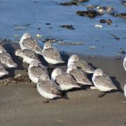
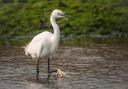
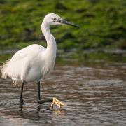
2 (SZ356891) Just beyond it you reach a junction, where you bear right along the bridleway-cum-cycleway, a wide track that follows the route of the old railway line. (A brief detour to the left leads to the former Yarmouth Station, now a café/restaurant.) Follow the track south. A variety of wading birds and waterfowl can be seen in the estuary, especially in winter.
3 (SZ348871) At the road to shorten the walk turn right up to the church rejoining the main route at waypoint 6. Otherwise turn left and follow the road to the B3399. Turn briefly left, cross the road and continue along Manor Road, very soon bearing left through a gate to follow the bridleway (Freshwater Way) that leads to Afton Down. Bear right along a track to the golf club house, continue along the access road, turn left to the A3055 and right down to Freshwater Bay.
4 (SZ345857) Take the second footpath on the right (Coastguard Lane) signed Freshwater Way. At a fork in the path bear right and continue to a minor road, passing an Afton Marsh Nature Reserve sign. Turn right and just before the bridge go left along a footpath signed Afton Marsh & Afton Road. Cross a footbridge and take the right-hand path to head north to the A3055.
5 (SZ344868) Turn briefly left, then right on the opposite side of the road along a bridleway which soon turns right taking you back to waypoint 3. Now turn left along the road up to the church.
6 (SZ346872) Turn right along the Freshwater Way footpath which leads north to the A3054, then right back to Yarmouth.
Compass Points
Start/finish: Ferry terminal, Yarmouth (SZ354898)
Map: OS Explorer OL29
Distance: 6¾ miles (11 km) or shorter option, omitting lower loop: 4¼ miles (6.7km)
Terrain: Easy walk, mostly on the level. Wide track along east side of Yar, thereafter country road, downland and field paths.
Time: 3 hours (1½ - 2 hours for shorter option)
Pub: Bugle Coaching Inn, Yarmouth (01983 760272), www.characterinns.co.uk/the-bugle-coaching-inn and others including Red Lion, Freshwater.
7 more festive pub walks

Longstock and the Peat Spade
Start: St Mary’s Church, Longstock (SU359371).
The picturesque village of Longstock is situated on the western bank of the River Test just north of Stockbridge. The village has some lovely, thatched cottages and a renowned pub, the Peat Spade. Head up the downs to Danebury Hill to the west or enjoy an easy level walk along the nearby Test Way to the east.
 Fiona Barltrop")
Exton and the Shoe Inn
Start: Parking area at north end of Church Lane, near junction with A32 (SU617212)
Situated in the Meon valley, Exton is a charming village with a popular pub. Work up an appetite with a climb up Old Winchester Hill or Beacon Hill, or stroll along the Meon Valley Trail, an old railway line.
 Fiona Barltrop")
Langstone and the Royal Oak or Ship Inn
Start: Car park near to Ship Inn on north side of Langstone Bridge (SU719047). Cross the bridge and follow the Hayling Billy Coastal Path along an old railway line as far as you like, returning the same way. Then take your pick from the two waterside pubs.
 Fiona Barltrop")
Bank and the Oak Inn
Start: Parking area at bend in road, Pinkney Lane, south of Oak Inn, Bank (SU288067).
Explore the forest trails, then enjoy some refreshment at the walker-friendly Oak Inn at Bank, set in a lovely location just outside Lyndhurst.
 Fiona Barltrop")
Itchen Abbas and The Plough
Start: Roadside parking near Itchen Abbas church, just off B3047 (SU534328)
Head up the downs to the north or enjoy a gentle walk along the Itchen valley followed by a visit to this highly rated pub.
 Fiona Barltrop")
Keyhaven and the Gun Inn
Start: Car park next door to the pub (SZ306915)
Stretch your legs along the Solent Way beside the Lymington-Keyhaven Marshes Nature Reserve or out to Hurst Castle, then enjoy some fine foodie fare at the Gun Inn.
 Fiona Barltrop")
Bembridge and the Crab & Lobster or Pilot Boat Inn
Start: Car park near the lifeboat station (SZ657880)
Follow the coastal path in either direction, looping inland via Bembridge Windmill, then sample one of the seaside hostelries.