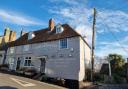

Enjoying a stunning setting on the banks of the Royal Military Canal, the quintessential village of Appledore provides a postcard-worthy spot from which to embark on this month’s route. Boasting a brilliant blend of peaceful village life, wide-open landscapes, and even a glorious Garden of England vineyard, ramblers will be left feeling truly calmed by the Kent countryside on completion of this fabulous 5 mile circuit…
The route: Alannah Crouch")
● Follow the Saxon Shore Way signpost which will lead you between a fence and a small public toilet block, onto the recreation ground. Cross the park diagonally - heading for the left hand corner.
● Go through the metal gate into the field here, turn left and follow the way marker (diagonally left) for the stile in the corner of the field. Cross this stile and a small bridge into another field.
● Continue straight across this field to a stile on the fence line ahead.
● Cross this stile into a field and follow the waymarked path under overhead wires, heading towards a large grass mound ahead. This stretch provides your first glimpse of the rows of grape vines that stretch out in perfect uniform across this landscape.
 Alannah Crouch")
● Follow the waymarked trail up and over the mound. Rest for a few minutes at the top, and enjoy the far-stretching views of the Romney Marsh from here.
● Make your way back down the other side of the mound to continue along a pathway. Follow way marker arrows to the right, to walk with the line of trees on your left. Bear left at the end of the line of trees to follow the grass path ahead, straight across another field.
● Cross a narrow bridge across a ditch and follow the path ahead across another field.
● Come out of the field and turn right at the road. After a few steps, follow the footpath signpost on your left. Climb up a short flight of steps into another field and follow the path along the boundary of the vineyard.
● Follow the path down a further short slight of steps to cross a small wooded area. Continue ahead up some steps again, and through the gate on the other side.
● A few steps on, pass through another gate into a field. Follow the waymarking along the right hand side boundary to the road.
● Go through the gate into a quiet road. Turn left and walk for approx. 10 metres before turning right through a gate into a field. Follow the boundary around to the left until you reach a gate at the church.
● Here, turn right to follow the footpath across a field. Head across the field with the church behind you, continuing towards pylons until you reach the field’s boundary and a stile.
● Cross over the stile into a field and follow the waymarking directly across, heading for a building on your right, up ahead. Cross over a further stile and a small bridge into the road before turning left to head down the road.
● Just before the bridge, turn right to go through a metal kissing gate, where you will follow the Royal Military Canal path.
● You will come to a metal kissing gate (on your left), which you will need to go through, continuing onwards.
● Keep on the bank to follow this path alongside the canal for 500 metres, to another fence and kissing gate on the left. Pass through this gate to continue ahead.
● Just after passing under some overhead wires, look for a small bridge on your right. Cross this bridge and stile to follow the enclosed path. This path will soon become a surfaced road (called Old Way). Turn left, and make your way back to the church where today’s route first started.
COMPASS POINTS
Steps, stats & stiles: At 5 miles (8km) long, you should allow approximately 3 hours to complete this countryside circuit from start to finish. The route takes place along a stretch of the popular Saxon Shore Way, through gently rolling hills, taking in spectacular views of the Romney Marsh’s unique landscape. This walk uses largely grassy paths across open fields, with some gentle slopes in places. There are also several stiles and gates to be aware of.
Make a day of it: Sitting just outside of Appledore village, why not taste the fruits of the Garden of England with a visit to Gusbourne Estate? Explore the vineyard here and find out what makes this corner of England so special for winemaking, before sampling the goods for yourself at Gusbourne’s tasting room the Nest, with views stretching out over the vines.
Refreshments: When the setting is this quintessentially British, there really is no better way to reward yourself after a springtime stroll than with an indulgent cream tea from Miss Mollett’s High Class Teamroom, situated right in the heart of Appledore village. Sink your teeth into freshly baked scones topped with clotted cream and jam, while warming up with a pot of loose leaf tea… the ultimate post-ramble refuel!
Route followed: For this month’s route we followed the Appledore Walk route, which can be found on Explore Kent’s website. Follow the full route at: explorekent.org/activities/appledore-walk/