
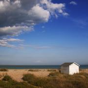
The county of Kent has traditionally been blessed but also burdened by its moniker ‘The Garden of England’, which references its apple and pear orchards, its hops and its pretty villages. But its extensive coastline has made it as much a maritime as an agricultural county. Above all, Kent’s geographical position, pointing like a dagger from London towards the French coast, has dictated its historic role as a bridge to, but also a defence against, Europe. Kent has historically been the strategic key to England: it was no accident that it was the county chosen for the first printed map of the infant Ordnance Survey, published in 1801.
A Map of Kent 1769 can lay claim to being the most skilfully engraved of all the historic maps of Kent. For the first time it, contained the level of detail needed to equip landowners to meet the challenges of the modern world, and minutely depicts what is now south-east London before urbanisation in the later nineteenth century.
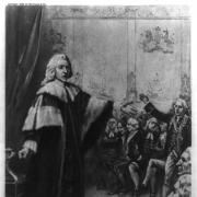
Perhaps the most striking feature of the map is that it is an – inevitably subjective – image of Kent society at the time. The highly sought-after map was created by London map-seller and publisher Andrew Dury and the surveyor and engraver John Andrews, who worked meticulously for four years to create the intricate and elegant Topographical Map of Kent, originally published in 1769. The map found supporters in esteemed figures such as King George III, the Archbishop of Canterbury, the Duke of Dorset and the brother of the pioneer feminist Elizabeth Montagu.

Readers who immerse themselves in Map of Kent may imagine they have been transported back to the 18th century, as they explore Southern England’s coastlines, hills, rivers and streams, towns and villages, great houses and their parks (with owners’ names in most places), farms, churches, gardens, and more. In addition to its beautiful depictions of the landscape, the map gives an insight into the cultural and economic significance of Kent as a region throughout Britain’s history to the present day.
The mid-18th century is evoked from the very first page. The clarity and delicacy of the engraving, the sensitive balance between sizes of the inscriptions and the variety of fonts employed to convey the different levels and types of information, the dignity of the hill-shading, the massing of the woods and the sinuousness with which the course of the rivers and streams is depicted – enhanced by the colouring of some of the copies – all combine to make Dury and Andrews’s map arguably the prettiest map of Kent ever to have been published.

The sense of period is increased by the map’s peculiarities and particularly the alternatives so often given for place names, which reflect, in part, the dialects of the time and in part the variant names since suppressed in the name of uniformity and convenience. If viewers immerse themselves in the imagery and names, they might feel they are back in the cultural and economic world of the mid-eighteenth century, which can be fleshed out by the novels of Henry Fielding and written accounts of travellers such as John Byng, or, somewhat earlier, Daniel Defoe and Celia Fiennes.
A Map of Kent 1769 reveals how trade also benefited from Kent’s favourable strategic position. The pilgrimage route to Canterbury from London was also a trade route that extended, and still does, to Dover and, beyond that, to Europe. Kent’s rivers, particularly the Medway and Stour, in addition to the Thames, provided other convenient means of transportation. As a result, Kent saw the development of numerous market towns such as Maidstone, Rochester, Canterbury, Sevenoaks and Ashford that grew rich through their favourable links with the wider world.

The map highlights ports such as Margate that provided packet boats carrying mail to the European mainland, while Gravesend and Deptford on the Thames served as additional outlets for trade – and destinations for immigration. The foreign-born ancestors of a substantial proportion of modern Britons first stepped onto British soil at a port in Kent, and within the county their presence was particularly felt in Canterbury.
Socially, the map provides the reader with fascinating associations with oner of the most important British authors all time, Jane Austen. The senior branch of the Austen family lived in Grovehurst House, Horsmonden, near Sevenoaks, and among the subscribers to the map of Kent was Jane’s great-uncle, the long-lived Francis Austen (1698–1791). He paid for the university education of Jane’s father, the Rev. George Austen, and was godfather to his namesake, Jane’s favourite brother, Frank. It was also while staying with her brother Edward and his wife in a house on the Goodnestone estate in 1796 that Jane began writing what was to become Pride and Prejudice, and in the following years she was a regular visitor to Edward’s estate at Godmersham Park.
The Weald and central areas of Kent, watered by the Medway and its tributaries, abound in handsome country estates and prosperous market towns such as Rochester, Tunbridge, Maidstone, Ashford and Canterbury. Though little more than villages by 21st-century standards, with the exception of Canterbury and the Strood, Rochester and Chatham conglomeration, the layouts of these towns and villages centred around their churches seem to exude wealth and stability even if swamped in size and social status by the surrounding great estates and their owners. It is easy to imagine the burgesses, merchants and shopkeepers making their way down the streets and between the houses. While the wealth of the landowners is undoubted, however, this impression is misleading: research suggests that though not poor, the bulk of the inhabitants of these central regions lagged behind their counterparts in the north-west part of the county in terms of affluence.

Closer examination gives an impression of developments in the county. The suburbanisation of the north-west can be seen through the sheer number of closely packed estates and the dynamic growth of the towns and villages to be found stretching from Greenwich by way of Blackheath, Beckenham, Bromley and Chislehurst towards Orpington and Sevenoaks, squeezing the intervening open land.
The dockyards at Deptford, Chatham and Sheerness, increasingly the main centres for the fitting out of Britain’s battle and civilian ships, are prominently shown, and, though there is no sign of the brass foundry at Woolwich, the powder mill and ironworks at Dartford that were to make a major contribution to the local economy are indicated. There are the first signs of industrialisation particularly along the Thames and in the districts to its south, with indications of paper, printing, gunpowder and silk mills as well as chalk quarries. Tunbridge Wells is seen at its apogee as a watering place, and an inscription highlights the striking ‘pier-head’ of Ramsgate Harbour, which had been under construction since 1749.

Throughout the map, Andrews and Dury take care to depict the extent and shapes of commons. This was not simply motivated by a desire to depict the physical realities. In an age when landowners, spearheaded by lords of the manor, were increasingly using acts of parliament to enclose common land to enrich themselves at the expense of the agricultural poor, it provided information that could increase sales of the map among the groups they were targeting.
Andrews and Dury’s map of Kent remained the only printed map of the whole county at a scale larger than one inch to the mile until the publication of the first edition Ordnance Survey maps at a scale of six inches to the mile from 1858 onwards.

Addison publications have produced 500 numbered limited-edition facsimile volumes of A Map of Kent 1769, with a commentary volume by Peter Barber, former Map Librarian at the British Library. Copies - half-bound in polished calf-skin leather with individually hand-marbled paper - are available to buy from addisonpublications.com at £2,500 each


![The torchlit Wassail procession makes its way to the New Ash Green Community orchard [Photo courtesy of New Ash Green Woodlands Group]](/resources/images/128x89/1x/17558355.jpg)
![The torchlit Wassail procession makes its way to the New Ash Green Community orchard [Photo courtesy of New Ash Green Woodlands Group]](/resources/images/180x180/1x/17558355.jpg)